-
The Kentucky Bourbon Trail: Our First Time on the Trail.
(This is part two of a five-part series. Part one can be found here. Stay tuned for the rest of the series.)
The Bourbon Trail started as a way for my dad and I to continue bonding after my mom passed away. It wasn’t about the drinking (well, maybe we were excited for a little taste or two) but rather finding a common ground and a shared new adventure.
We had no idea what we were getting ourselves into or how much we would come to learn and love- not just about bourbon- but also about Kentucky!
Terms of the Trail:
Rickhouse: A building or structure used for storing or stacking barrels of bourbon.
Mashbill: The recipe of the grains contained in each bottle of bourbon.
Angel’s share: This refers to the amount of liquid that evaporates out of the bourbon barrel during the aging process.
Devil’s cut: This refers to the amount of bourbon or whiskey that gets absorbed into the wooden barrels during the aging process.
White dog: Raw, unaged whiskey distillate.
Still: A distillation apparatus used to distill liquors, some are columns and others are pot stills.
Kentucky Hug: This refers to the opening of flavors and warmth that “hug” the mouth and body after tasting bourbon.
Fermentation: This is the first step in bourbon production. The grains from the mashbill are ground together and then hot water and yeast are added to convert the natural sugars to alcohol. The chunky liquid produced is called distillers beer.
Distillation: This is the second step in bourbon production. The distiller’s beer is heated in a still and the alcohol vapors are condensed and collected as a liquid. The product is often distilled 2-3 times.
Maturation: The final stage of bourbon production. The distilled product is stored in charred, new oak barrels and follows the rules of the bourbon ABC’s.
Trip #1 Itinerary:
First stop: Louisville, KY.
Instead of flying into Louisville, KY (Bourbon Trail headquarters) we met up in Nashville, Tennessee and drove three hours north to Louisville. It was my first time exploring the Bluegrass State and my first observations were that it was quite lush and beautiful–lots of rolling hills (which Dad called mountains) and red barns with farms under a big, open sky.
About thirty minutes outside of Louisville we saw signs for the Jim Beam Distilling Co. We didn’t plan on making the stop but we were so excited to see our first distillery that we decided to go for it. Shortly after the exit, we saw the iconic Jim Beam logo on an old white barn.

Our first stop on the trail; Jim Beam Distilling Co. (J. Foster, 2019). It was in that moment I realized the full effect of marketing and advertising that surrounds our daily lives. For the next several days we would be delving deeper into these familiar logos and brands, learning what they were all about. I instantly wanted to see the process of how these products were created from start to finish–from grain to distilling to being placed on the shelf.
We made it to the main entrance and gift shop just before closing. We missed the last tour, but it gave us an idea of what we might expect to see on this trip: gift shops, tasting rooms, historic buildings, distilling rooms, and iconic labels surrounded by lush landscapes. As we walked around and looked at the products, I noticed a small brown book labeled “bourbon passport.” The clerk behind the counter explained how it worked and suddenly we were more committed than ever to tour the trail!
We arrived in the city center of Louisville, KY after dark. We found a good deal for lodging at the Galt House, located on the Ohio River. The city and the riverfront felt alive. We checked-in to our room and then walked down the street to Merle’s Whiskey Bar; southern-style food and whiskey? Yes, please!

Downtown Louisville, KY and the Ohio River. (Goodfreephotos.com, stock image). Day 1: Hitting the Trail
The next morning, we woke up and ate breakfast at the hotel, overlooking the river. It was a cloudy, rainy day but we felt energized and glad to be together.
Our first distillery tour of the day would be Buffalo Trace Distillery. In my previous post I mentioned that not all of the distilleries in Kentucky are on the official Kentucky Bourbon Trail, Buffalo Trace is one of them. However, it is definitely one of the best bourbon tours in the country (and one of our personal faves)!

Buffalo Trace Distillery; Frankfort, KY. (J. Foster 2019). What really stood out to me was the vastness and beauty of the property itself, along with the many historic rickhouses. You just feel surrounded by history at Buffalo Trace.
As we later learned, many well-known bourbon makers have had an association with what is now known as Buffalo Trace…such names as: EH Taylor, George T. Stagg, Blanton, Pappy Van Winkle, Elmer T. Lee, and more.
Note: Prior to our first bourbon trip, I was not familiar with the oh so popular Pappy Van Winkle….So, in addition to getting bourbon passport stamps, we also began our quest for a taste of this hugely hyped (and expensive) bourbon. I will share about the moment we finally got to taste some Pappy in post #4 of the series.


Not all distilleries are the same. Some only offer tastings, others have tours and tastings. Most charge for one or the other. The cool thing about Buffalo Trace is that the tour is FREE and includes a tasting! However, reservations are definitely a must! Click here for availability.
The Process:
Fermentation–> Distillation –> Maturation = Bourbon

It starts with the grains, (J. Foster 2023). The above process is essentially what you get to witness when touring the Kentucky Bourbon Trail distilleries. It is such a cool experience to get a behind the scenes look at how our country’s leading brands produce their bourbons! It feels like being in a big science lab! As you explore different distilleries it is interesting to compare mashbills and see what makes different bourbons and brands unique!

STEP 1: FERMENTATION 
STEP 2: DISTILLATION 
STEP 3: MATURATION
Next Stops Along the Trail:
After Buffalo Trace we then drove 20 minutes south to Woodford Reserve Distillery. The outside of this distillery felt like quintessential Kentucky with white picket fences and gorgeous buildings! We enjoyed lunch in the main visitor center and signed up for a tasting. We didn’t have time for a tour but enjoyed their bourbon tasting selections, the straight bourbon was my favorite.

Bottles of Woodford Reserve, (J. Foster 2019). Next, we continued another 20 minutes south to Wild Turkey Distilling Co. This was a smaller venue compared to the other two distilleries, but the friendliness of the staff was top notch! We sat and tried a small flight of their bourbon offerings. We tried the Russell’s Reserve Rye and the Longbranch (mesquite). They both contained a long Kentucky hug for my palate.
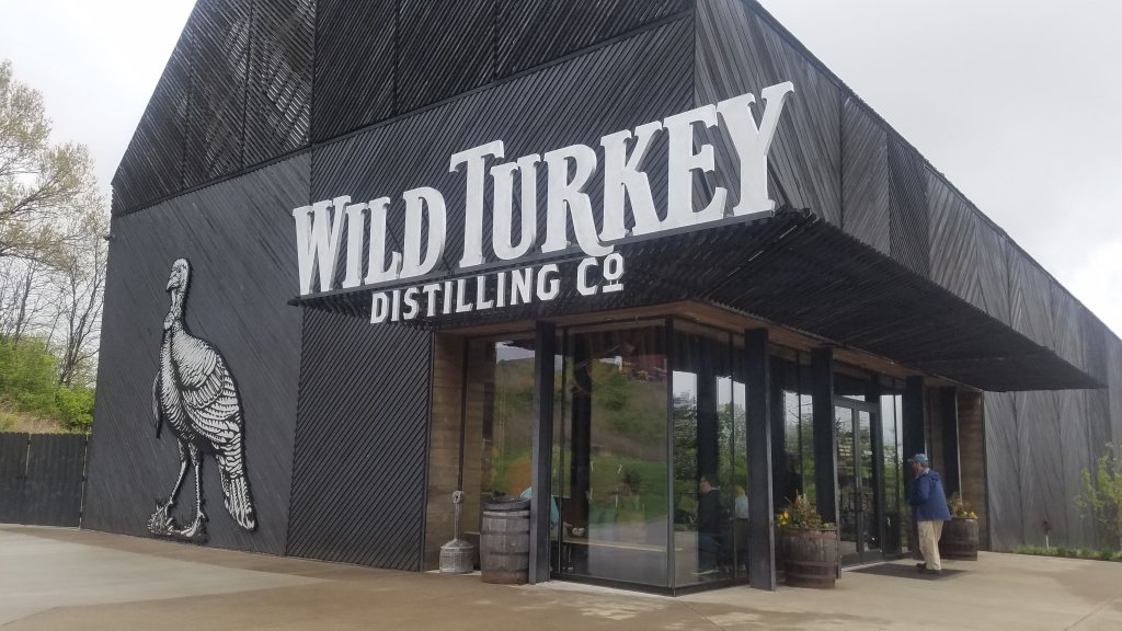
Wild Turkey Main Visitor Center and Tasting Room, (J. Foster 2019).
Bourbon Trail Trip # 1 Totals:
Distilleries: 4, Passport stamps: 3. Memories: Abundant!

Photo from our Woodford Reserve tasting, (J. Foster 2019).
We Had Fun Off-Trail:
Since this was our first trip, we planned things to do on and off the bourbon trail in case we didn’t return to the region. (Little did we know we would be back several more times and still counting….)
We continued our way back towards the Nashville airport. However, we couldn’t leave Kentucky without visiting Mammoth Cave National Park. We checked into the Lodge at Mammoth Cave and stayed in one of their cabins for the night. Not every National Park has onsite lodging so that was really cool to stay inside of a National Park.

Entrance to Mammoth Cave National Park, (J. Foster 2019). We had reservations for the Extended Historic Tour, which was a 2-mile tour that included seeing an 1840s tuberculosis unit inside the cave! We walked through narrow passageways along with huge rotundas! It was an awesome cave tour adventure! We definitely had fun! You can read about the cave tour descriptions here and make your reservations here, through Recreation.gov.

Former tuberculosis unit inside Mammoth Cave. After our time at Mammoth Cave, we arrived back in Nashville. We checked in to a hotel close to the airport and then took a rideshare to downtown. This was my Dad’s first time to experience Nashville’s honky tonks. We walked up and down Broadway, popping in and out of live music venues. Tootsie’s and Layla’s are two original venues and are still hot spots for good singer-songwriter talent. We had dinner on the rooftop at Ole Red’s (Blake Shelton’s new restaurant and live music venue). It was a great way to wrap up our first bourbon tour.
We headed back to the hotel and sat in the lobby. We talked, laughed, and then packed up for the morning flight.
Grateful for our time together on the trail and off the trail!

Dad and I, honky tonking. (J.Foster 2019). In the next post, I will share about historic Bardstown, Bourbon Manor, Heaven Hill Distillery, Maker’s Mark, and several other stops. Stay tuned.
-
The Kentucky Bourbon Trail: An Introduction.
During the first series, we will learn what makes bourbon unique, as well as, introduce the Kentucky Bourbon Trail. In series 2-5, I will share my bourbon trail trip itineraries and a few insider tips!
Part One: What is Bourbon?

Photo: The front page of the original bourbon passport. Now there is a newer, expanded Field Guide, 2019. So, what is bourbon? What makes it different from whiskey? There are several rules that help to distinguish the essence of bourbon. Those in the industry often call these rules the ABC’s of bourbon:
A–Bourbon must be made in America.
According to the 1964 Senate Concurrent Resolution 19, bourbon is “a distinctive product of the United States.”
B–Bourbon must be aged in a new charred, oak barrel.
*Note: Previously, rules stated that the barrels had to be made of white oak.
C— Corn! To be a bourbon, the recipe must contain at least 51% corn.
D— Bourbon cannot be distilled above 160 proof.
E— Bourbon cannot enter the barrel at more than 125 proof.
F— Bourbon bottles must be filled at 80 proof or higher, or 40% alcohol by volume.
G–Genuine! Bourbon cannot have anything added to it throughout the entire process–except water. No added flavors or color, except the color that comes from the charred oak barrel.
If you’re still wondering what the main difference is between bourbon and whiskey…think about it this way: whiskey is essentially grain, water, and yeast (similar ingredients as bread and beer) …without any rules!
Bourbon, on the other hand, has rules.

Photo: Large vat of sour mash, one of the steps in the fermentation process, Wilderness Trail Distillery, 2023.
Kentucky: The Bourbon State
As mentioned in the rules above, bourbon has to be made in America. Bourbon does not have to be made in Kentucky. However, Kentucky is the leading state for bourbon production.
Bardstown, Kentucky is currently known as the Bourbon Capital of the World, as it has the most distilleries per capita of any other city in Kentucky.
Before Kentucky was known for bourbon, it was known for its whiskey. Immigrant farmers from Ireland and Scotland soon started to make whiskey from their excess corn harvest. Prior to this, rye was the main ingredient in whiskey. As the popularity of whiskey began to grow, so did the production. The corn-based whiskey from a little county named Bourbon County (named after French royals) soon became known as bourbon. In more recent times, instead of being a byproduct of frugal farmers, bourbon has become its own niche in the world of distilled spirits.
(Source: Bourbon, Straight; The Uncut and Unfiltered Story of American Whiskey, Charles K. Cowdery).
Hit The Trail…The Kentucky Bourbon Trail!

Photo: A display at the Frazier History Museum in Louisville, KY. The “official” start of the Kentucky Bourbon Trail, 2023. According to my last Google search, Kentucky has over 86 distilleries and each year more pop up! Many of these distilleries offer tours of their facilities, where visitors can watch and learn how bourbon is made.
In 1999, The Kentucky Distillers’ Association trademarked the term “Kentucky Bourbon Trail” and created passport books featuring distilleries that are members of the Kentucky Distillers’ Association. Now, the Kentucky Distillers’ Association has created essentially two tours: the original Kentucky Bourbon Trail Tour (featuring 18 signature distilleries), as well as, the Kentucky Bourbon Trail Craft Tour, which came onto the scene in 2012. The craft tour is different from the original trail tour in that they are marketing it for a more intimate, hands-on experience compared to some of the larger tours at the other distilleries.
Note: It is important to know that there are several awesome distilleries that are not members of the Kentucky Distillers’ Association, and therefore are not featured in the Bourbon Trail Passport & Field Guide (e.g., Buffalo Trace) but are still worth the drive and the time to taste and explore!

Photo: Vendome brand pot still,
distilling operation at Stitzel-Weller, 2023.When my family and I first set out to tour the Kentucky Bourbon Trail, we had no idea what to expect. Along the way, we have enjoyed the rolling hills of Appalachia, viewing the limestone rock that holds up Kentucky–and is what gives its water such purity for its bourbon concoctions, visiting all 18 of the original trail distilleries and learning the vocabulary of the bourbon-making process.
Most importantly, our adventures on the Kentucky Bourbon Trail have given us plenty of memories and stories to share.
Stay tuned for Parts 2-5, where I will share more photos and information about the fermentation and distillation processes, helpful bourbon vocabulary terms, trip itineraries, insider tips, and stories about my family’s time exploring the backroads of Kentucky!
Order your Bourbon Trail Passport and Field Guide HERE.
-
The Shaggy Sheep: A Cozy Colorado Wayside Cookhouse
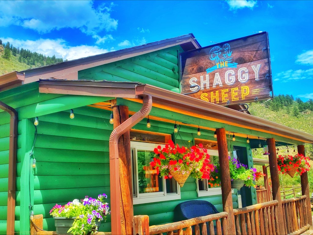
The Shaggy Sheep front entrance. I have driven by the Shaggy Sheep cookhouse many times over the years on my way into the Colorado mountains. It is situated off to the side of US Highway 285, without any other attractions around. I imagine the clientele are either regulars who live nearby or those (not unlike myself) who finally decided to pull over and explore this wayside eatery.
On our first visit, we arrived during their lunch service. (They serve breakfast from 7am-11:30 and then lunch from 11:30-3pm). We loved the cozy, cabin-like feel, as well as the food. What we enjoyed most was the friendly waitress who had the best southern accent and charm! We felt right at home. Before we left, she told us to come back sometime for breakfast!
So, we did!

Inside felt like a cozy mountain cabin. 
We enjoyed their breakfast menu! 
jalapeno cheddar biscuits Owners, Sarah Bennett and Chris Howe, opened the Shaggy Sheep in 2016. In addition to the main cookhouse, they also have a small baked goods counter and coffee bar. Outside they have a seasonal outdoor area, featuring a classic airstream as a “snack shack.”
We have visited two times now in about as many months. The food is excellent, the people are friendly, and the vibe is full of Rocky Mountain goodness! We will definitely be back again!
After the third time can we officially call ourselves regulars?

-
Scotts Bluff National Monument: A Place Where Several National Historic Trails Converge.

Photo: Scotts Bluff National Monument, J. Foster 2023. Most roads can take you to where you want to go. But all roads- if you pause long enough to think about it-can carry you back in time.
On a recent road trip to Scotts Bluff National Monument in Gering, Nebraska (only three hours northeast of Denver, Colorado), I stood at an intersection where several historic paths converge. Located within the ancestral homelands of the present-day Arapaho, Cheyenne, Pawnee, and Lakota are several geologic features that have stood as landmarks over the centuries.
One such feature is now known as Scotts Bluff, named after Hiram Scott, who was a mid-level employee for the Rocky Mountain Fur Company. Although there are multiple histories as to his final days, it is said that Scott was on his way back from a fur trading rendezvous when he died near the bluff in 1828. By the time prairie schooners and covered wagons made their way to the area in 1830, the bluff was already known as Scotts Bluff.

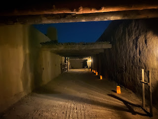
Photo: Approaching the tunnel, looking back towards the visitor center, J. Foster 2023. As settler colonialism dominated the 19th century, many people traveled west in search of land and farming opportunities. From 1841 to 1869 as many as 250,000 emigrants passed by Scotts Bluff. As you stand atop Scotts Bluff you can look in multiple directions and know that you are looking out at several of the famous emigrant overland trails: the Oregon National Historic Trail, the California National Historic Trail, the Mormon Pioneer National Historic Trail, and the Pony Express National Historic Trail (For more information about America’s historic trails, check out the National Historic Trail System website). Most of the above trails followed the same path as they traversed from Missouri or Kansas until they got to Wyoming, then they started to split off towards Oregon, California, or Utah. It was really interesting to stand in this spot and reflect on the history that surrounds this landscape.
Hiking at Scotts Bluff National Monument
The Saddle Rock Trail winds its way up and around to the summit of the bluff, and even has a short, hand-carved tunnel! (It is quite evident this tunnel was hand-carved; you can even see the finger marks throughout!) This hike is 3.2 miles roundtrip from the visitor center. As you climb to the summit, the views of the bluff and the valley are constantly changing. There’s also a nice audio tour along the trail, which provides tidbits of history as you hike (cell phone required).
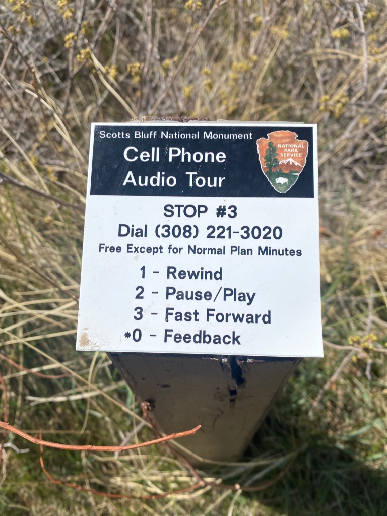
Photo: Audio tour stop along the Saddle Rock Trail, J. Foster 2023. Hikes that originate on top of the bluff:
North Overlook Trail originates at the northeast corner of the summit parking lot. This half mile trail consists of a nice overlook of the North Platte River Valley, including the towns of Gering and Scottsbluff.
South Overlook Trail starts at the southeast corner of the summit parking lot. This short asphalt path leads to views of remnants of the Oregon Trail, Mitchell Pass, and the Visitor Center.

Photo: Entrance to Scotts Bluff Summit Road, J. Foster 2023. Driving the Scotts Bluff Summit Road:
Scotts Bluff Summit Road is a 1.6 mile drive to the top of Scotts Bluff. The road is only open during the day (hours vary by season). Trailers and vehicles longer than 25 feet and higher than 11ft, 7 in. are prohibited.
Safety Tips:
- Be aware of changing weather patterns
- Bring water and sunscreen
- Be aware of prairie rattlesnakes in the area. Do not let small children wander away from you. Stay on paved trails.
Junior Rangers Wanted

Learners of all ages can earn a Jr. Ranger badge! Ask at the visitor center! 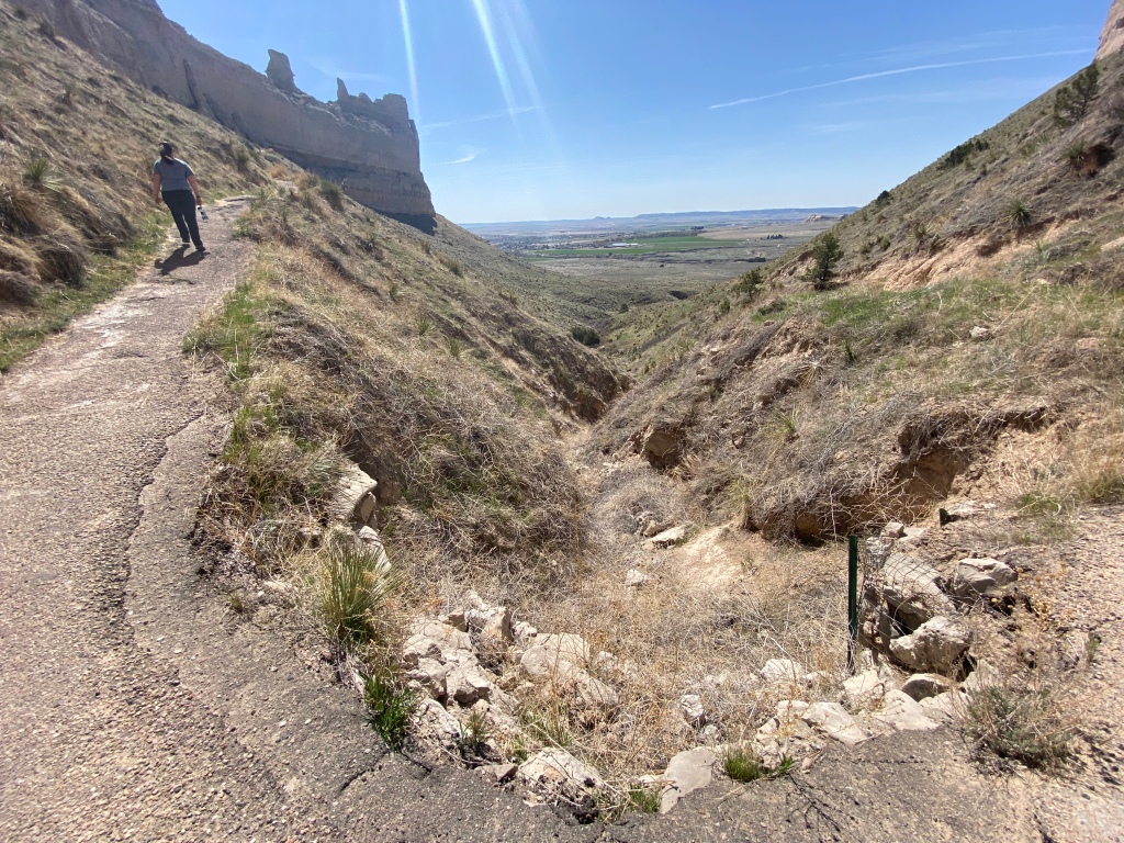
Photo: A hiker on the way to the top! -
She’s Fly: A Fly Fishing Company Empowering Women To Be Their Own Guide

Gear table with She’s Fly logo. She’s Fly is a woman-owned and operated business based in Northern Colorado, that offers fly fishing clinics, retreats, and gear made specifically for women. Owner/Founder, Dylan Demery began fly fishing as a way of processing the loss of her husband, to feel close to him. Now, she and Co-Founder Emily Anderson teach the basics of fly fishing in hopes of empowering other women to feel confident casting their own lines out in the water.
I recently attended a Ladies’ Fly Fishing Basics Clinic hosted by She’s Fly and Sweet Heart Winery, in Loveland, Colorado. I have always wanted to learn the basics and this three-hour clinic was a perfect introduction. It was evident that Dylan and Emily feel at ease with a rod and reel and have found their niche in the art of fly fishing.

Practicing the clinch knot. We began by learning the anatomy of a rod (e.g. reel, line, leader, tippet). This was the first time I had ever heard of the word tippet–I was definitely a newbie. We learned how to tie a surgeon’s knot, for when you need to secure your leader to the tippet. And then we practiced what Dylan and Emily said was the most popular knot for securing your fly: the clinch knot (see above photo).
After practicing a few different knots, we discussed gear basics such as: rod/reel, forceps, nippers, and the importance of using a silicone–not nylon–net (for the safety of the fish). Then we moved into more serious gear options like waders, sun protection gloves, and other accessories. She’s Fly offers a nice woman’s vest from Summer & Co. to help hold your tools, along with some other “fly” gear.

Owner/Founder: Dylan Demery (left) and Co-Founder: Emily Anderson (right). We ventured outside and Emily demonstrated three different casting techniques. (Side note: it is not exactly how Brad Pitt did it in A River Runs Through It). The main take away from this demonstration was: less wrist!… allow your wrist and arm and rod to become one entity as you move/extend back and forth. We practiced casting into a small cone inside of a hula hoop that was on the ground. This was very helpful!
Later, Dylan shared about river etiquette and how to read a river. She encouraged us to take a look at the macroinvertebrates beside, on top, and even under the rocks inside the riverbed–these might be an indicator of what the fish are looking for. “Match the hatch” was her motto.
“You can’t not be present when you’re fly fishing.” -Dylan Demery

She’s Fly: fly box Upcoming She’s Fly Events:
The next Ladies Fly Fishing Basics is coming up on April 16, 2023. Clinic size is limited for a smaller class experience. Get your tickets and reservations here.
She’s Fly is a local partner for the upcoming Fly Fishing Film Tour, a traveling film festival showcasing the best films about fly fishing! They have stops all over the country! Coloradoans: they will have stops in Denver, Boulder, Steamboat Springs, and Fort Collins. For tickets or more information click here.
-
Redwood National and State Parks: Like Nowhere Else on Earth

Entrance to Mill Creek Campground at Del Norte Coast Redwoods State Park. (Photo: J.Foster, 2021) There is an ancient sliver of land in the northern most region of California (often called the northern, northern of California) that is unlike anywhere else in the world. It is a region, like Narnia, that once you step inside—beckons your imagination and awakens your soul to nature’s mysterious and magical side.
It is home to the tallest trees in the world. Contained in its canopy and understory are other layers of life and biodiversity. There is a reason movies like E.T., Star Wars, and Jurassic Park were filmed nearby; it is both ancient and other-worldly. Bright yellow banana slugs slowly glide along the red mulched earth. Rumors of the endangered northern spotted owl and marbled murrelet speak of their existence in the towering canopy. Ferns, redwood sorrel, western hemlock, and neon moss wrapped around maple trees also compose this fairyland scenery. It is a place of beauty and resilience.
The place I am referring to is Redwood National and State Parks.
Currently, it is the only National Park that is comprised of three State Parks (e.g. Jedediah Smith State Park, Del Norte Coast Redwoods State Park, and Prairie Creek Redwoods State Park). The park is managed as two regions: the northern region (Crescent City, CA) and the southern region (Orick, CA). The park tells the story of how different agencies came together to help protect the remaining 4% of the world’s coastal redwoods. The coastal redwood (sequoia semperviren) is a different species than the giant sequoias (sequoiadendron giganteum). The coastal redwoods are the tallest (reaching up to 380 feet sometimes!!) and the giant sequoias are generally the largest by volume/width. (Although there are some coastal redwoods that can rival the giant sequoias). The third species of redwood is the dawn redwood found in parts of Asia (metasequoia glyptostrobeoides).
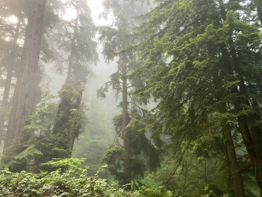
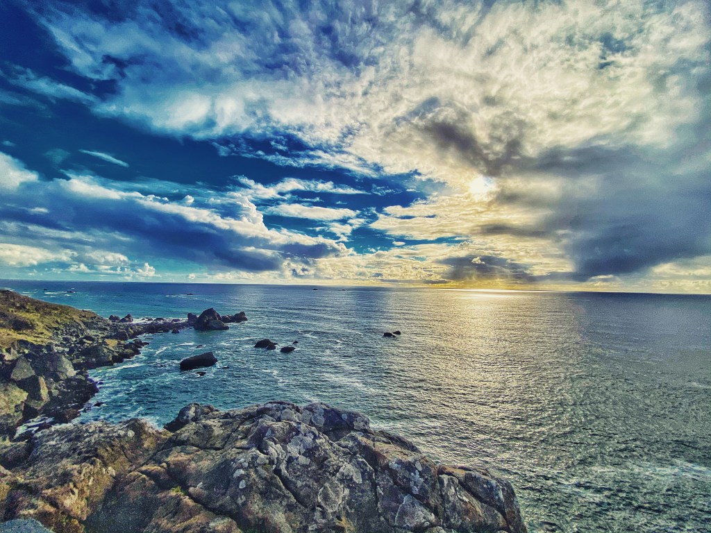
Redwoods draped in mystique near Last Chance Grade, along the Redwood Highway/U.S. 101 (Photo: J.Foster, 2021) I worked one summer as a campground ranger for Redwood National and State Parks and one of the things I enjoyed most was feeling like I was living on the edge of the world. The jagged coastal cliffs with tide pools and amazing sunsets to the west…. and the deep, fog-soaked redwood canopy situated along the redwood highway just a few minutes inland.
After living and working in the dense tall forest, I sometimes felt like my own taproot was competing with the other living things for sunlight and chlorophyl. I would often seek the openness and light from the Pacific at the end of the day.
Pacific Coast View, (Photo: J. Foster, 2021) One of the many things I appreciate about Redwood National and State Parks is that the California State Parks and the National Park Service continue efforts to restore the redwood forest from generations of logging and land degradation. They are working to improve vital watershed areas, coastal ecosystems, and they continue to protect these sacred trees and their habitat.
If you would like to learn more about how you can help save the redwoods, please check out the Redwoods Rising program through Save The Redwoods League.

Banana slug (ariolimax columbianus) gliding on the forest floor. (Photo: J. Foster) Things to do in the Northern District of Redwoods National and State Parks:
Jedediah Smith Redwoods State Park is a must see when in the Crescent City area of RNSP. You really can’t go wrong with any hike in the Jedediah Smith area. This particular park contains 7% of all the old-growth redwoods in the RNSP system. Therefore, you are quite literally surrounded by ancient giants.
One of the best treats located in the area of Jedediah Smith Redwoods State Park is the Smith River. It is the only undammed river in all of California, its emerald waters flow freely from the Klamath Mountains to the Pacific Ocean. It is truly one of the most beautiful rivers in the country! You can experience the river from Jedediah Smith Campground or Day Use area (there is an $8 entrance fee). During the summer, a footbridge connects Jed Smith Campground to Stout Grove. I definitely recommend hiking from the Jed Smith Day Use area through the campground to the bridge. (Check the park website for opening dates of the footbridge).
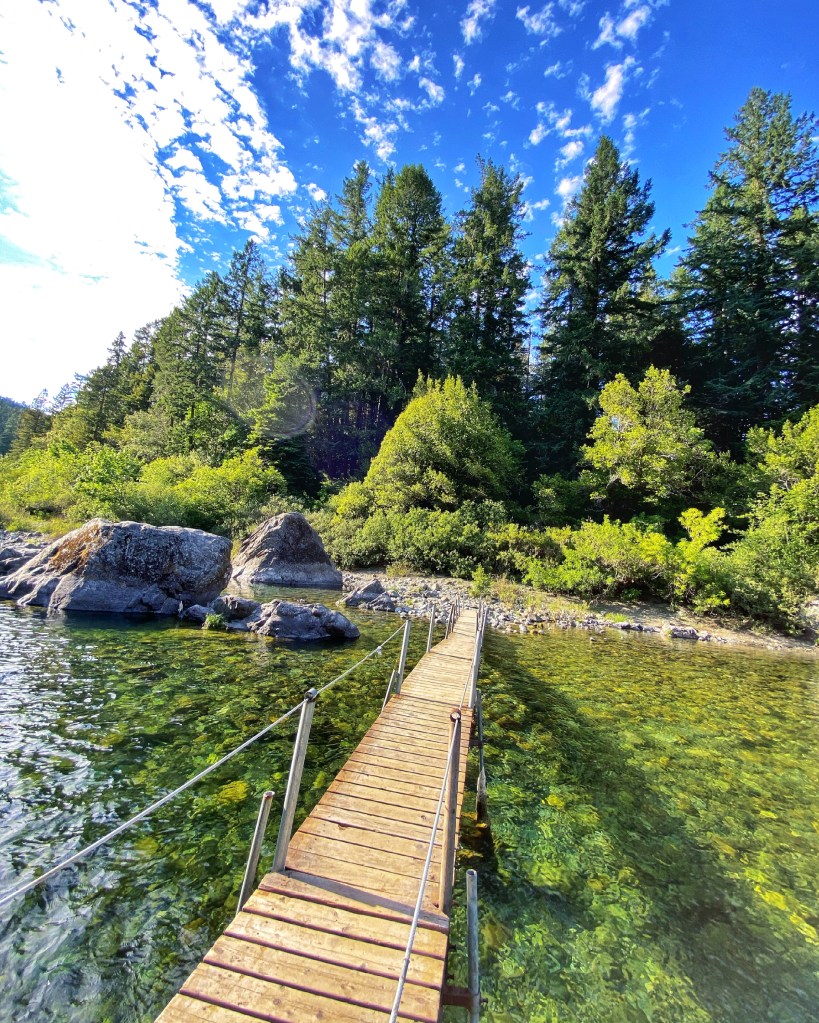
During the summer, a footbridge connects Jed Smith Campground to Stout Grove, over the Smith River (Photo: J. Foster) Hikes:
Stout Grove Trail
Stout Grove Trail (if you park in the parking area off of Howland Hill Road) is a 0.6 mile loop. It is a short hike but offers amazing views of magnificent coastal redwoods. I guarantee anyone over the age of thirty will feel like you are on the planet Endor, as you await ewoks and storm troopers to jump out at any turn. You can also walk down to the Smith River and see the river as it cuts through the redwood forest.
Simpson Reed Grove Trail
Another great family-friendly hike is the Simpson Reed Trail. This is a 0.9 loop trail and like many of the other hikes in this area–superb redwood forest scenery!
Boy Scout Tree Trail
For those looking for a longer hike, check out the Boy Scout Tree trail, 5.5 miles out and back. This trail has plenty of old-growth trees and a small waterfall just a little beyond the Boy Scout Tree.
Grove of the Titans
This trail just recently opened to the general public. There are trees on this hike that will blow your mind and leave you awestruck. I am not going to say any more than that because sometimes you just need to be surprised and explore for yourself. (Another great asset of this park is that it hasn’t yet lost all of its mystery. I pray it never will.)
Important: please stay on the metal boardwalks that you find along this trail. They are there to protect the root systems of these magnificent trees.
Scenic Views:
Howland Hill Road (Scenic Drive)
One of my favorite scenic drives in all of the Redwood National and State Parks region is Howland Hill Road. It is a 10 mile, ONE WAY (although you will often find people going in both directions, but it is very narrow and meant to be one way) dirt road that starts in Crescent City and meanders through Jedediah Smith Redwoods State Park (ending at HWY 199, near Hiouchi). There are several areas to pull over and hike/explore and meet up with trail heads. Be advised: No RV’s or trailers are allowed on Howland Hill Road.

Howland Hill Road, a dusty adventurous tour through the redwoods! Enderts Beach Road to Crescent Beach Overlook
For one of the best sunset views head over to the Crescent Beach Overlook off of Enderts Beach Road. There is a small parking area with a picnic spot that overlooks an awesome stretch of Crescent Beach. If the weather is right, you will not be disappointed! Also, watch out for elk when driving near Enderts Beach Road–they are often spotted crossing the road in this area.
Sunset View from Crescent Beach Overlook, Enderts Beach Road. (Video: J. Foster) Local Fare:
SeaQuake Brewing
You can’t visit Crescent City, CA without stopping at Seaquake Brewing! After a day of hiking treat yourself to one of the best burgers on the West Coast (the 9.2 burger, named after the earthquake and subsequent tsunami of 1964)! Or try one of their signature IPA’s! This is definitely one of the best restaurants in town! SeaQuake Brewing, 400 Front St., Crescent City, CA.
Visitor Centers/Campgrounds in the Northern District:
Visitor Centers in the Crescent City area:
Hiouchi Visitor Center (1600 US-199, Crescent City, CA 95531) It is located in between the town of Hiouchi and the Jed Smith Campground/Day Use area. It is easy to miss if you are speeding by….
Crescent City Visitor Center/NPS Visitor Center (1111 2nd St., Crescent City, CA 95531) It is located near downtown Crescent City.
RNSP Campgrounds in the northern district:
Mill Creek Campground at Del Norte Coast Redwoods State Park
Jedediah Smith Redwoods State Park
For more information regarding camping reservations click HERE.
During the summertime, camping reservations are highly encouraged!

One of the best moments of my life, exploring Redwood National and State Parks, (Photo: J.Foster) Things to do in the Southern District of Redwood National and State Parks:
Hiking:
Lady Bird Johnson Grove Trail
In 1968 Redwood National Park was established to protect the remaining redwood forest from clear cut logging practices. Lady Bird Johnson Grove is the dedication site and was named by President Nixon in honor of the former First Lady, Lady Bird Johnson for her conservation efforts (1969).
The trail is a 1.5 mile loop and has a nice selection of old-growth redwoods (some with burned out areas known as “goose pens” where early inhabitants kept geese). One of the hobbies I enjoyed while exploring Redwood National and State Parks was trying to learn the various fern species. Did you know there are over 345 species of fern in North America? See how many various fern species you can find on this trail.
Fern Canyon
This is a really cool hike.
However, it comes with some important rules/regulations/information. As of 2022, between the months of May -September you MUST have a PERMIT to access the Gold Bluffs Beach Day Use area (which is where you park to access the Fern Canyon Trailhead). Click HERE for more information on how to get your parking permit/reservation.
Also, be aware that Davison Road is a narrow, steep, bumpy road not suitable for RVs/trailers. Depending on the time of year/weather there is also a possibility of one or two river crossing areas that are not good for low clearance vehicles. Check the park website for more up to date road conditions.

Fern Canyon Trail, (Photo: J. Foster, 2021) From the trailhead walk a little until you get to the mouth of the canyon. Then proceed upstream for about a half mile. At this point you will see a more traditional type of trail wind uphill, meeting up with the James Irvine Trail. To make it a loop, take the trail to the left (you are now up above the streambed in which you just hiked) and walk back towards the beach, eventually ending up where you began–at the mouth of the canyon. There are other trail options in this area so pay attention to trail signs to be sure you are taking the route you want.
Fun fact: Fern Canyon was featured in Jurassic Park 2, The Lost World. It is a unique hike, walking in a shallow streambed with walls made of ferns….it really did feel like something out of a movie!
Prairie Creek Visitor Center and Trailheads
The Prairie Creek Visitor Center has several trailheads right outside the doors with varying skill levels and lengths. If you are short on time, stop and have a picnic at the visitor center and then choose a short hike nearby. Several short hikes to choose from: Redwood Access and Revelation Trails (1.2 miles), Elk Prairie Loop (2.8 miles), or take a short drive to Big Tree (2 minute walk from Big Tree parking lot). For a longer hike, the James Irvine and Miner’s Ridge Loop (7.2 miles).
Scenic Drives:
Newton B. Drury Scenic Parkway
This 10 mile stretch of road takes you through a scenic drive of redwood forest. Several pull out spots and trailheads are along the way. If you have the time, this is a much better option than taking US 101, if your objective is scenery.

Black bear near Bald Hills Road, (Photo: J.Foster) Visitor Centers/Campgrounds in the Southern District:
Visitor Centers:
Prairie Creek Visitor Center (US Highway 101, off the southern end of the Newton B. Drury Scenic Parkway)
Thomas H. Kuchel Visitor Center (US Highway 101 just south of Orick, CA)
Campgrounds:
Elk Prairie Campground (located within Prairie Creek Redwoods SP)
Gold Bluffs Campground (located within Prairie Creek Redwoods SP)
For more information about camping reservations click HERE.

Coastal Redwoods, (Photo: J.Foster) A trip to Redwood National and State Parks is truly an unforgettable experience. Today, most of us are surrounded by concrete or agriculture. Why not surround yourself with an ancient primeval redwood forest adventure?
Tips:
Parking
Parking within Redwood National and State Parks can be very limited due to the growing trend of visitation to our NPS sites. Trailheads and Day Use areas can be very congested. Remember RV and trailer parking is even more limited outside of the campground areas.
Safety
Remember to keep your valuables out of sight and/or with you when parked at trailheads.
Tide Pools
The best time to look for tide pools is when the tide chart predicts negative numbers. The lower the number, the better chance for tide pools. Be aware of weather and possibility of rogue waves. The beaches along Crescent City are a good spot for exploring tide pools.
Poison Oak
Be aware that there is poison oak in areas. Be careful if you find yourself wanting to hug various trees as poison oak can be wrapped around the tree in vine-like fashion.
Elk
Be cautious when driving through the park as herds of elk are often present near or even in the road at times.
California State Parks, Camping, Coastal Redwoods, Fern Canyon Trail, Gold Bluffs Beach Campground, Hiking, Howland Hill Road, Jedediah Smith Redwoods State Park, National Park Site, Newton B. Drury Scenic Parkway, Redwood National and State Parks, Save the Redwoods League, Scenic Drives, SeaQuake Brewing, Tide Pools -
Radish and Rye: New Mexican Fare With an Amazing Whiskey Menu.

Radish & Rye located in Santa Fe, NM On a recent trip to Santa Fe, New Mexico I had one of the most enjoyable dining experiences of recent years. After a brief Google search, I found that Radish & Rye had many great reviews and a savory food and drink menu. So, we took a chance and made reservations. As we entered, the ambiance felt intimate and upscale. The hostess and waiter were both quite friendly and seemed eager to accompany us on this new foodie adventure.
The bourbon lover in me immediately noticed the extensive and high-quality bourbon, whiskey, and rye list! They also offer flight menus! I tried the flight from Buffalo Trace so that I could taste the Eagle Rye and Elmer T. Lee for the first time. I felt like we were back on the bourbon trail with such an exciting and stellar bourbon list!

Radish & Rye, Whiskey/Bourbon Flights We love the farm to table mission and philosophy to seek locally sourced agriculture. The menu had a handful of offerings for each of the categories: appetizers, entrees, desserts. The vibe felt almost like a take on New Mexican soul food. It was perfect! We ordered the pan fried trout with a green chili corn bake (doesn’t that sound like a mixture of New Mexico and the southeast?) and the blackened snapper. Both were full of flavor and prepared just right. It’s no surprise that we later learned Chef Dru Ruebush won “2022 Best Chef in Santa Fe” by Edible New Mexico. Everything about our visit this particular evening felt like it was meant for us–even the music playlist kept playing songs that we loved. Some nights are just magical. Our evening at Radish & Rye was exactly that.

Left: Pan fried trout with green chili corn bake 
Right: Blackened snapper So, if you are interested in one of the best full-service dining experiences Santa Fe has to offer, or you just want to try a well-crafted cocktail…find your way to Radish & Rye!
Reservations encouraged.
-
Hiking the Narrows: A Refresher Course on Life
By: Jessie Foster
Photos: Rebekah Sorkin

Heading into the Narrows Several months ago, my hiking buddy and I began planning an epic road trip from Denver, CO to Mt. Carmel, UT with the Narrows as the ultimate goal. Located within Zion National Park, the Narrows is a high-walled canyon where the Virgin River flows through. Hikers literally traverse the river on either a half-day, up and back (which does not require a permit) or a top-down hike (which does require a permit and a lot more time). Upon leaving Denver, we took the southern route going down through southwest Colorado and up through southeastern Utah.
After preparing our dry bags and finalizing our footwear choices, we entered Zion National Park. We parked at the Visitor Center and waited for the park shuttle to transport us to the Temple of Sinawava, the last stop on the line. This stop is where the Riverwalk Trail begins, a paved trail shrouded in lush habitation that follows the Virgin River and eventually leads into a deep, narrow canyon. Thus, the Narrows hike begins.
We arrived at the trailhead at 10:30a.m, an hour and a half later than we intended but it did not deter us. Eight hours later, at 6:30pm, we arrived back where we started. Those eight hours spent hiking over rocks and small boulders, through a steady river flow taught me a lot about myself. It also reaffirmed several key lessons about life.
The processes of life are all around us.
At the very start of our hike, just after the first bend in the river, we started to smell an alarmingly foul smell. I started having conversations with myself about how over-used such trails and parks have become, chalking up the odor to people not packing out their human waste. However, as I looked down and to the left, inside one of the first carved out openings that set back from the water there were maggots on the bottom of the rock wall. Of course, maggots symbolize death so as Rebekah and I looked to see what was decaying, we quickly saw the remains of a dead, rotting deer. I imagine that the poor thing must have wandered into the canyon and got swept away by a flash flood, coming to rest where we now stood. This was not the most pleasant way to start our adventure but later on in the day this experience took on new meaning, almost as clear as an Aesop fable.
Throughout the hike we were surrounded constantly by three elements: rock, sand, and water. The entire canyon was a visual reminder of process, change, and the power of water. We observed the way the canyon walls curved and were carved, the way some rocks were smooth and others porous (Rebekah’s favorite word) from water’s presence. What is life but time and pressure? What is life but the processes of burgeoning and decaying? At the very end of our awesome journey, as we walked with sore hips and tight quads back to the shuttle, we came across a large deer feeding on the bushes about six feet away from us. This lone deer noticed us and continued to feed on leaves, letting us watch. It was a striking end to the day…beginning the trek with death at our feet and ending the day with life and nourishment. The cycles of life are all around us.
As we rode the shuttle back to the Visitor Center, I couldn’t help but overhear the people next to us. A lady who looked in her early forties, who was from Michigan, was talking with a woman in her sixties about all of the National Parks they have seen and hikes they still want to do. When the subject of retirement came up, the younger woman stated, “I think you just have to do it now. We aren’t promised retirement. You never know how much time you have.”
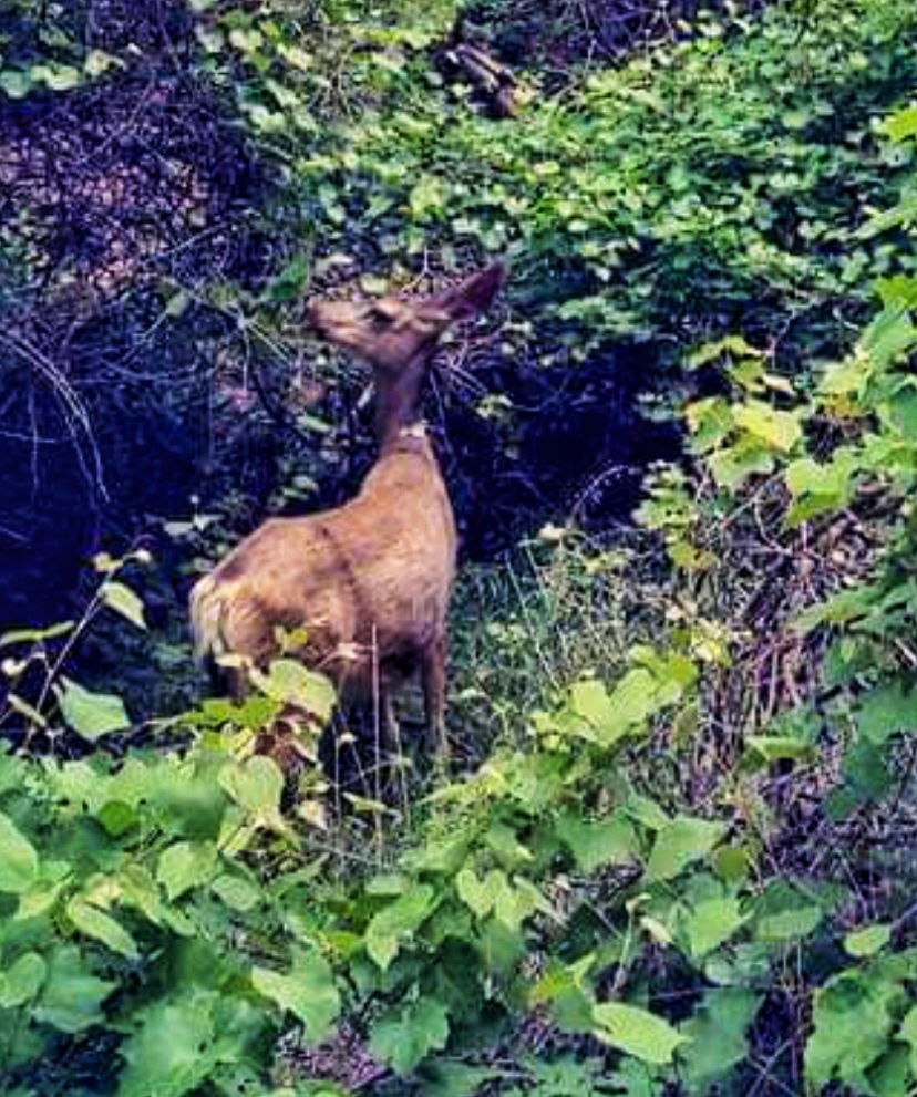
The deer we saw at the end of our journey. New Adventures Create Opportunities to Conquer Self-doubt…
As eager and excited as I was to participate in this uniquely beautiful and slightly challenging hike, I had moments of wondering if I was overestimating my abilities. Of course, taking a self-assessment is wise when undertaking such adventures but sometimes our inner critic can often judge too harshly.
During the hike there were moments when my anxiety reared its head. Moments when a three feet width of river suddenly started to cause me panic (even hours into the hike, after already trekking through rushing portions of the same current). At times the dialogue in my head began asking such questions as: Am I going to fall? Can I make it? But I reminded myself that not only can I do this but, in fact, have been doing it for a few hours now.
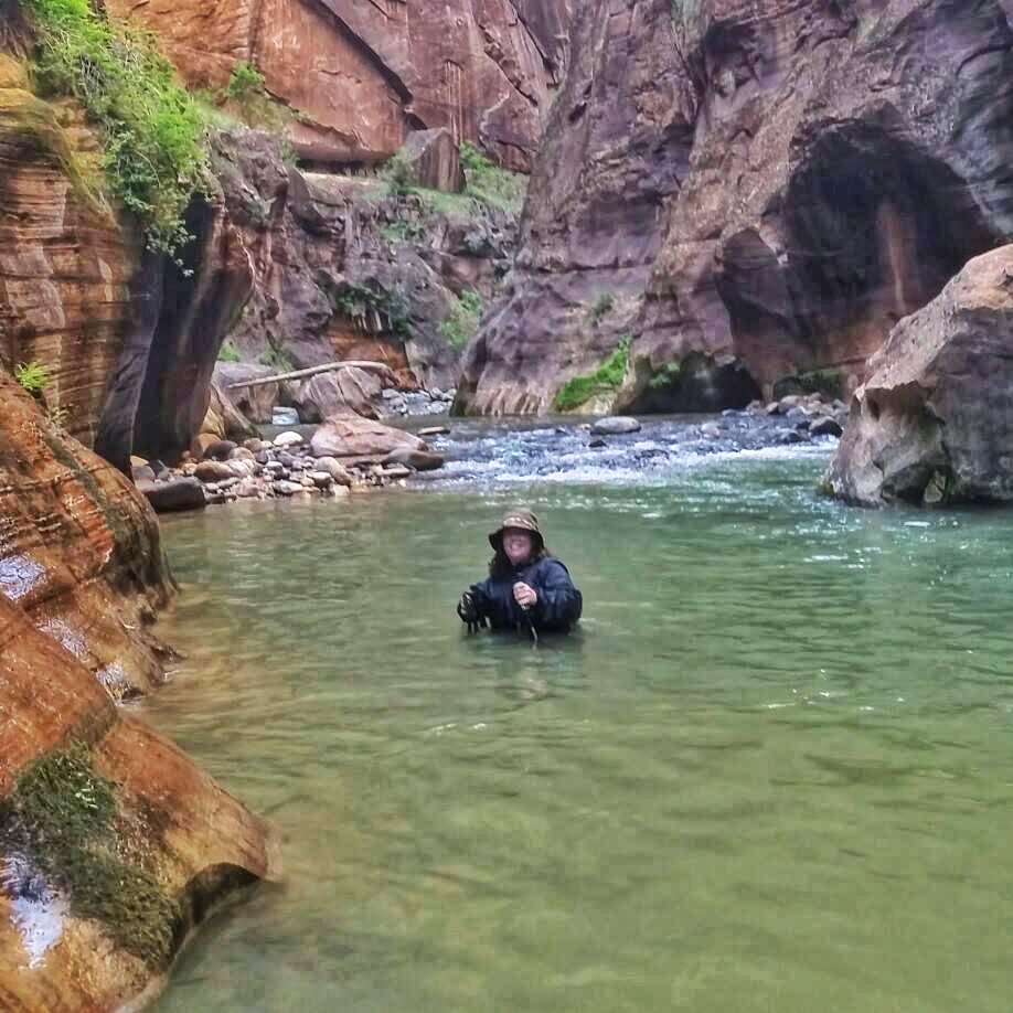
Up to my neck (almost ) in the Narrows. I remember reading some of the writings of Chris McCandless in my favorite book Into The Wild where he wrote:
”…And I also know how important it is in life not necessarily to be strong but to feel strong, to measure yourself at least once in the most ancient of human conditions, facing blind, deaf stone alone, with nothing to help you but your own hands and your own head.”
I took a deep breath and cautiously but with determination put one foot in front of the other, giving a silent middle finger to the voices of self-doubt. The feeling of accomplishment I felt as we walked out of the Narrows will stick with me the rest of my life.
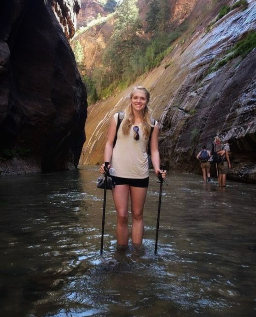
Adventures are better when shared.

Friends and hiking companions. Continuing the theme of Chris McCandless writings, he wrote in his journal toward the end of his life: “happiness is only real when shared.” And I must concur.
I’ve always been an independent person (mostly) and I have done solo hikes and solo trips before. But there is something about having a friend or fellow traveler along that makes the moments richer and altogether more fun. I mean, every few minutes while hiking the Narrrows we had to stop and just say out loud, “Whoa! Look at the beauty” or some variation thereof. I imagine if either of us had been hiking solo people would of thought us mad, as we stopped to proclaim the beauty so exuberantly before us.
But seriously, the laughs, the talks, and the shared experiences add to the enjoyment of the journey. And such is life….But even more, there will always be another soul with flesh on somewhere on this spinning globe that will know exactly what I mean when I say: remember when?
One hike: two different experiences.
The half-day, bottom up hike is one where you can only hike so far before you have to turn around and head back the same way you came (unless you have a special permit). On the way up the Narrows the sun was shining mostly directly down upon us. The canyon was bright and sunbeams danced all around us. On the return hike, the sun was less direct and the canyon became less illuminated. Thus, the canyons own natural colors became more visible. The river became more greenish-blue. Instead of sunbeams dancing it was now shadows that danced before us. Both directions were beautiful. Both directions offered different experiences; something I wasn’t expecting.
I am reminded that sometimes I miss things the first time around.
Sometimes I misjudge people. Sometimes I turn off my mind before the ride is over. Or I close my eyes before the real performance begins. If I had kept my eyes down on the return hike, thinking that I had seen it all before, I would have missed out on the canyon’s true beauty.
I must remember to keep my eyes open. And to remember that the elements of surprise and wonder may just be around the corner…even if it is a path I have already journeyed.
Sometimes it is helpful to plan your steps. Sometimes it is helpful to go with the flow.
The river showed me things about myself.
Besides bringing to the surface bits of self-doubt it also showed me parts of my personality and that of my hiking buddy.
Ready to walk through the river! There were numerous times when we had to criss-cross the river due to boulders or one side being more or less rushing than the other. About twenty minutes into the hike I began to develop my own system of navigating the hike for myself. I would look upstream and see what was coming and where the white water was so that I could go around (if possible) the more powerful currents. The river became like a chess board as I tried to think two steps ahead. My hiking buddy was fearless. I noticed her several times taking on the river in sections where I chose to go to the left but she was chill with going to the right side. She was spontaneous and fierce; taking the river as it came to her.
I believe life is best lived when balanced between these two approaches: planning and spontaneity. I must be mindful of how I tread and yet if I try to plan out every step I will certainly take all of the joy out of life (not to mention be very frustrated when unforeseen events occur). I must also learn to go with the flow.
Like the river, I must remember that I am strong. But I must learn to bend. It is okay to have both deep and shallow moments. And it is okay to let people in.
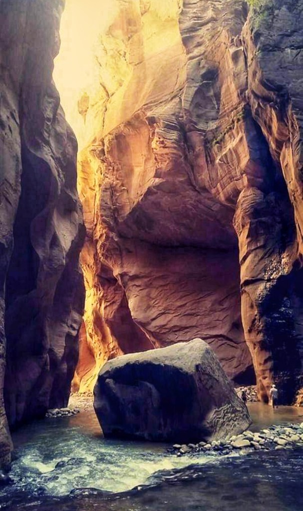
The beauty of the Narrows… (This post was originally shared on my older blog: www.DenverExcursions.Blogspot.com. I have revised it and added more photos since the original post).
TIPS:
*For lodging the night before the Narrows, we camped at Zion Ponderosa Ranch Resort about an hour northeast of Springdale, Utah. Highly recommend!
*A lot of people have asked what footwear to use while doing this water hike. It is a bit unconventional, but I wore a pair of wool socks and old tennis shoes. I did not want my toes to get stuck between any rocks that were under the water. This worked really well. I also recommend hiking poles for certain sections of the hike.
*Do your due diligence and monitor the weather. You do not want to be in a slot canyon during a rain/flood event. Late spring/early summer worked well for us, having less monsoon rain. But definitely be aware of the weather for whatever day(s) you go.
-
Bent’s Old Fort and Sand Creek Massacre National Historic Sites
Entrance to Old Bent’s Fort Situated along the Old Santa Fe Trail, in present day La Junta, Colorado, is a reconstructed trading post where at one time mountain men, various Indigenous tribes, Mexicans, and Anglos converged. Bent’s Old Fort National Historic Site was the main trading grounds for the Bent, St. Vrain Co., it was a multi-cultural hub during the mid-1800s and not uncommon to hear a handful of different languages spoken on the property. During its prime, the dealings at the fort actually impacted global economics. Bent’s Old Fort represents a unique time in borderlands and American West history.
Interior galley, inside of the fort We visited for the first time during their limited candlelight tours, which usually take place a couple of weekends in December. (Tickets are required). During this special tour, volunteer living history reenactors help to make history come alive. The fort was beautiful by candlelight, as shadows flickered and lurked along the interior/exterior walls.

Storage room, fur trading room Earlier in the day we visited the Sand Creek Massacre National Historic Site, located in Eads, Colorado (1.5 hours east of Bent’s Old Fort). This is a sobering and moving memorial to the Cheyenne and Arapaho individuals who died during the American Indian Wars. Chief Black Kettle flew the American Flag and a white flag, as a sign of peace. However, General Chivington of the 1st Colorado Infantry (Volunteers) and 3rd Regiment of Colorado Cavalry ignored the peace signs, ordering an attack. Most of the casualties were of women, children, and elderly.

Entrance to Sand Creek Massacre National Historic Site The park is completely an outdoor experience designed to be a walking tour. There is a small mobile unit set up for visitor contact and small bookstore. The park is isolated and remote but honors a significant moment in Colorado history. I’m glad I was finally able to make my way here.
It is a long, dusty drive to see these two sites (we had fun dodging tumbleweeds along the way), so I definitely recommend making an overnight trip. If you want a place to stay not too far from the fort, I suggest KOA Journey in La Junta, CO. It was clean, close, and had an adorable caboose to rent for a night! The interior of the caboose looked practically new and was designed with an eye for detail and an artsy vibe.
We had so much fun!
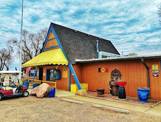
KOA Journey office, La Junta, CO 
The Caboose where we stayed–and LOVED it! *This post was taken from my former blog (www.denverexcursions.blogspot.com). I am in the process of migrating my old blog to this new site.
-
Subscribe
Subscribed
Already have a WordPress.com account? Log in now.
