-
Things To Do in Estes Park This Weekend (July 10-12, 2026).
Many people who visit Estes Park are familiar with F.O. Stanley, the original owner of the famous Stanley Hotel. However, not many know about his other contributions to the town such as the Fall River Hydroelectric Plant. The Estes Park Museum hosts tours of this facility on select Fridays in the summer.
Tour the Historic Fall River Hydroplant
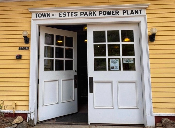
Photo: Entrance to the Historic Fall River Hydroplant, 2026. 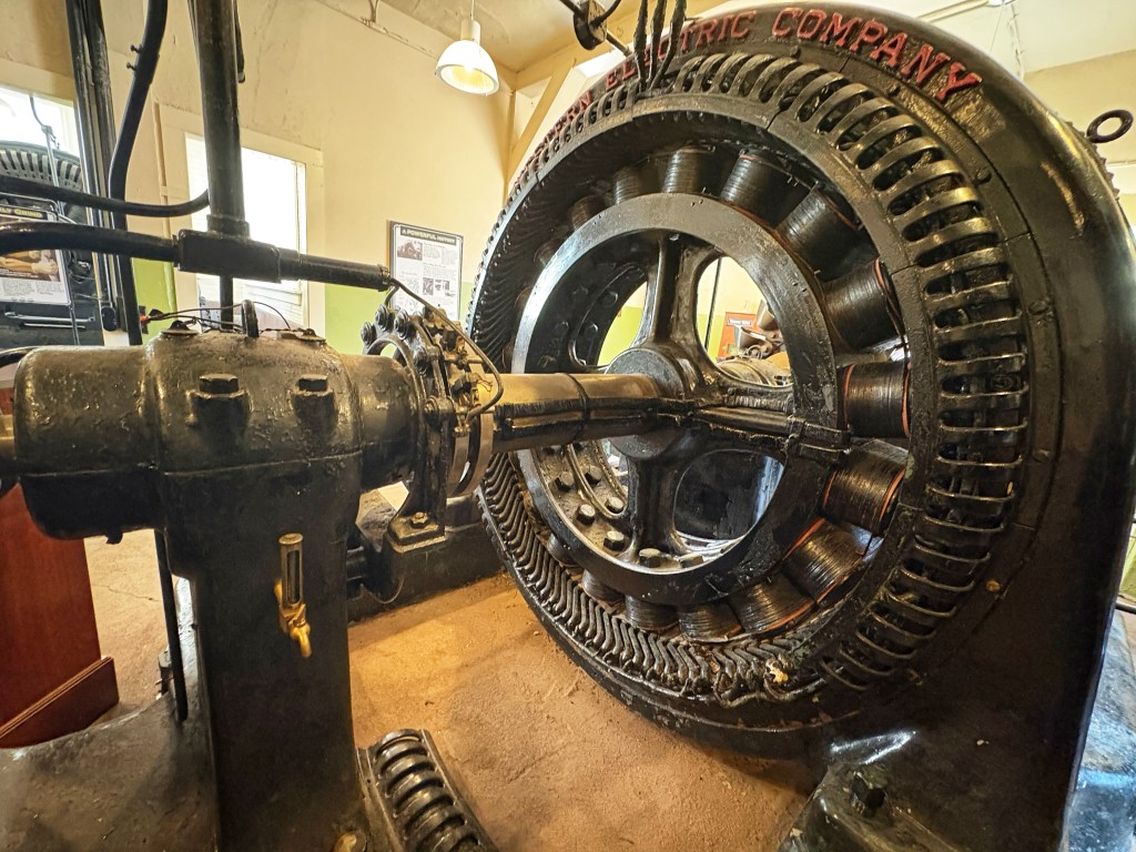
Western Electric Co. Water Turbine 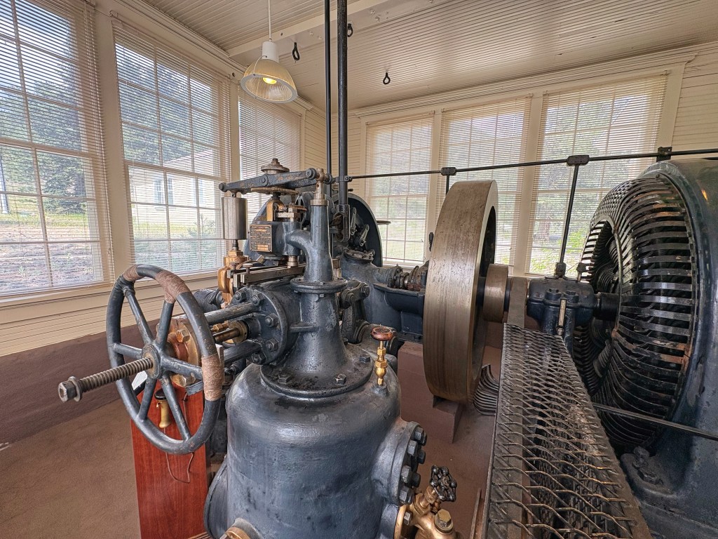
Worthington Diesel Turbine Tour Days for Summer 2026: June 12 & 26, July 10 & 24, August 7 & 21 (Times: 12:00, 1:00, 2:00, and 3:00pm).
Admission is FREE to the hydroplant. Location: 1754 Fish Hatchery Rd., Estes Park, CO 80517
Attend a Starry Sky Soiree
Larimer County Natural Resources is partnering with the Colorado Astronomical Society for a fun, educational event of stargazing! Telescopes will be available for observing objects in the nightsky such as constellations, galaxies, and planets!
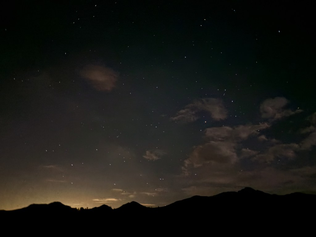
Date: Saturday, July 11 at 9-11pm.
Location: Hermit Park Open Space (17 Hermit Park Rd, Estes Park, CO)
Cost: parking pass required ($10/per resident vehicle or $15/per nonresident vehicle).
Catch the Rooftop Rodeo!
The Rooftop Rodeo is in town! Located at the Estes Park fairgrounds, the rodeo is here through July 11th!
Photo: Image not mine.
Grab a latte from KIND Coffee and take a hike!
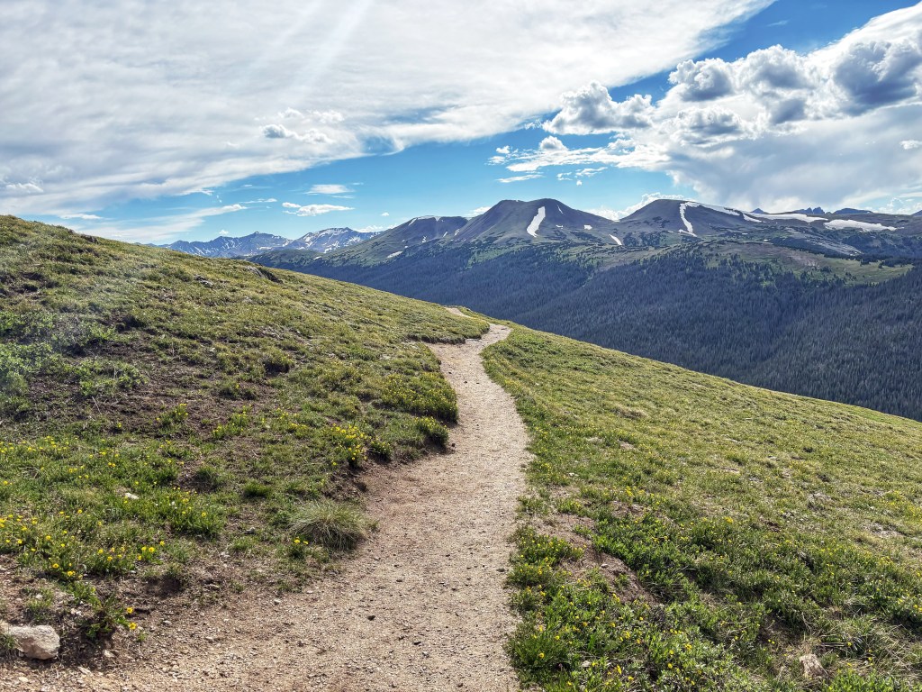
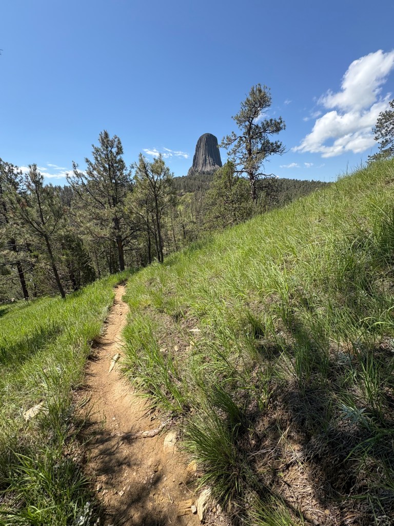
Hiking in Rocky Mountain National Park, 2026. There are trails inside the national park AND outside of the national park. Get out a map and find a new trail to explore!
NOTE: Rocky Mountain National Park is one of the parks that operates on a timed-entry system May-October. Plan accordingly. Check Recreation.gov for one of two types of reservations for the park. And here is information from Rocky’s website.

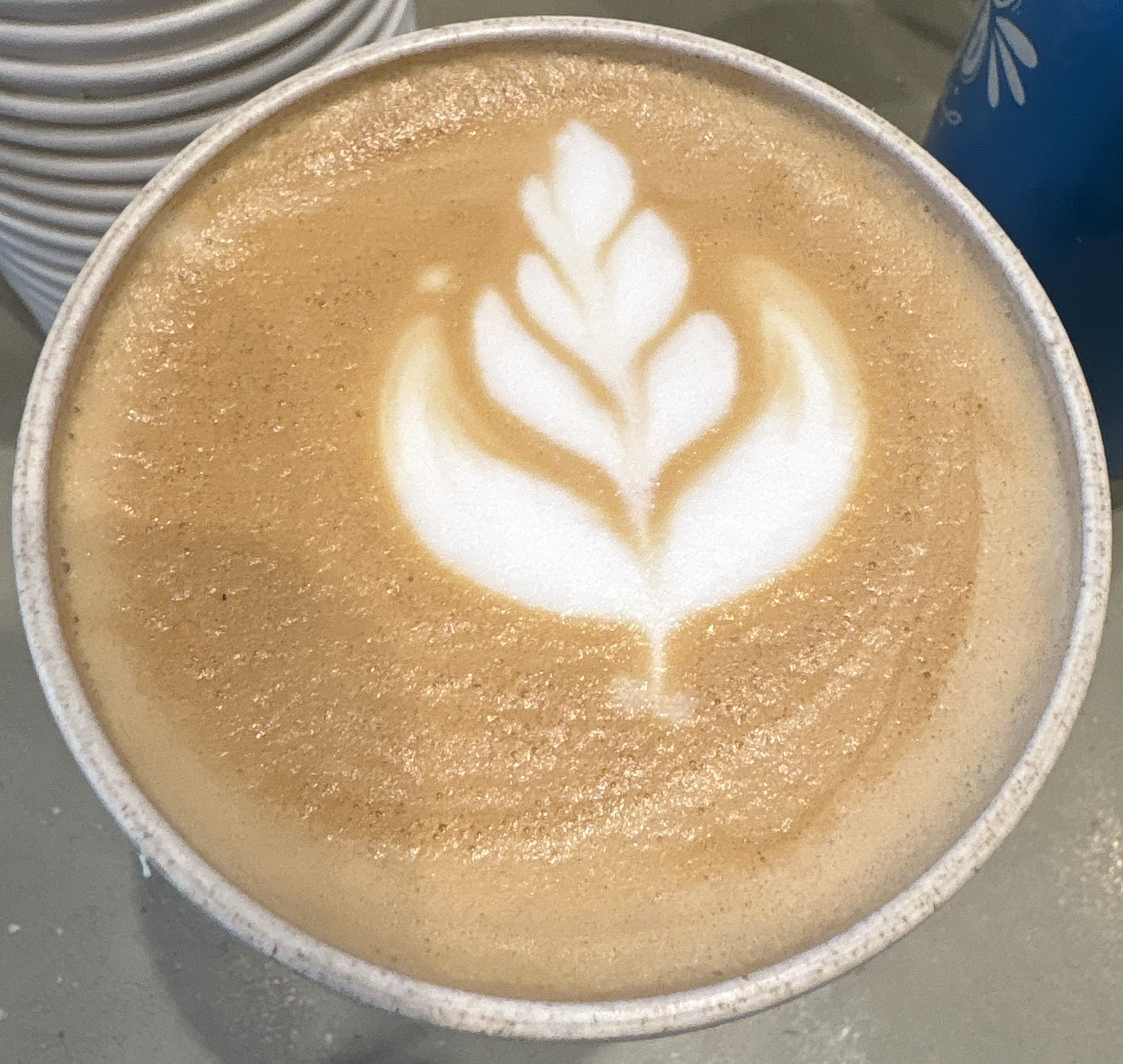
Photo: New fave at KIND Coffee –> The Wildflower Latte (homemade lavender syrup mixed with honey) Have a great weekend!
-
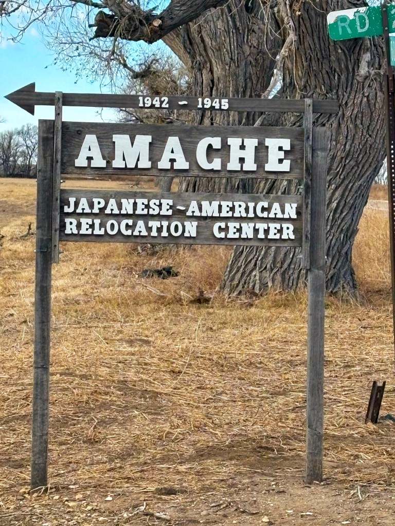
Remembering Amache: Stories of Resilience Against a Backdrop of Injustice.
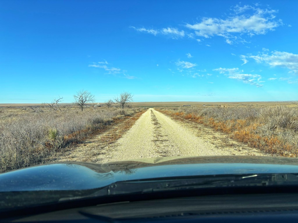
The road to Amache (2026). Imagine going to the post office or grocery store one day and seeing signs posted telling you and the local community to pack up and evacuate. You are given one week to close out your business dealings, pack up your family, and drive to an assembly center. From there, the United States government, under the direction of the War Relocation Authority, transports you and your family to what they called a “relocation center” (but today we know them as internment camps).
This is what happened to approximately 120,000 Japanese Americans from 1942-1945, here in the United States.
Most of whom were United States citizens.
Entrance to Amache National Historic Site. After the attack on Pearl Harbor in 1941, people of Japanese descent living here in the United States were labeled ‘alien enemies’, despite the fact that many were American citizens. As xenophobia and fear spread across the country, Franklin D. Roosevelt signed Executive Order 9066, which authorized the military to create exclusion zones and then to remove Japanese Americans from these zones.
They were then bussed to ten different “relocation centers” spread across the United States but mostly concentrated in the western portion of the country.
The Amache Camp, also known as the Granada War Relocation Center, was a Japanese internment camp located in Granada, Colorado. Now, preserved as a memorial and NPS site, Amache National Historic Site, shares the history and resilience of its former Japanese American residents.
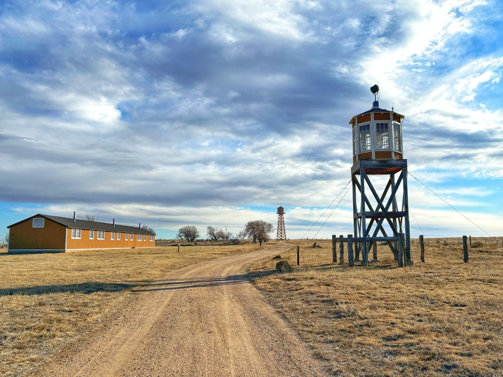
Replica of one of the living quarters, situated to the left of an old guard tower at Amache National Historic Site. 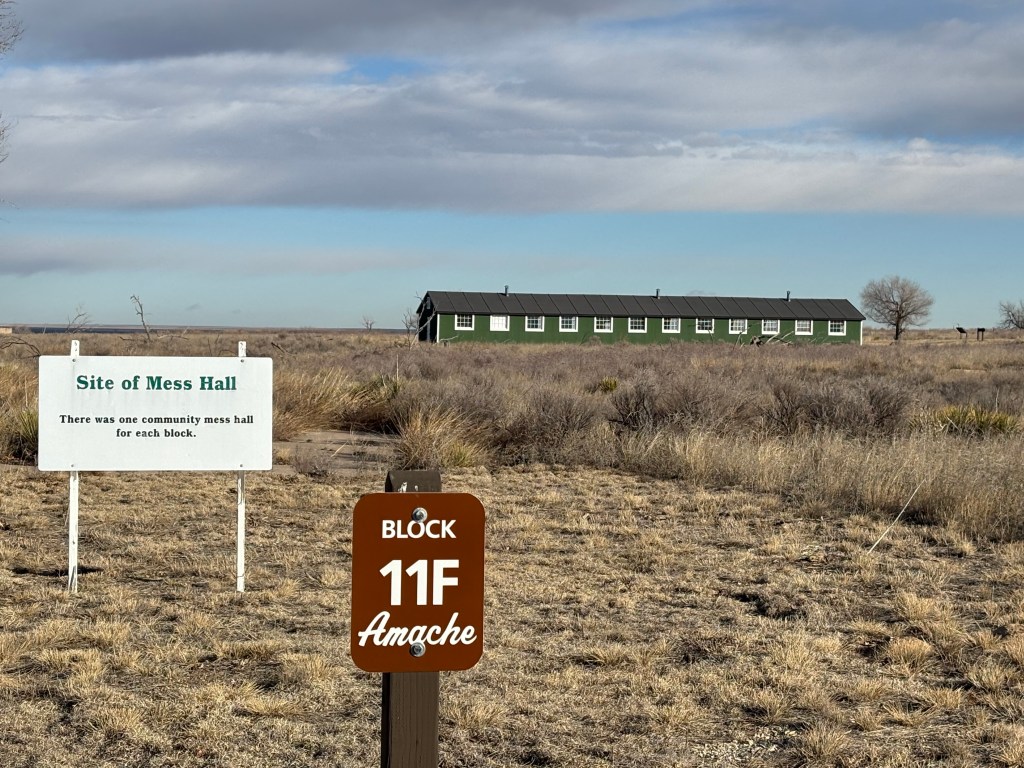
Mess Hall at Amache National Historic Site. It was a solemn experience driving and walking around the grounds. There are several reconstructed buildings, guard towers, old foundations, a memorial wall, and a cemetery that honors 121 internees who died at the site, as well as, 31 Japanese Americans who served in the 442nd Infantry Regiment. It was quite moving to stand before the memorial and to reflect on the lives of these individuals.
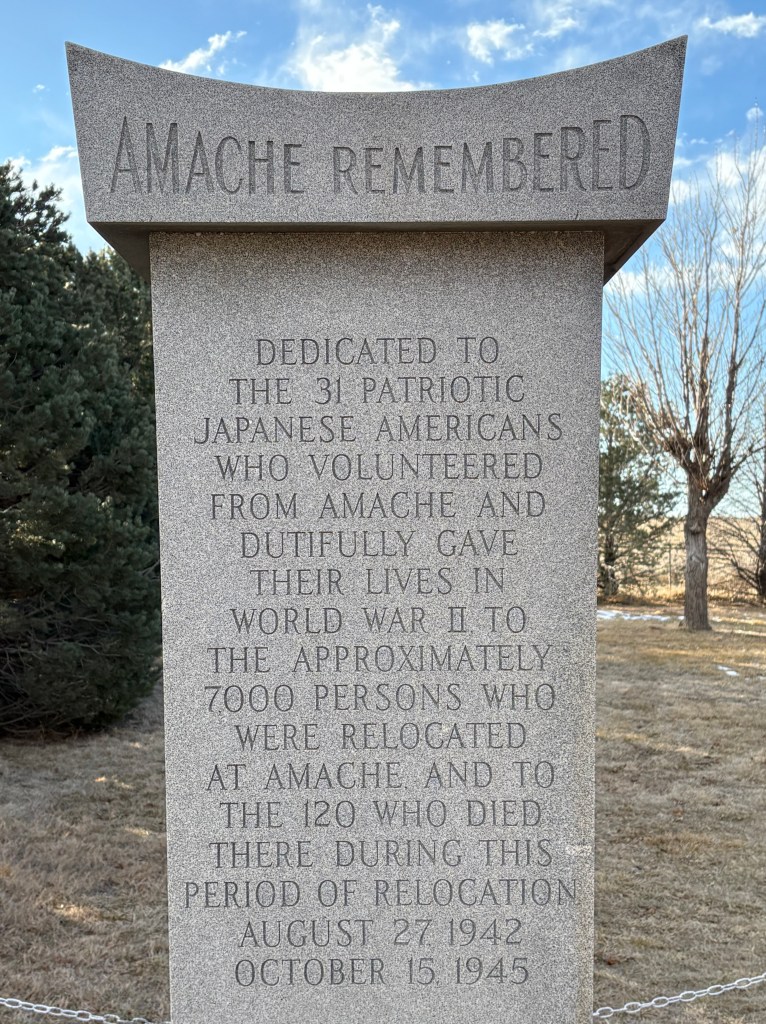
Memorial site at Amache National Historic Site. Despite the injustice, many Japanese American internees volunteered to serve in the war as part of the 442nd regiment. After the war, President Truman acknowledged their sacrifice and predicament when he said, “You fought not only the enemy, but you fought prejudice–and you have won.” The 442nd Regimental Combat Team is still one of the most decorated units in US military history, earning 4,000 purple hearts and 21 medals of honor, along with 18,000 individual decorations.
Visiting Amache was a stark reminder that injustice happens even in our own backyard. Just how strong (or fragile) are civil rights? It made me wonder about how to prevent such atrocities in the future. Amache reminds me that we must continue to work against racism and injustice.
And…walking through the museum and reading the stories of those who lived at Amache…I am also reminded just how resilient humans can be.
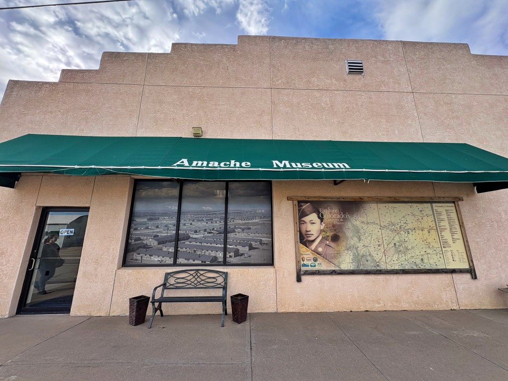
The Amache Museum, located in Granada, Colorado. Things to Know for Your Visit:
- There is a museum! The Amache Museum is located about 5 minutes east of the historic site entrance, in the town of Granada, Colorado. They have artifacts and objects donated by survivors. I definitely recommend visiting before or after your site visit.
- There is a self-guided auto tour of the Amache National Historic Site.
- The location is on the High Plains and therefore watch out for cactus and possibility of rattlesnakes.
- Thanks to the Amache Preservation Society for their efforts to maintain this historic and special site. And to the National Park Service for helping to preserve and share American history….even the challenging parts.
- Visit with Respect.
- Additionally, Amache NHS has one of the best Junior Ranger booklets I’ve ever seen from an NPS site! Yes, they have the NPS passport stamp and Junior Ranger program located at the Amache Musuem!
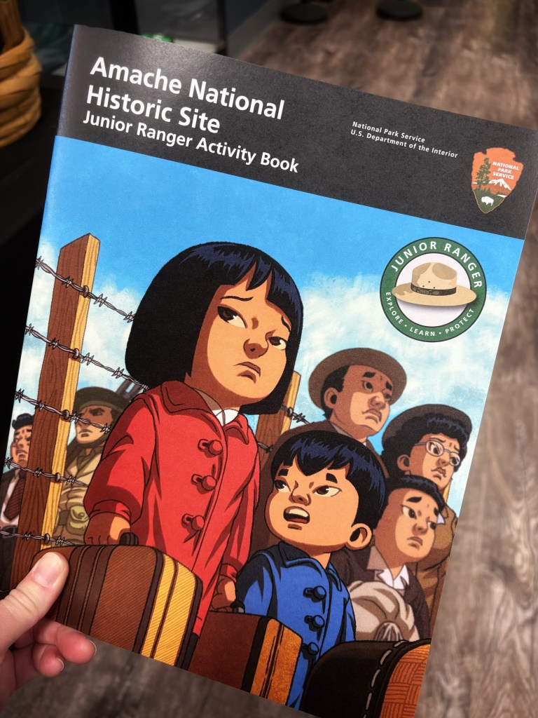
The Junior Ranger book at Amache National Historic Site: Very well designed and put together! 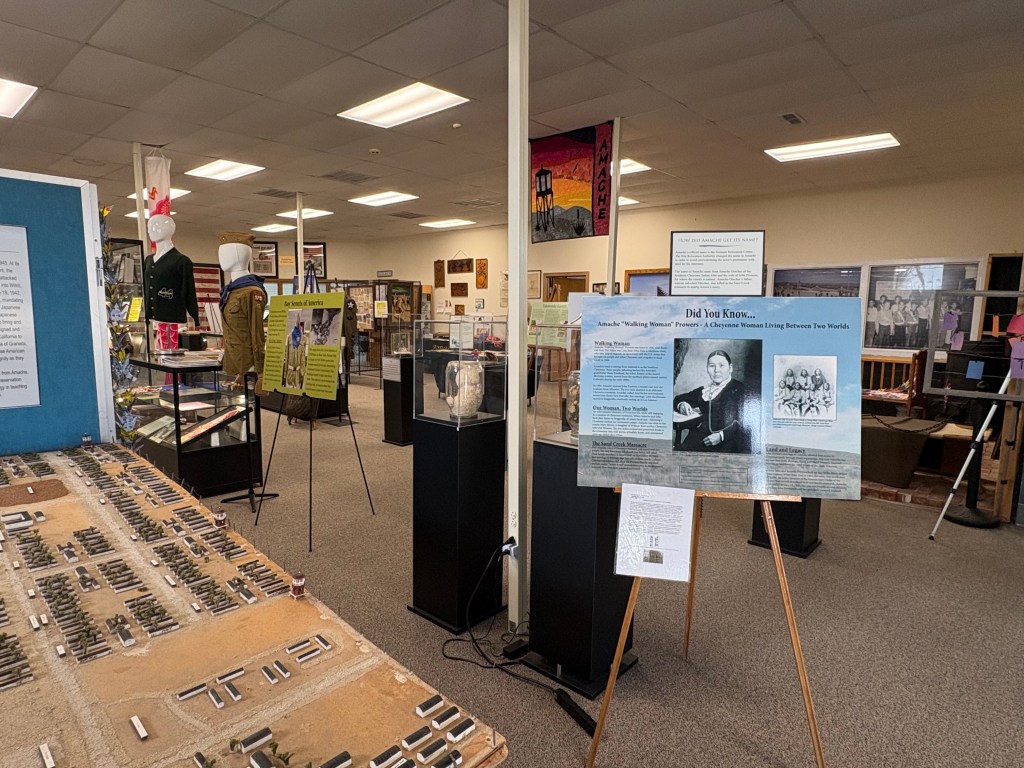
View from inside the Amache Museum. -
Council Grove, Kansas: Where the West Was Opened.
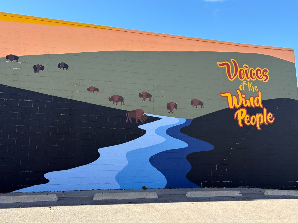
Mural in Council Grove, KS.
The Kansa or Kaw Nation; known as “the Wind People.”(2026)I asked my spouse if we could swing through Council Grove on our way to Tallgrass Prairie National Preserve. Council Grove, Kansas is located in the heart of the Midwest, along the Neosho River. I remembered reading about a certain oak tree where the leaders of both the Osage and the Kansa met and later signed a treaty with the U.S. government under this grove of trees. Hence, the name Council Grove.
When you understand what went down in Council Grove, you understand how America came to be as it is today.
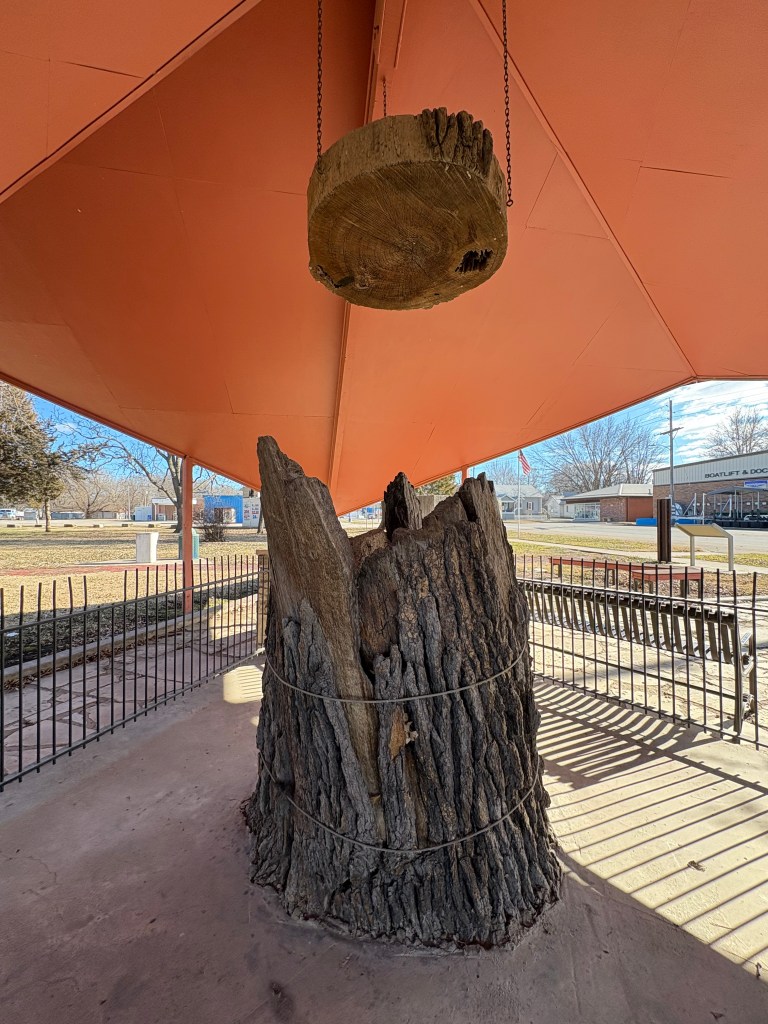
What remains of the Council Tree (2026). From 1778 to 1871 the United States signed more than 350 treaties with Indigenous tribes. Many of these treaties resulted in land reduction for Indigenous tribes, while others were meant to quell conflict as settlers and squatters moved West.
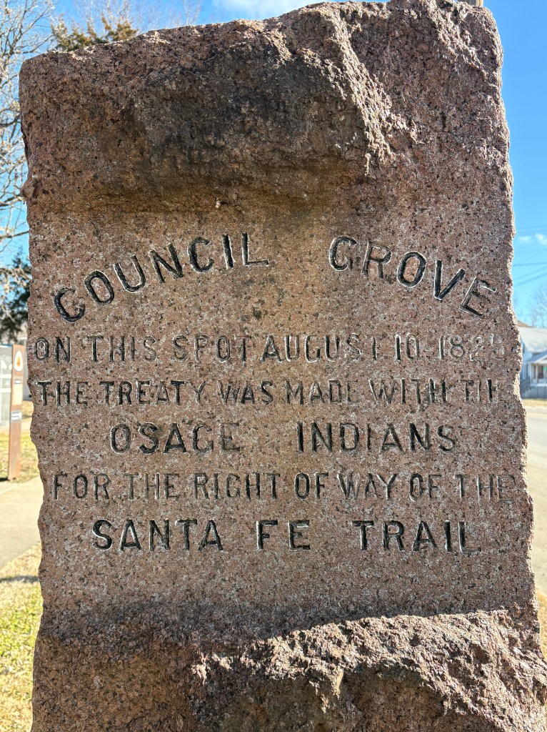
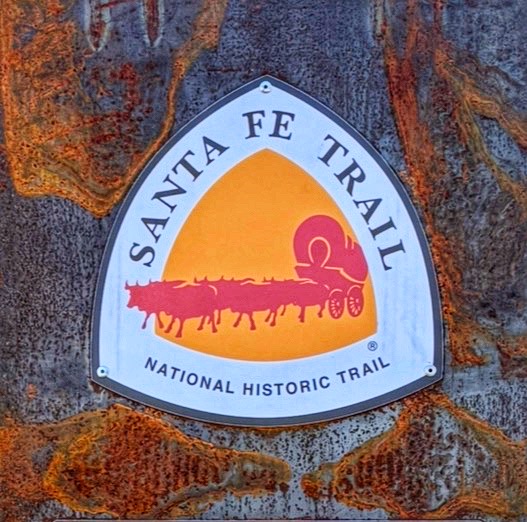
The treaty signed in August of 1825, at Council Grove, gave the right-of-way for settlers to travel through Osage Territory along the Santa Fe Trail.
Several commissioners sent by President Adams (i.e. George Sibley, Thomas Benton, Benjamin Reeves, and Thomas Mather) met with Osage leaders, Pawhuska and Watonga. For $800 the Chiefs gave permission to allow safe passage of wagons and settlers traveling through their land.
Gradually, this dusty international trail brought more and more settlers into the West and into Indian Territory.
Council Grove Marker (2026).
Council Grove is more than just a dot on a map; it is a place that holds deep historical and cultural significance.
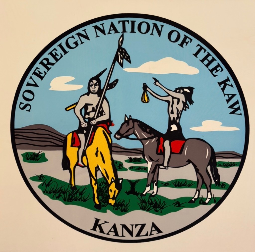
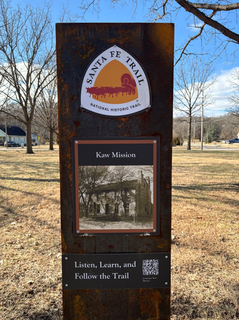
Kaw Nation (2026). Just down the street from the Council Tree, is the Kaw Mission State Historic Site; a former boarding school turned museum. This was definitely a more solemn tour as we learned about 30 Kaw boys who were taught farming and Christianity but were not really appreciated for who they were inherently…and we learned how the Kaw were pushed out of their own territory into Oklahoma. However, I am glad this museum did not white-wash history. I am glad to see historical societies still sharing the full story, even though it is hard and complex.
[Side note: The mission is managed by the State Historical Society, but they do have NPS passport stamps for all of you National Park Geeks out there. We found a stamp for the Kaw Mission, Last Chance Store, and the Santa Fe Trail.]
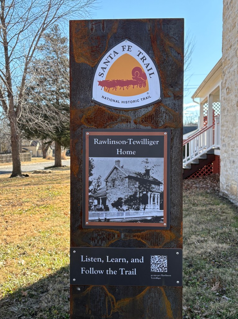
Santa Fe Trail Marker 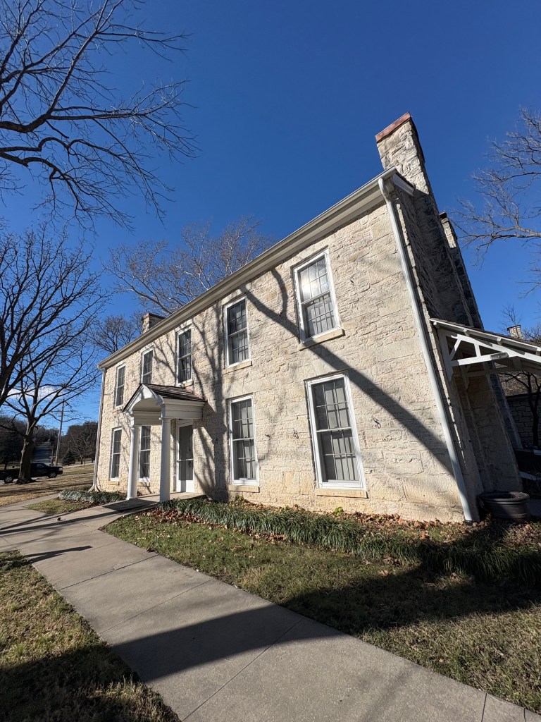
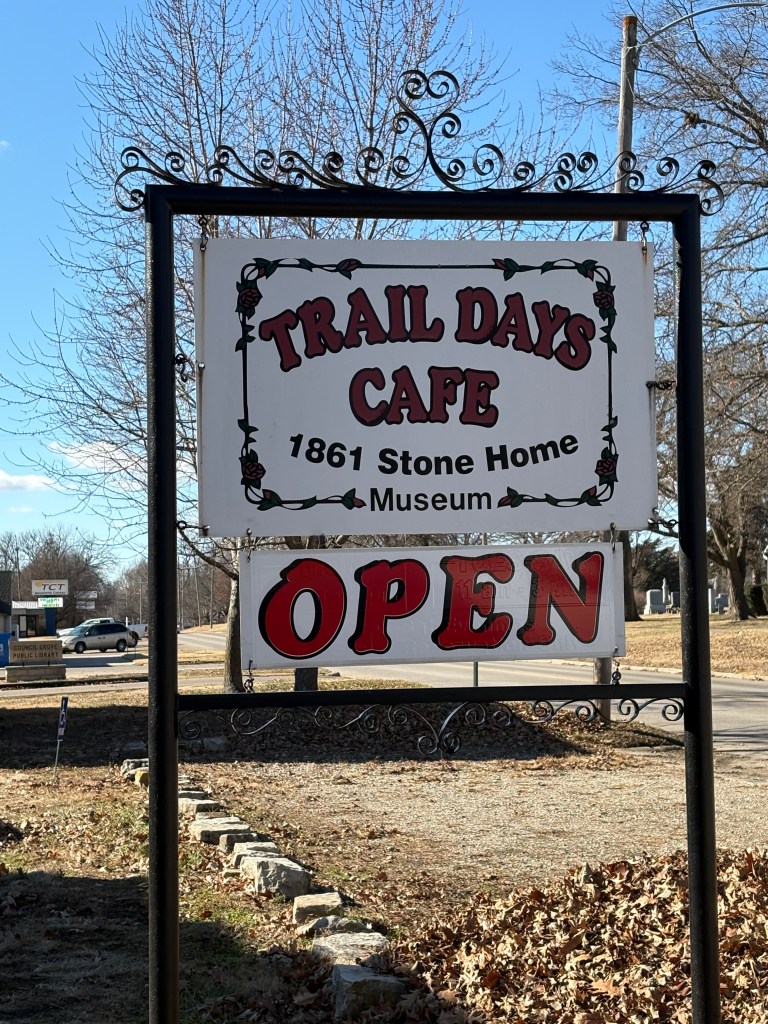
Kaw Mission Based on the advice of a friendly docent, we ventured further down Main Street, along the Old Santa Fe Trail and arrived at the historic Rawlinson-Terwilliger Home. This historic home is now the site of the Trails Days Cafe and Museum, Council Grove’s hidden gem!
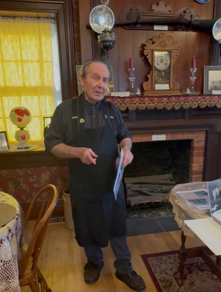
Kenneth, Owner of Trail Days Cafe and Museum. Tucked away inside the Trail Days Cafe and Museum, we found local historian and preservationist, Kenneth McClintock. He and his wife, Shirley, bought the historic property in 1994. It was in poor condition, but they raised money and put in the sweat equity to get the home renovated from top to bottom. In 2002, they opened the Trail Days Cafe and Museum inside of this historic stone house.
We sat down for lunch and were impressed with the menu, as there were various options representative of the different ethnic groups of the region. While we ate, we listened to Ken share snippets of Council Grove history. His passion and dedication to historic preservation made our visit to Trail Days Cafe and Museum one of the highlights of our five-day adventure through Kansas.
[To read more about other sites we visited on our adventure, click here.]
Council Grove is rich in history and culture. I’m glad we were able to take a little detour and spend time learning about the people and history of this place.
Santa Fe Trail National Historic Trail Sign. -
Five National Parks, One State: A Kansas National Parks Road Trip
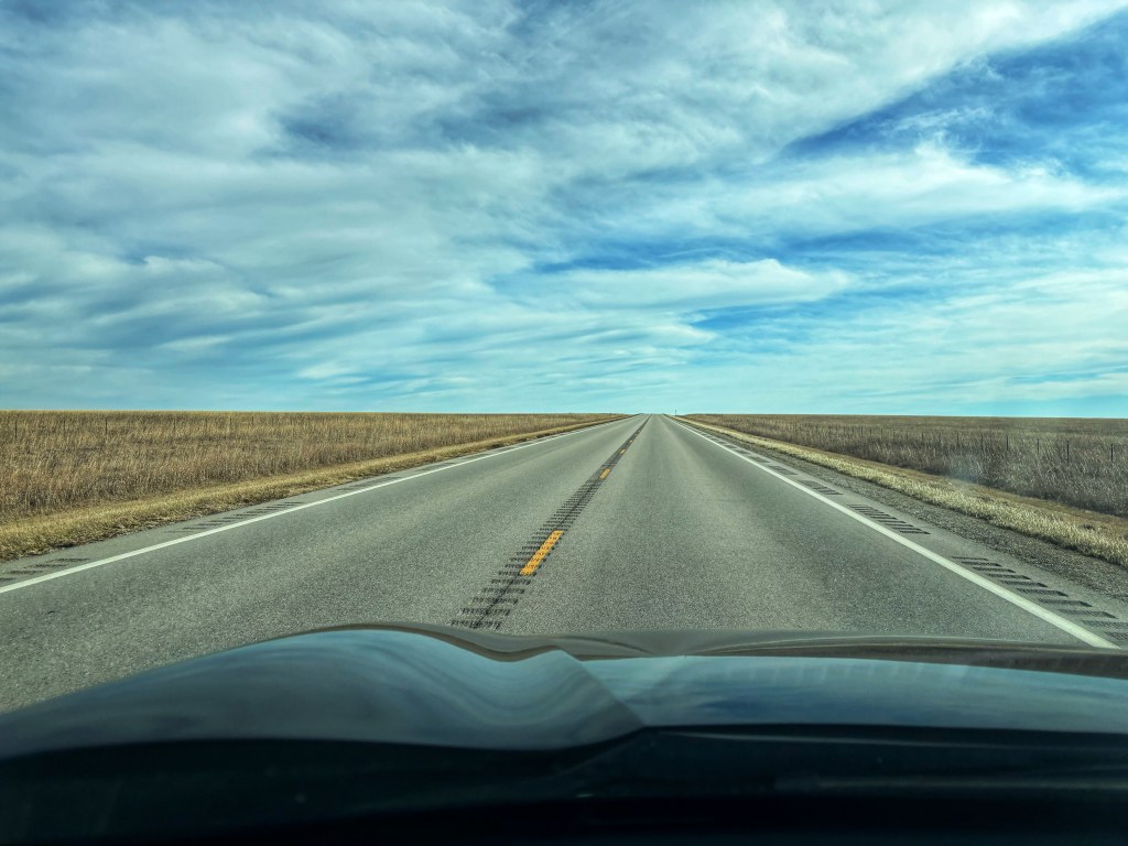
Driving along the open road in Kansas, photo: J. Foster, 2026 Kansas is usually one of the states I am either passing through or flying over. However, recently my spouse and I set out on an adventure with Kansas as the ultimate destination.
Five days and 1800 miles later, we visited all five of the Kansas National Park sites: Fort Scott, Brown vs. Board of Education, Tallgrass Prairie National Preserve, Nicodemus National Historic Site, and Fort Larned.
I learned a lot about indigenous tribes, military outposts used during western expansion, civil rights, the Santa Fe Trail, and the significance of the prairie ecosystem on this adventure. Kansas is at the heart of American history.
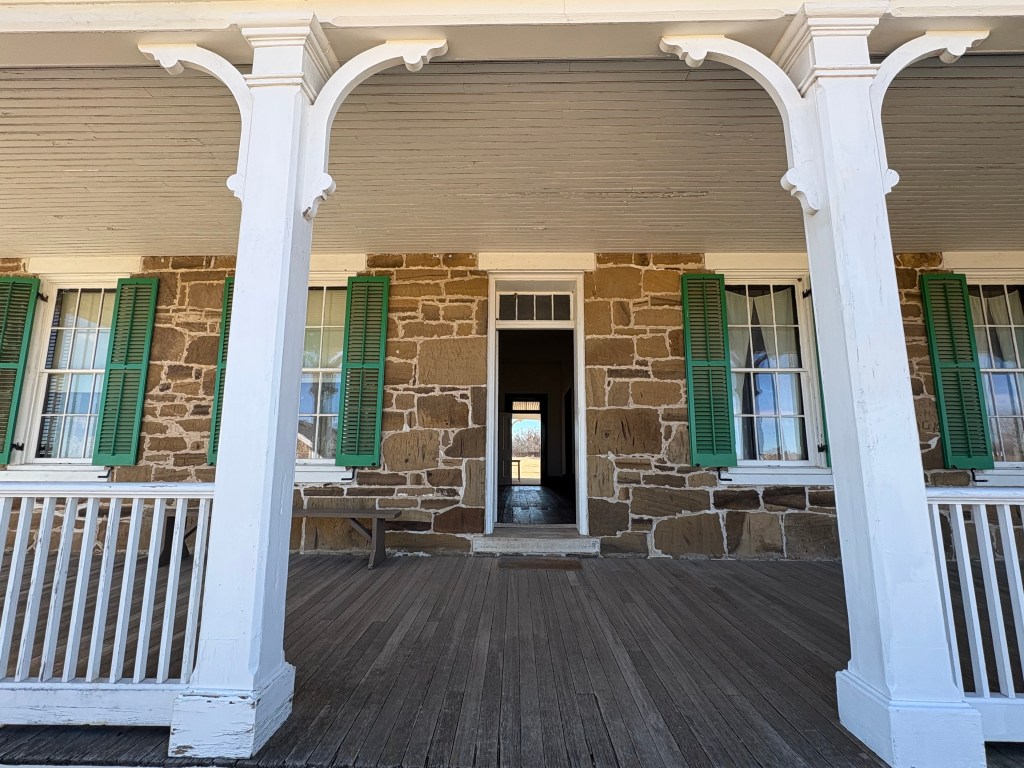
Fort Scott National Historic Site
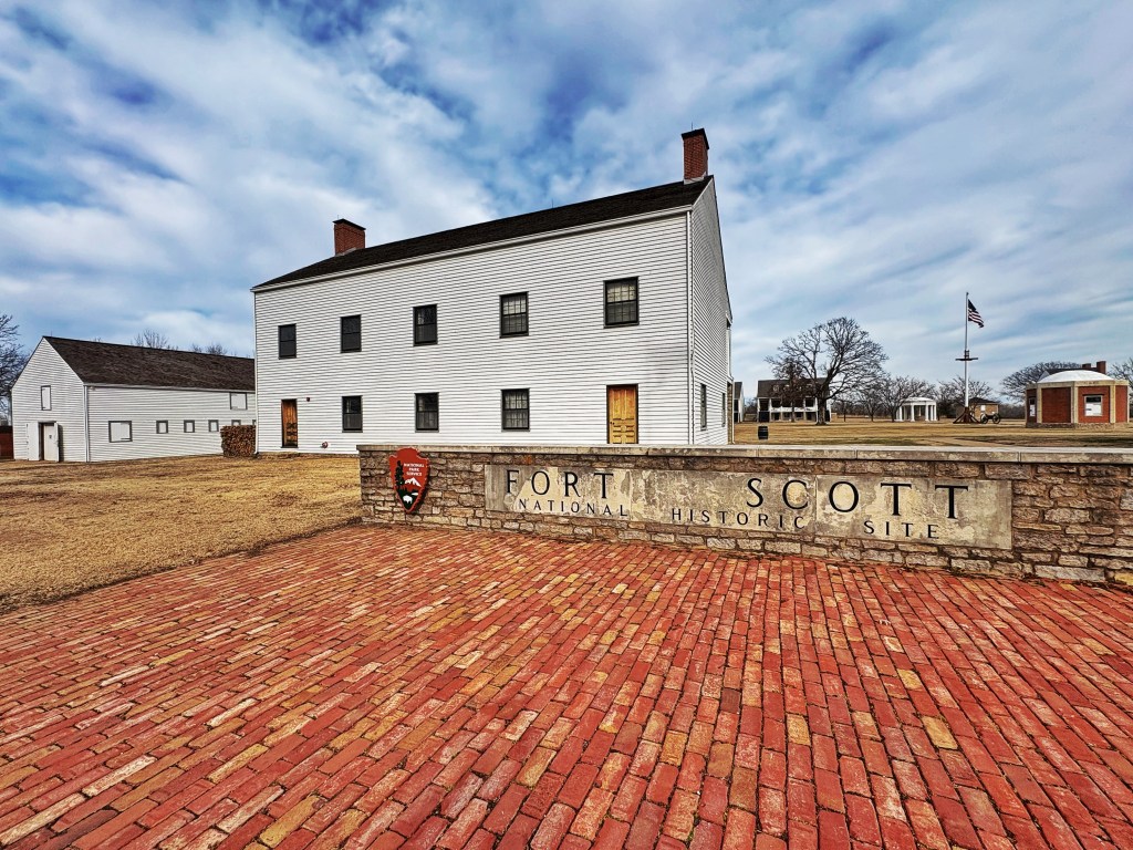
Entrance to Fort Scott, Photo: J. Foster, 2026. Just beyond the small downtown of Fort Scott, Kansas, stands an old military fort from which the town takes its name. (Named after General Winfield Scott who served in the Mexican-American war). Similar to many of the forts we have visited, Fort Scott National Historic Site is laid out in the shape of a square with several buildings making up the perimeter.
With the Indian Removal Act of 1830 and then the Indian Trade and Intercourse Act of 1834, the U.S. Government sought to push the Plains tribes further West and to establish military outposts along the frontier. Some might say these forts were to protect the Permanent Indian Territory, others argue they were buffer zones that facilitated white settlement.
Established in 1842, if the walls of Fort Scott could talk…they could tell stories of soldiers who worked hard to keep the peace during the changing frontier. They also bore witness to the Civil War era, and the battle over the Kansas Territory on the subject of slavery. Interestingly, Kansas was the first Northern state to recruit and train black soldiers for combat in the Civil War. Fort Scott was the home base for the 1st and 2nd Kansas Colored Infantry.
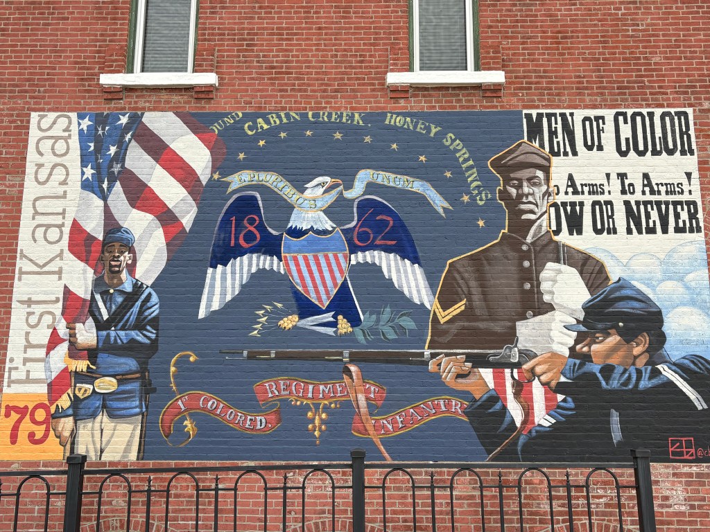
Mural in downtown Fort Scott, across the street from the military fort of the same name. Photo: J. Foster, 2026. The park has an informative 20-minute film, several nicely constructed exhibits, and various facilities to explore.
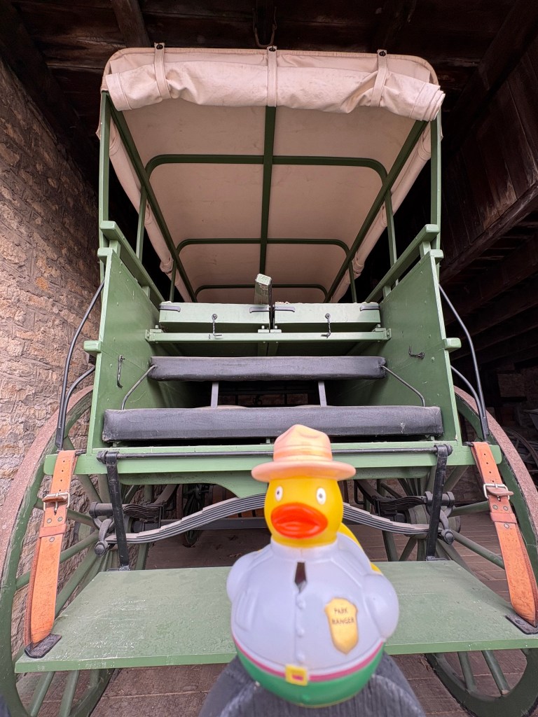
Behind the rubber ducky ranger is a replica of an ambulance wagon used to transport soldiers during the Civil War. Designed by Charles Tripler, first medical director for the Army of the Potomac. Photo: J. Foster, 2026. Nicodemus National Historic Site
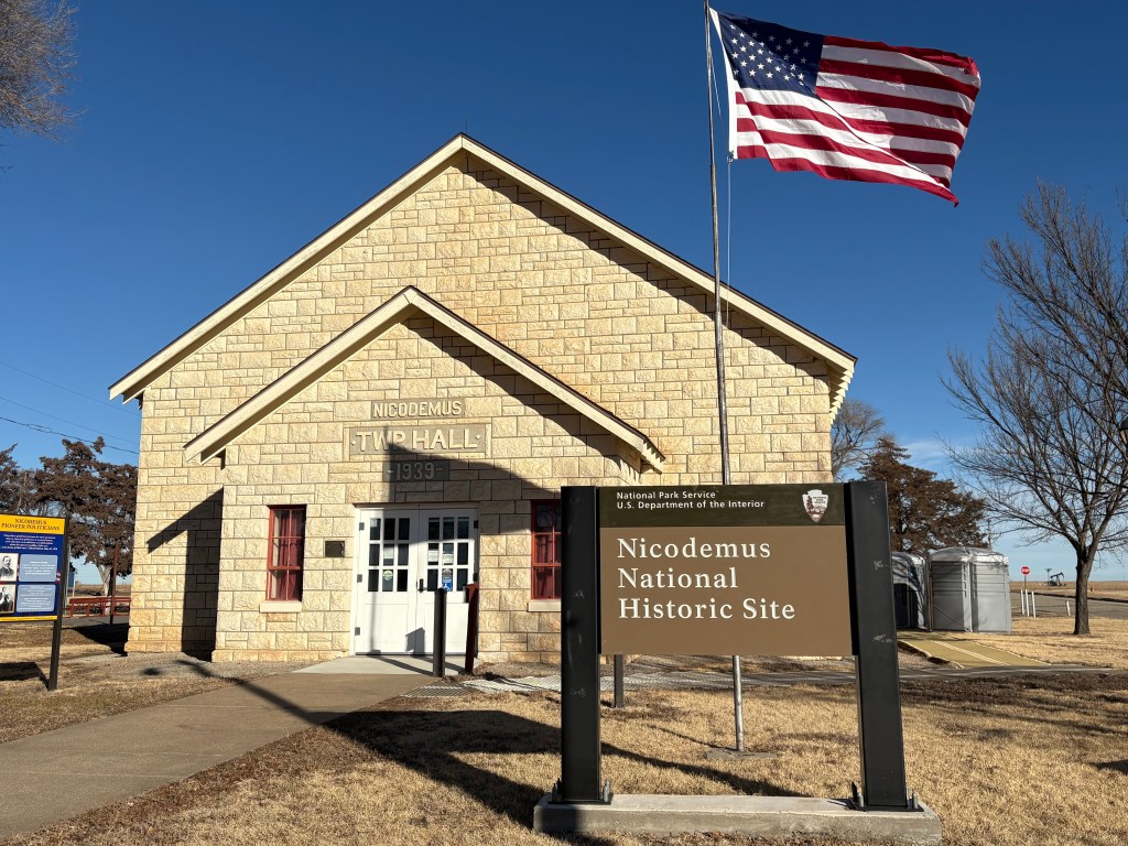
Nicodemus National Historic Site Visitor Center, J. Foster, 2026. One of the sites I was most excited about visiting was the Nicodemus National Historic Site, located in Nicodemus, Kansas.
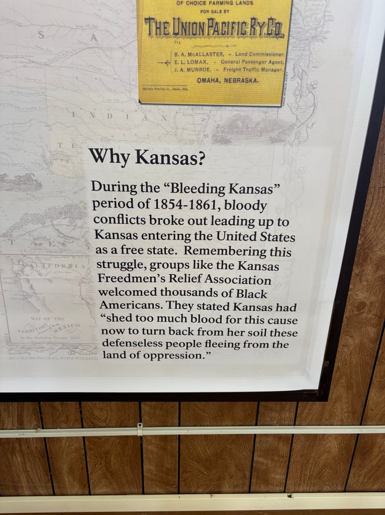
I am so grateful that the National Park Service is protecting this site and sharing the story of the “oldest remaining Black settlement West of the Mississippi.” Formerly enslaved African Americans left Kentucky (and a few other states) in search of a community they could make their own, and to escape from racism and Jim Crow laws that were rampant in the South.
Many of these brave individuals lived in hand-carved dugouts before they were able to build more conducive homesteads and buildings. Faith played (and continues to play) a vital role in the Nicodemus community. There are a handful of descendants remaining as many have moved to larger cities for better economic opportunities. Most of the town is now white retirees but the legacy of the Nicodemus lives on its descendants. The visitor center showed a handful of 3-5 minute clips that tell the history and resilience of the Nicodemus community.
One of the most moving video clips included a spoken word poem shared by Sunni Patterson. Listen below:
Powerful, beautiful spoken word poem “O Nicodemus” by Sunni Patterson. There are five historic buildings that remain in the community and help to tell the story of this community. They are listed on the NPS website here.
From an interpretive display at the visitor center. 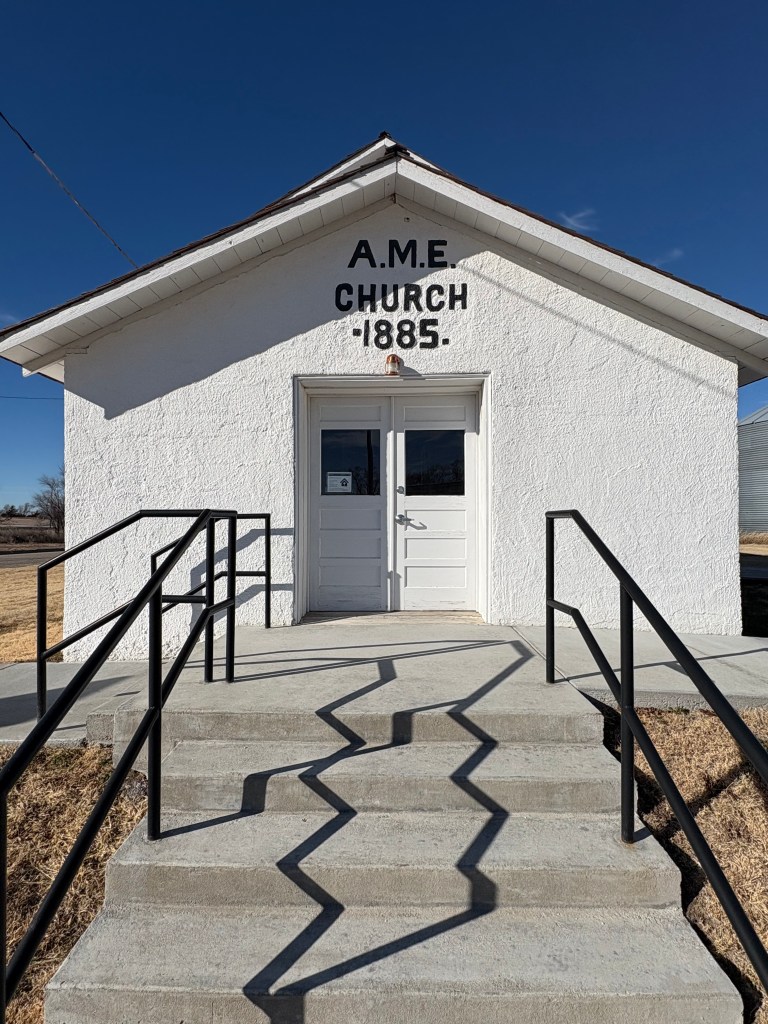
The A.M.E. Church onsite. Tallgrass Prairie National Preserve
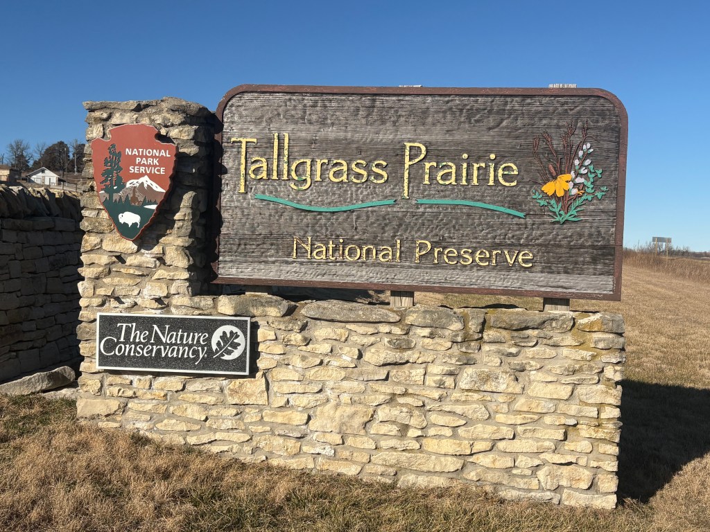
Entrance to Tallgrass Prairie National Preserve. Before farms, towns, and cities took over the landscape, over 170 million acres of the United States was made up of tallgrass prairie. Now, less than 4% of tallgrass prairie ecosystem remains intact.
The National Park Service, in partnership with The Nature Conservancy, helps to conserve and protect the Tallgrass Prairie National Preserve.
The preserve is home to over 500 species of plants, as well as various animals, birds, and a small bison herd. You might get a chance to see the Greater Prairie-Chicken, the famous bird of the plains. During Springtime, they are known for their iconic mating dance ritual, known as “booming.”
There are 12 hiking trails in Tallgrass Prairie National Preserve, as well as various tours of the park. Click here for more information on tours.
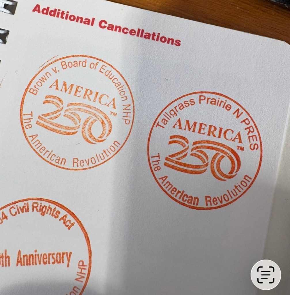
NPS passport stamps showing the “America250” collection, 2026. Fort Larned National Historic Site
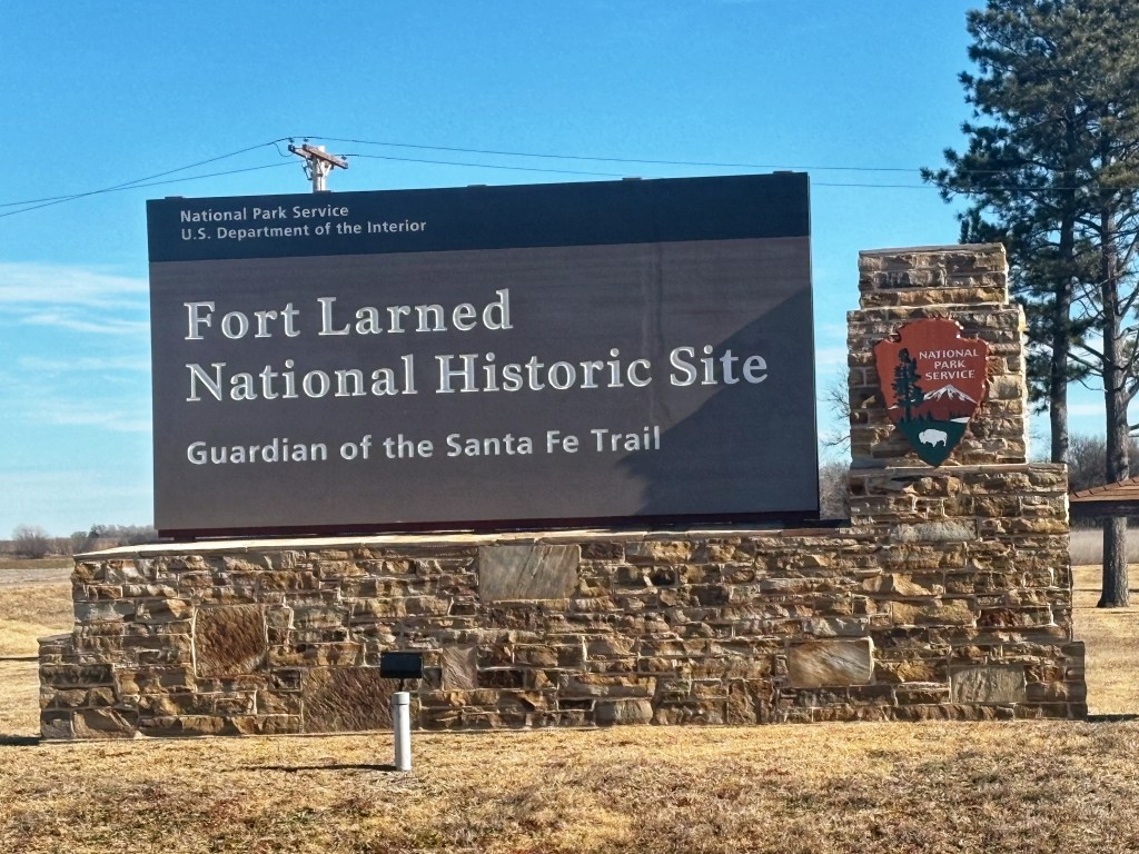
Entrance to Fort Larned, 2026. Built in 1860, Fort Larned was established to protect mail carriers and travelers along the Santa Fe Trail. (Again, one of several forts built during the period of westward expansion). Located next to the Pawnee River, this site remains in great condition. The visitor center had a good selection of history books and a nice exhibit starting with Spanish explorers and going into the Indian Wars era and up to present day. They even had a small display highlighting the Buffalo Soldiers. With the remote location of this site, it helped to imagine what it might have been like walking along the Santa Fe Trail.
Officers Row 
Pawnee River 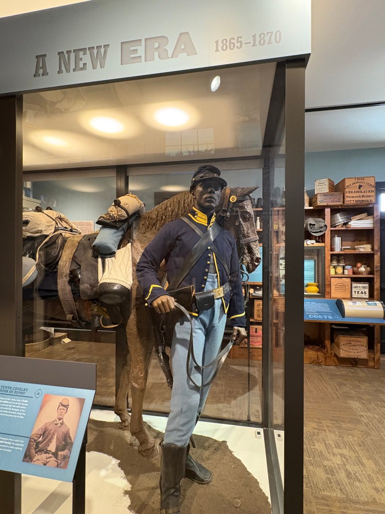
10th Cavalry Regiment, also known as the Buffalo Soldiers, exhibit at Fort Larned. Brown vs. Board of Education
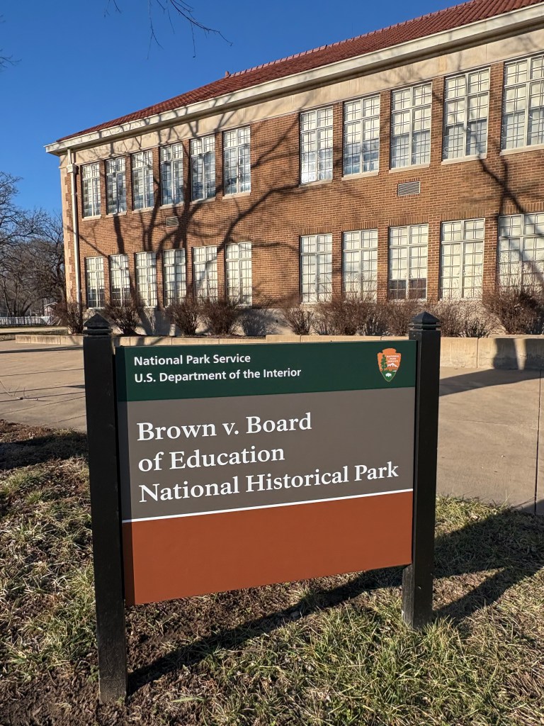
Entrance to Brown vs. Board of Education, 2026. The Brown vs. Board of Education Visitor Center is located inside of the Monroe Elementary School. Established in 1927, the Monroe Elementary School was one of four segregated black schools in Topeka. After trying to enroll his daughter, Linda Brown, into their neighborhood school, Oliver Brown was told his daughter would have to attend school across town due to segregation. Oliver and his daughter became the plaintiffs in the Brown vs. Board of Education of Topeka, which landed on the desk of the Supreme Court.
In 1954, the Supreme Court ruled that the segregation of schools was unconstitutional.
“We conclude that in the field of public education the doctrine of ‘separate but equal’ has no place. Separate educational facilities are inherently unequal.”
–Chief Justice Earl Warren
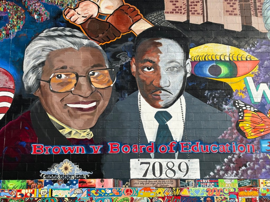
Mural across the street from the Monroe School, Brown vs. Board of Education site. I really enjoyed the exhibit hall which featured civil rights history. They also have several well-made film clips that depict the struggle for freedom and the importance of civil rights. This may be a small park site, but it is packed with powerful history and cultural significance.
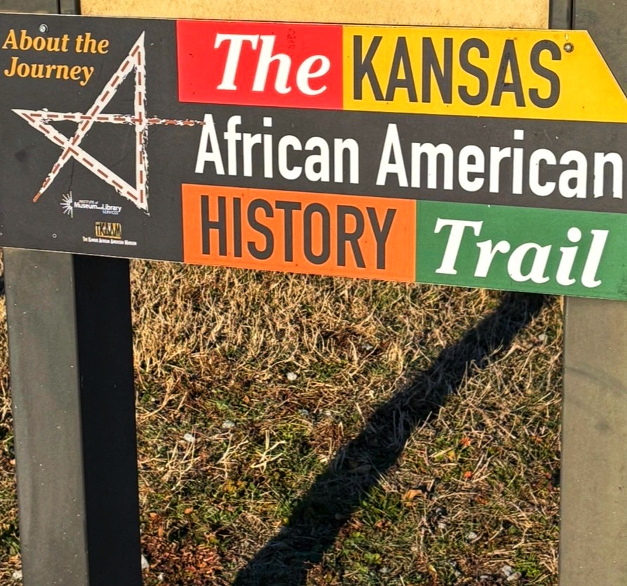
Learning about the Kansas African American History Trail while in Topeka, KS. In all honesty, I never realized how rich Kansas is with African American history. It’s easy to see the hay bales and sunflowers as you drive along I-70 but my eyes are now opened to the significance of Kansas in the battle for civil rights. I see the first black soldiers of the civil war. I see those who fought against unjust policies. I see the home of the abolitionist. Now when I drive through Kansas, I will think of those whose courage and faith led them to freedom.
Check out sites along the Kansas African American History Trail here.
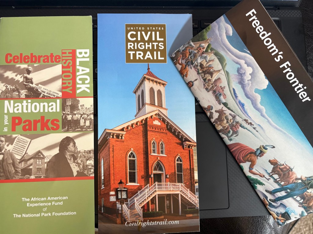
Brochures we collected on our trip that highlight the civil rights movement. Established in 2001, the African American Experience Fund is “the only national charity initiative of the congressionally chartered National Park Foundation that supports and preserves African American history in our national parks.” Learn more here.
From indigenous tribes who call Kansas home, to military forts and historic trails, to civil rights and Black homesteaders; Kansas is truly at the heart of American history.
Stay tuned…in the next post I’ll share about a detour we took through the historic town of Council Grove, Kansas.
1st Kansas Colored Infantry, African American Experience Fund, American West, Black History, Brown vs. Board of Education, Buffalo Soldiers, Fort Larned National Historic Site, Fort Scott National Historic Site, Kansas, Kansas African American History Trail, kansas-history, National Parks, Nicodemus National Historic Site, the-santa-fe-trail, Travel -
Public Lands are Sacred Lands
What do you hold sacred?

Ancestral Puebloan cultural site, (color saturation enhanced) 2025. Sacred means deserving of respect (typically in relation to a spiritual or religious affiliation).
Sacred is also used to describe sites or places too significant to alter or change.
For many indigenous tribes, certain landscapes are held sacred due to their spiritual and historical connections. Many indigenous tribes believe that the natural landscape is a living being, deserving of respect rather than ownership.
Public lands are places for our souls to connect with those who have passed on, they are places to connect with those who are here right now, places for our minds to find peace from the stressors of daily life, places to witness the diversity of wildlife, and places for the telling of our past so that we know how to move forward.
I am grateful for organizations that seek to PROTECT and PRESERVE our sacred public lands.
Will you help protect these places?

Owachomo Bridge at Natural Bridges National Monument, Photo: J. Foster 2025. I recently took a long weekend to explore some of our national monuments, many of which are at risk of being downsized. I wanted to visit them now, just in case something unfortunate happens in the future and they end up—heaven forbid—developed or taken over by industrial companies. I’m staying hopeful…but you never know what might happen.
Natural Bridges National Monument
View from Bridge View Drive, Natural Bridges National Monument, Photo: J.Foster 2025. At Natural Bridges National Monument, the bridge formations are stunning reminders of the passage of time (even rocks age). These walls hold thousands of years of history and culture within them.
An unmaintained trail links a lot of the bridges together at the very bottom of the canyon. In the heat of the day, it is not recommended for those who are unprepared as the heat and the hike are pretty intense. However, you do not have to venture all the way down to appreciate the beauty and significance of the area. There are viewpoints all along Bridge View Drive to see the bridges: Sipapu Bridge, Kachina Bridge, and Owachomo Bridge. Interestingly, the word Sipapu is a Hopi term meaning “place of emergence,” eluding to the passageway by which the Hopi believe their ancestors entered this world.

Natural Bridges National Monument was the first designated International Dark Sky Park on March 6, 2007, Photo: J. Foster 2025 Living in a rural mountainous area of Colorado, I’m accustomed to stunning night skies, but the sky above Natural Bridges National Monument was by far the deepest and darkest I’ve ever seen.The next most beautiful sky I’ve ever seen was in the heart of the Navajo Reservation, about an hour outside of Flagstaff, AZ. We went to a night sky program hosted by a National Park Ranger at the Natural Bridges Visitor Center. The Milky Way was so vivid that my camera didn’t even need a special setting or filter.
Camping at Natural Bridges National Monument, Photo: J. Foster 2025 I really enjoyed camping at Natural Bridges National Monument. There were other campers not too far away, but everyone was respectful of quiet hours, and it felt very peaceful at the campsite. I woke up in the middle of the night and stared up at the sky for a while, and for a moment, nothing else mattered. Just a moment of pure peace and an awareness of the earth around me.
I honestly didn’t know what to expect at this monument. I had barely heard of this place before, and I was not very familiar with it. But the stillness and the night sky were very refreshing to my mind and soul. I thoroughly enjoyed the views, the trails, and the cultural significance.
Hovenweep National Monument

Entrance to Hovenweep National Monument, Photo: J. Foster 2025 Hovenweep National Monument had been on my list of places to visit for over a decade but due to its remote location, it took me awhile to plan a trip out there. I was glad to finally see it in person!
“In the desert, the two primary elements are stone and water. Stone comes in abundance, exposed by weathering and a lack of vegetation. It is a canvas. Water crosses the stone with such rarity and ferocity that it tells all of its secrets in the shapes left behind.” -Craig Childs
Known for several ancestral Puebloan villages and a kiva, Hovenweep National Monument is a journey through time. Archeologists are still divided as to why these stone towers were built where they are. Were they built for defense? Were they built to protect water resources? One thing remains clear: the historical and cultural significance of this area is undeniable and the meaning that it holds for many indigenous tribes in the four corners region is vast.

Hovenweep Castle at Hovenweep National Monument, Photo: J. Foster 2025
Chimney Rock National Monument
“Even though Chimney Rock is no longer inhabited physically, it is still inhabited by spirits that have never left.”
-Paul Pino, Laguna Pueblo
View from the Chimney Rock National Monument Visitor Center, Photo: J. Foster 2025 In southern Colorado there is a small national monument that many folks probably drive right by and have no idea how cool this site is. One of only 15 national monuments that is operated by the National Forest Service (as opposed to the National Park Service).
Chimney Rock National Monument is a really cool ancestral Puebloan site that was built with astronomical purposes in mind! Two sandstone pillars on top of a mountain were built to observe the northern major lunar standstill–a celestial event that happens every 18.6 years. There are also an ancestral Puebloan village and Chacoan-style Great House Pueblo. Thank you to the Forest Service for preserving and interpreting this site! The visitor center has also won interpretation awards from the National Association for Interpretation.

Chimney Rock Entrance 
Exhibit at the Visitor Center
Bears Ears National Monument
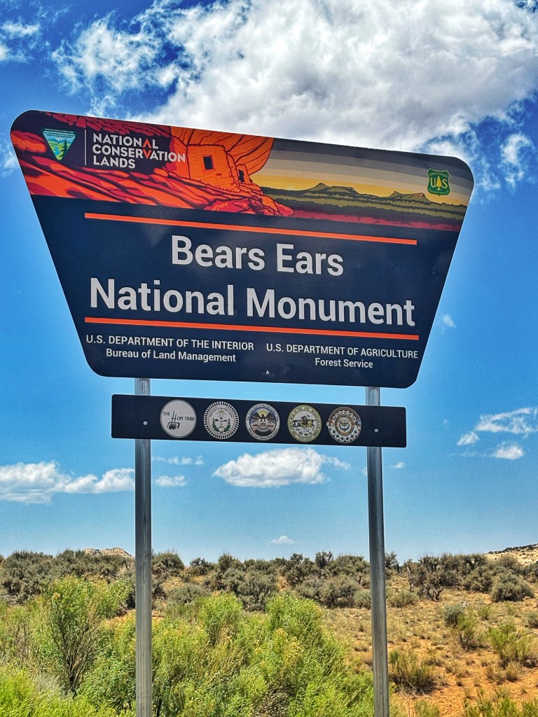
Driving through Bears Ears National Monument, Photo: J. Foster 2025 Bears Ears National Monument is co-managed by the Bureau of Land Management and the United States Forest Service. The land is held sacred by many indigenous tribes who continue to rely on these lands for traditional and ceremonial purposes.
This area of southeast Utah is considered sacred.
I don’t want to say too much about this area so as to protect the history and culture contained within its boundaries.
However, please know that this area is in need of ongoing protection.
Note: For those who collect the National Park Service passport stamps, you can get your Bears Ears National Monument stamp from the Kane Gulch Ranger Station, located on Utah highway 261, about twelve minutes southeast of Natural Bridges National Monument. (They keep the stamp secured outside so that you can get your stamp even when the station is closed.)

View of Bears Ears formations from Natural Bridges National Monument, Photo: J. Foster 2025
Devils Tower National Monument
Devils Tower National Monument was America’s first national monument, created in 1906 under the Antiquities Act by Theodore Roosevelt. The monument and surrounding area hold sacred significance to over twenty different indigenous tribes. The tower is known as Bear Lodge or Bear’s Tipi in several indigenous circles. Many tribal members often perform ceremonies and return to the area for prayers.

Bear Lodge (aka Devils Tower), Photo: J. Foster 2025 The name Devils Tower originated when Colonel Richard Dodge, on an expedition for the U.S. Geological Survey, misinterpreted the Lakota word wahanksica (meaning black bear) for the word wakansica (meaning evil spirit).
[Source: Standing Witness; Devils Tower National Monument A History by Jeanne Rogers, 2008.}
Devils Tower, made of the igneous rock phonolite porphyry, is the world’s largest example of columnar jointing! There are still a lot of theories as to how the tower was formed.
Hiking along the Joyner Ridge Trail at Devils Tower, Photo: J. Foster 2025 I traveled to Devils Tower not knowing much about the area except for its location in the Black Hills. I don’t usually go around talking about feeling energy, but I really did sense a certain spirituality surrounding this place. As I walked along the Joyner Ridge Trail, I stopped and raised my hands and remembered my own family members who have gone before me. And I felt a deep sense of gratitude for the present moment. I am grateful for open space and public lands where our hearts and minds are able to expand and breath.

Image: unknown copyright; I do not own the rights to this image. I came away from this trip not just with a deeper appreciation for these landscapes but also a palpable sense of the spiritual realm that is ultimately inherent in time and space. Observing the spiritual significance these sites hold for others, brought me into a mindset of the bigger picture: that many have come before us…they are always STILL around us…and one day we will also cross over from the physical world to the invisible. From a pictographic handprint left on a remote sandstone wall to a brightly woven prayer flag left tied to a branch; spirituality and wilderness go hand in hand.
Public lands are indeed sacred.
#Public Lands Forever
#Visit With Respect
-
Completing the Kentucky Bourbon Trail Passport!
With only two stamps needed to complete our original Bourbon Trail passport book, I met up with my dad again at the Nashville airport. This time we jumped in the rental car and headed to Owensboro, Kentucky.
If you are reading this blog for the first time, this is the conclusion to a five-part series. You can start from the beginning here.

Entrance to the Green River Distillery Day one:
Our first stop was the Green River Distillery (formerly known as the O.Z. Tyler distillery), located about two hours southwest of Louisville, Kentucky. We weren’t sure what to expect at this particular distillery since it was an outlier (on the map) and has been in transition over the years (after being abandoned for a while, the Bardstown Bourbon Co. purchased the property in 2022 and now also distills and distributes Green River Whiskey).

Green River Production Facility We arrived just in time for the last tour of the day. Founded in 1885, Green River holds the tenth oldest liquor license in the state of Kentucky, and we enjoyed learning about the history behind the brand. Similar to other companies operating when prohibition started, Green River at one point, became known for its “medicinal” qualities. Now it is known as “the whiskey without regrets.”

One of the highlights from this visit, besides the tour, was tasting Green River Wheated Bourbon. This one really stood out to me.
Wheated Bourbon:
Uses wheat in place of rye.
Usually has a sweeter flavor profile.Since it was already getting into the evening, we grabbed dinner and checked in to our hotel. Day 1: One stamp down, one more to go!

View of the Ohio River from Downtown Owensboro, KY. Day two:
We headed to downtown Owensboro to explore the city and grab some coffee. We stopped at the local coffee shop; the Red Swing. (They made a cozy pumpkin chai latte, perfect for this particular October morning).
We walked along the riverwalk, overlooking the Ohio River. I kept thinking about Patty Griffin and her song called, Ohio. I was glad to be here on this adventure with my family…seeing new places, checking things off of our to-do list, and simply being together.

Next, we headed to Louisville, Kentucky.
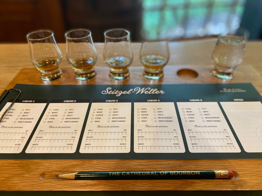
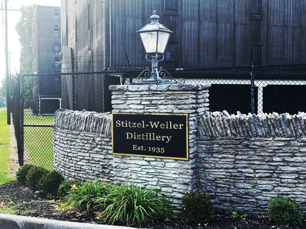
We made it to our early afternoon reservation for a tour of the Stitzel-Weller Distillery. I was really excited to see this facility as it has been associated with several well-known bourbon legends (e.g. W.L. Weller & Sons, Julian “Pappy” Van Winkle Sr., Arthur Stitzel). At one point in time, it was the home of Bulleit Whiskey but now it produces Blade and Bow.
We got our FINAL stamp, toured the facility, and then participated in a tasting. Day Two: FINAL STAMP COMPLETED!


Our last stamp! Bourbons Bistro: One of our favorite finds!
One of the highlights from this trip was stumbling upon Bourbons Bistro. The place had good reviews and wasn’t at all on our radar. When we walked in, the ambiance gave a speakeasy vibe combined with a flare of curiosity. I was eager to see what their bourbon menu held–it was very extensive and impressive! I tried a new-to-me bourbon series called Filmland, as the dim lighting felt like old Hollywood to me. (I tasted varieties from: Ryes of the Robots and Moonlight Mayhem!). I enjoyed the bourbon and the bottle labels for this brand!
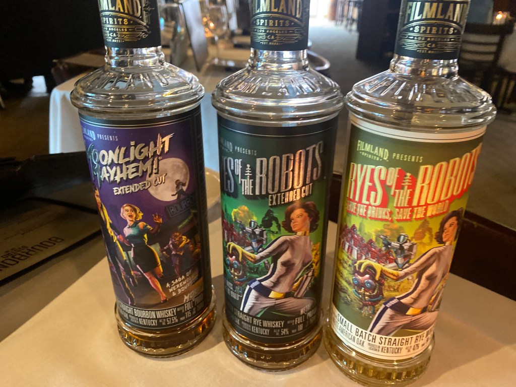
Filmland Bourbon Varieties And then there was the food…
This was-hands down- the best dinner we have had together on the trail. It was just the perfect combination of a last-minute surprise find, an amazing bourbon menu, quality comfort food, and great family bonding.
My spouse and dad were very intrigued by the bone marrow appetizer. They also both ordered the pork chop and loved it! I had the shrimp and grits, which was the best version of it I’ve had in a very long time! We ate, drank, and laughed together as our time on the trail was winding down. Thank you, Bourbons Bistro for the perfect evening!

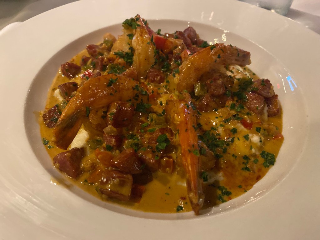
Shrimp and Grits 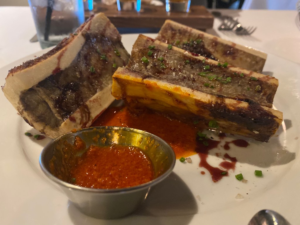
Bone Marrow Day three: just for fun.
We wanted to see the Bulleit Bourbon location and the Wilderness Trail Distillery before we wrapped up. So, we made a quick stop at Bulleit and then signed up for a tour at the Wilderness Trail Distillery in Danville, Kentucky. They’ve got a good thing going there at Wilderness Trail!


A stop at Camp Nelson.
In keeping with tradition, we also checked off another National Park Unit by visiting Camp Nelson National Monument, outside of Danville, Kentucky. This former Union Army base functioned as a supply depot, recruitment camp for black soldiers, and a refugee camp for many escaping slavery.
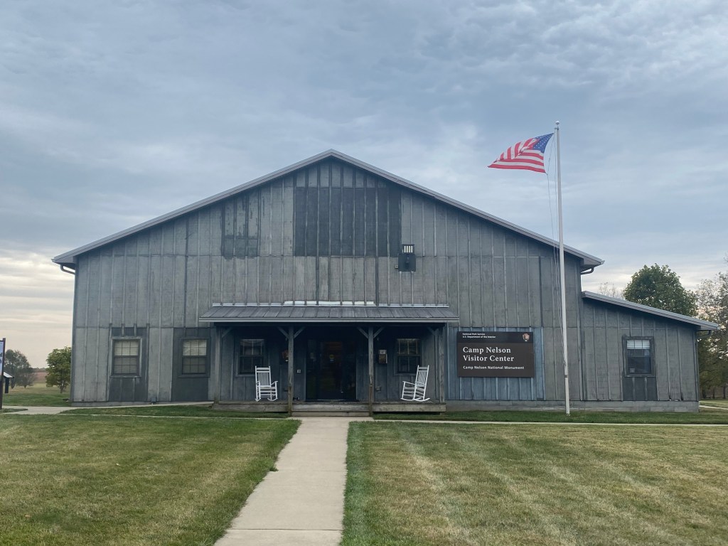
Camp Nelson Visitor Center 
End of the trail…or is it?
Finally, before we left Kentucky, we drove to downtown Louisville to where we first began back in 2019: The Frazier Museum (the “start” of the bourbon trail). We inquired as to how to turn in our passport books and tried to decipher what the “prize” might be. The person at the welcome desk gave us an email to respond to (this was October 2023). I’ll be honest, I wasn’t expecting much…maybe a sticker or t-shirt that said “I completed the Bourbon Trail” or something…. but…a few weeks later (after emailing someone) we received a tasting glass. Just a clear glass, with no mention of the bourbon trail. So, that was a little underwhelming.

The tasting glass prize next to our original passport book. However, this journey was never about the possible prize at the end. It was always about the experience: learning about the process of making bourbon, the people/places/history of bourbon, the tastes, the sights, and ultimately spending quality time together.
It took us four trips to Kentucky, over a five-year span but we finally finished our original Bourbon Trail passport book! However, by the time we completed it, more distilleries have popped up and there is now a newer, thicker version! So, what we thought was the end…might be a new beginning! Cheers to the trail and all of the memories we have made!

Left: the original passport book. Right: the current, newest passport book. Tips for exploring the bourbon trail!
- Get out the map! Like the Indigo Girls song, you’ll want to look at a map of Kentucky as you plan out your route/itinerary. There are some areas that are more concentrated than others with distilleries but overall, the “trail” is very spread out.
- Figure out which distilleries are top of your list, and figure out what kind of experience you want: a tour? a tasting? both? Then, make a reservation.
- Know your limits. Have a designated driver!
- There’s a lot more to explore in Kentucky besides bourbon! Have fun exploring!
- Making memories with loved ones is what life is all about! Cheers!

Good times had by all! -
Bourbon Trail Adventures: The First Time We Tasted Pappy Van Winkle!
Round three of our bourbon trail adventures! Highlights: touring the Independent Stave Company, exploring Lexington, and finding Pappy!
This is part four of a five-part series. You can follow us from the beginning here.
On our third visit to Kentucky, we hit the ground running! After meeting up again in Nashville, we drove straight to Lebanon, KY. We took a break from touring distilleries and decided to learn more about the black-charred bourbon barrels!
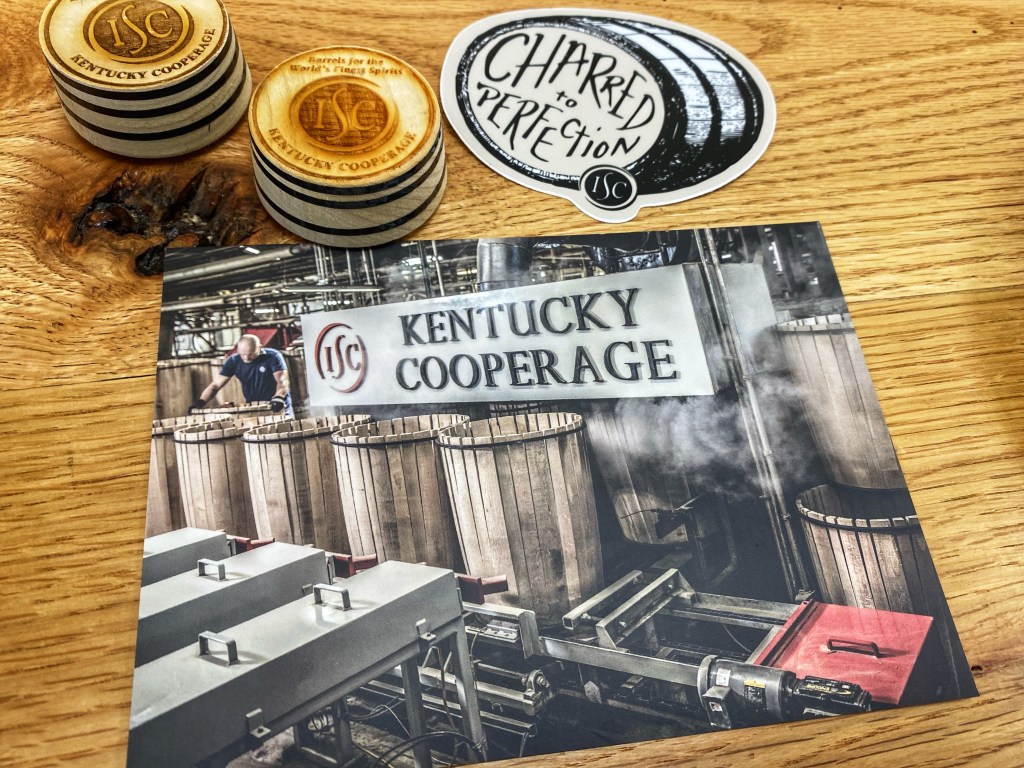
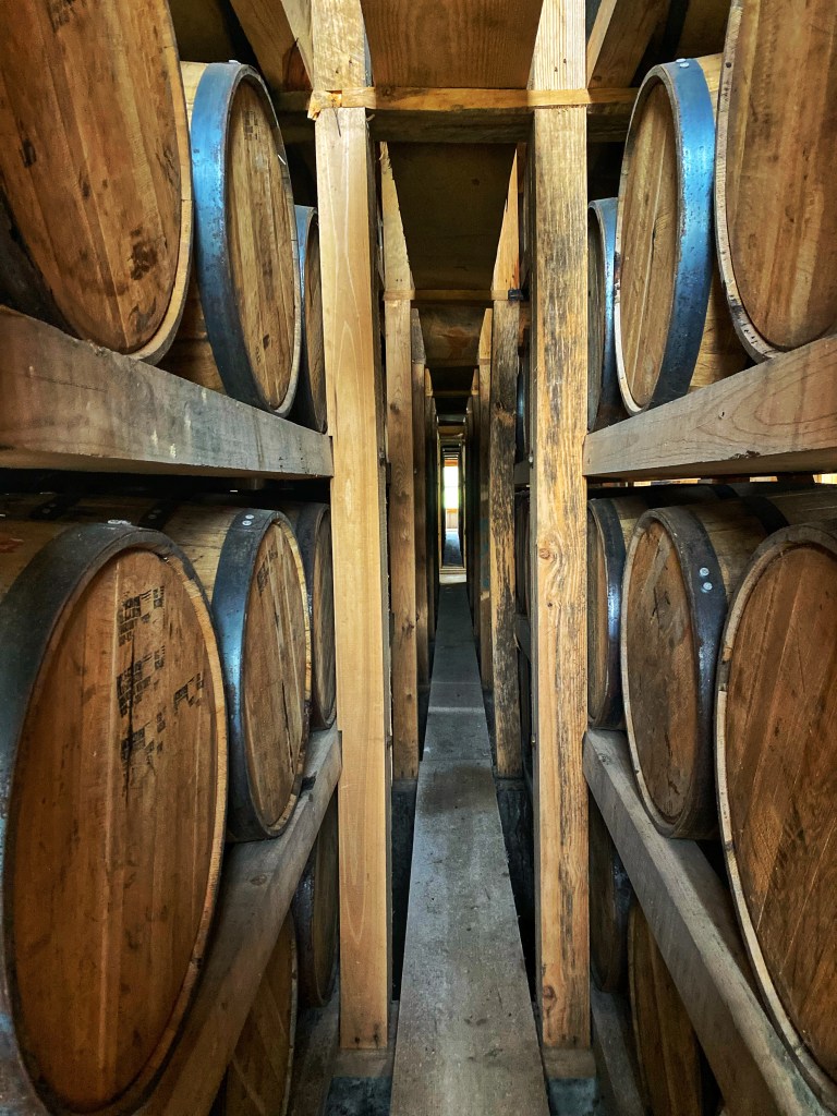
Postcard: Independent Stave Company’s Kentucky Cooperage The Independent Stave Company is the largest barrel production plant in the world! We kept hearing it mentioned on various distillery tours and decided to check out their Kentucky Cooperage. To this day, this is one of the BEST tours we have experienced! We watched as the barrel staves were assembled, charred, and then held together with a few finishing touches.
Currently, white oak has been the traditionally sourced wood but that could be changing as white oak forests are considered endangered. Several distilleries such as Makers Mark, Old Forester, and Buffalo Trace are doing their best to help with forest sustainability. However, this was an aspect of bourbon making that I had not considered-the impact on white oak forests. Most of the white oak comes from Ohio but those forests are not faring well. Will they use a different oak in the future? How can we mitigate this sustainability crisis? Something to think about…
After, leaving the cooperage we stopped at Limestone Branch Distillery. (My spouse was finally able to join in on this trip, so we picked up an extra bourbon passport and got stamping!)
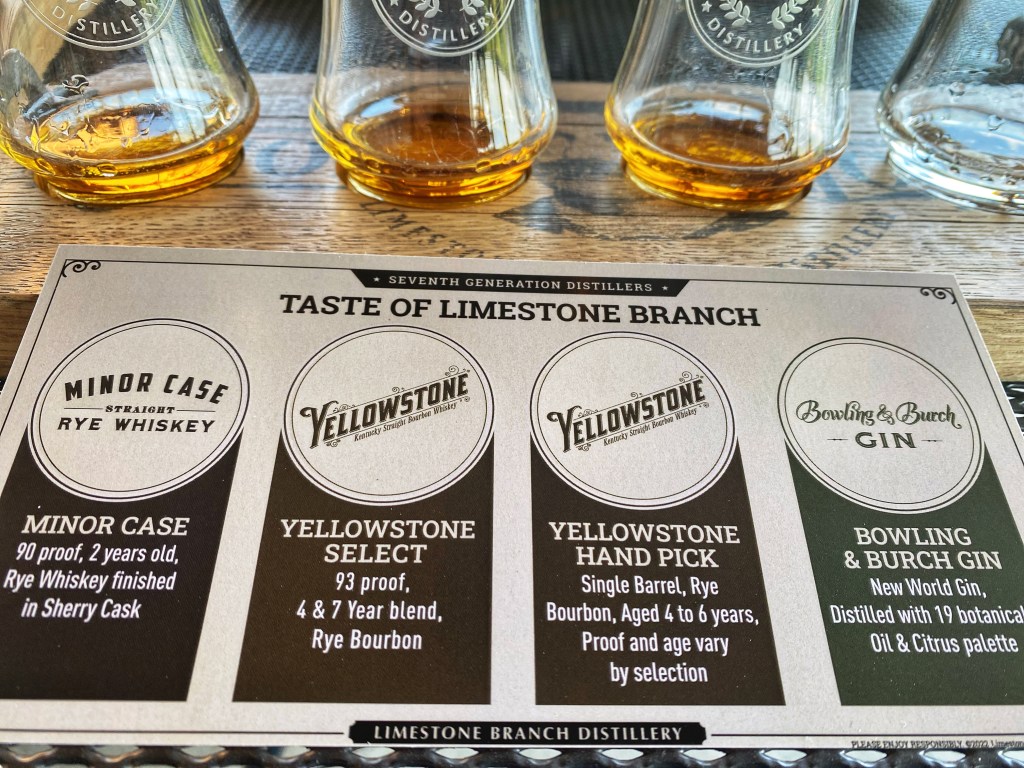
Limestone Branch Distillery: Producer of Yellowstone Select The main focus of this short trip was to visit the Kentucky Cooperage and to see the Four Roses Distillery–one of my dad’s favorite bourbons. So, we continued to Lexington, KY where we stayed a couple of nights at a cute Airbnb. We were quite impressed with the cool vibe of Lexington, a small college town with a lot of charm.
Day two:
Dad made everyone breakfast and then we were off for a tour of the Four Roses Distillery in Lawrenceburg, KY. The Four Roses Distillery was ornate and designed with Spanish Mission-style architecture, which seemed a little out of place in Kentucky…but it was a beautiful facility, and we really enjoyed the tour. The guided tasting room experience was probably my favorite so far. The knowledgeable tour guide combined with the quality flavors of Four Roses…definitely a great tour! I really enjoyed the Four Roses Small Batch!
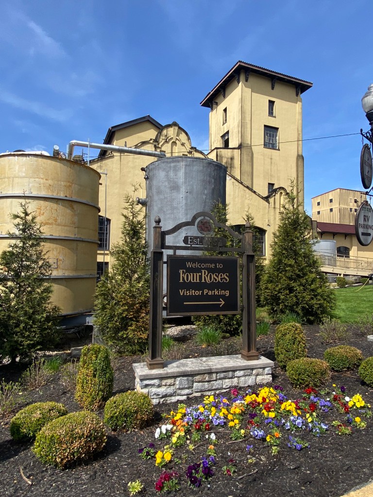
Entrance to Four Roses Distillery 
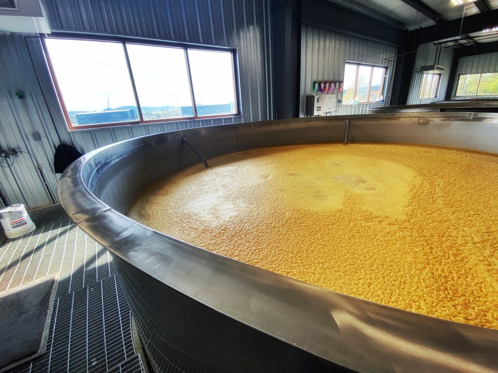
Four Roses Distillery: The fermentation room, a batch of sour mash 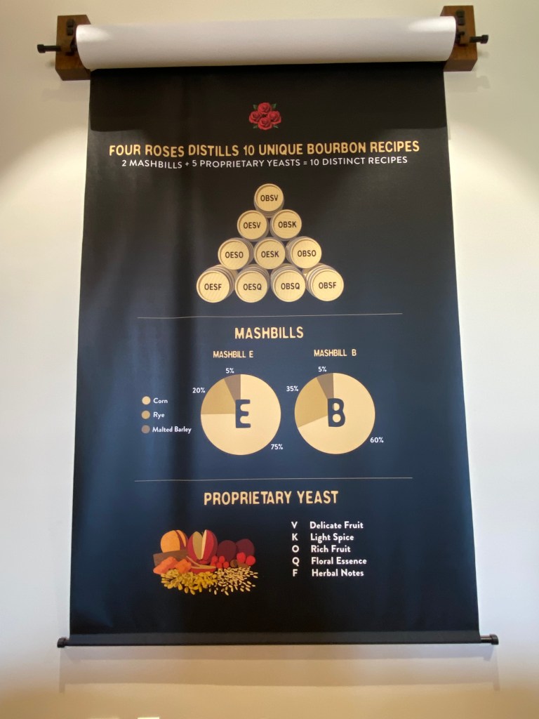
Four Roses Distillery did a great job of explaining their mashbill recipes. We were a little less than 30 minutes away from Buffalo Trace, so we decided to visit there again since it IS our favorite distillery! And I wanted my spouse to see what the big deal was all about!
We did a tour, tasting, had lunch on site, and toured the outdoor garden area. It really is a beautiful place, even if you don’t drink bourbon! (See previous posts for photos).
After walking around the gardens and being onsite at the facility where the Sazerac Company produces its infamous Pappy Van Winkle…we realized this was our third visit to bourbon country and we still had no idea what Pappy Van Winkle even tasted like….
We had tried in the past to find reasonably priced shots of Pappy but each time we found a place they were sold out.
We decided to try again and found a place that was advertising 1/4th of a shot for a reasonable price. We called ahead just to make sure they actually had some in stock.
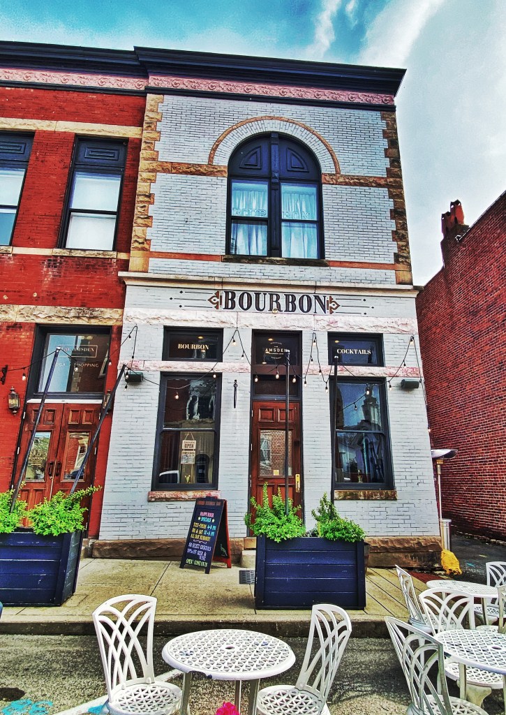
Amsden Bourbon Bar: The front entrance. We walked into the Amsden Bourbon Bar in Versailles, Ky. It was a small, studio sized bar with only a handful of tables. We sat down at the bar and discovered they had multiple selections of Pappy Van Winkle. We started to calculate how much it would cost for all three of us to try all of the available selections at 1/4th a shot. We figured this was probably our best chance considering the price and the availability. So, we went for it!
We tried the Pappy 10-year, Pappy 20-year, and Pappy 23-year!

That Pappy Moment! Our first taste of the famous bourbon! The moment we had been waiting for had finally arrived.
We raised the first glass and cheered together! Then, like they teach on all of the bourbon tours, we raised it to our nostrils and began to smell… hmmm…yep, it smelled like bourbon.
Then, our first taste. (It was the Pappy 10-year).
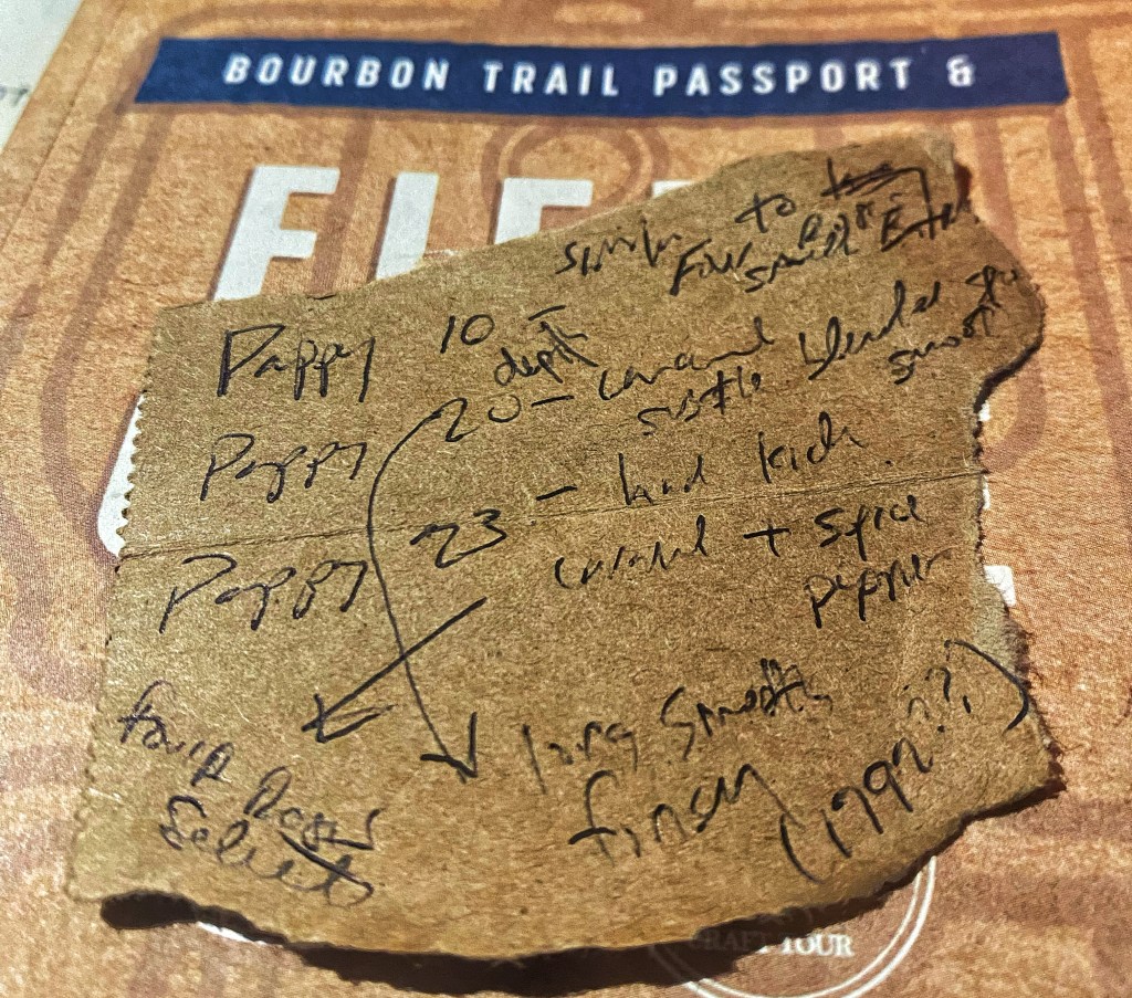
I tore off a piece of paper nearby and wrote little notes for memory’s sake.
Pappy 10-year: Four Roses Small Batch? Depth. (Maybe because we visited Four Roses earlier in the day …but this sip sure reminded me of the Four Roses Small Batch as far as flavor, texture, and taste).
Pappy 20-year: Hints of caramel, smooth on the palate, long smooth finish. Reminds me of the taste of 1792 (bourbon).
Pappy 23-year: Hints of caramel, has a kick, spice, pepper?
Given its reputation and price, I thought Pappy might offer a taste sensation unlike any I had experienced before. Yet, all I found myself doing was comparing it to other bourbons I enjoy, such as 1792, Four Roses, Larceny, Elijah Craig, Penelope, and so on. I’m certainly pleased that we had the opportunity to sample the famed Pappy Van Winkle. At the end of the day, I learned Pappy is just another bourbon, distinguished only by its reputation and price point, not necessarily because of taste.
And ultimately, our search for Pappy is one of those memories that will stay with me forever.
Thank you, Amsden Bourbon Bar, for making our Kentucky Bourbon Trail dream come true!
Notes about Pappy. We later had dinner at OBC Kitchen in Lexington, KY. We tried the baked pimento cheese and bacon dip–amazing! Returned to the Airbnb where we played dominoes and reminisced about our successful day!
Day three:
On our way out of town we stopped at the Lexington Brewing & Distilling Company (formerly known as Town Branch Distillery). They have a nice location right in the heart of downtown Lexington. They are known for their single malt whiskey.
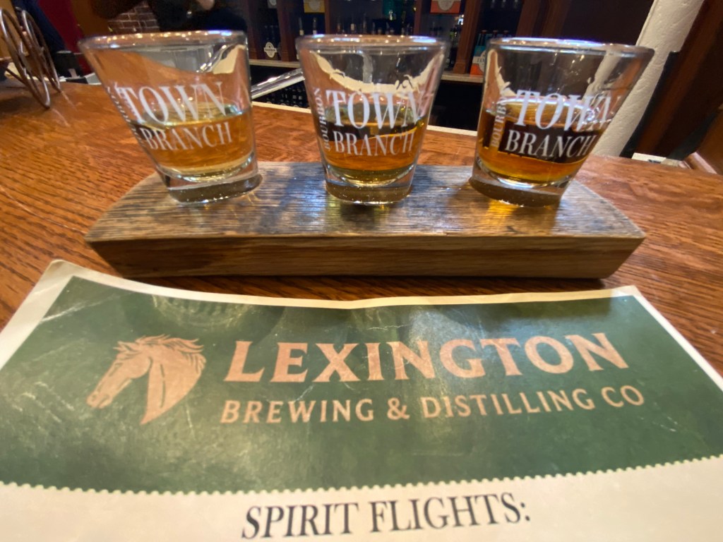
Whiskey Flight at Lexington Brewing and Distilling Co. Of course, if you have been following our journey, a bourbon trail adventure is not complete without a cave tour at Mammoth Cave National Park! This time we tried the Frozen Niagara Tour! (Reservations strongly encouraged).

Entrance to Mammoth Cave 
Frozen Niagara Tour 
A Common Cave Cricket (Hadenoecus subterraneus) at Mammoth Cave Year 4, Round 3 of our Bourbon Trail Adventures took place in April of 2022. The memories will last forever. I love you, Dad! I love you, Val!
Stay tuned for part 5…
-
The Legacy of Denver’s Mile Houses and Smoky Hill Trail.
There are mile markers, whether it be on the road of life or just your everyday commute, that signify where you are and how far you have traveled.
Most people are aware of Denver’s role in the early gold-seeking days but less know about the historic mile houses that marked the way to Denver City. A handful of these houses still exist.

(Image: Photo from Jerome Smiley’s, History of Denver, depicting the confluence of the Cherry Creek and S. Platte rivers, circa 1859). In 1859, present-day Colorado was still a part of the Kansas Territory, not yet a part of the Union, and was pictured on maps as indigenous territory. Denver continues to be the homeland for several indigenous tribes, including the Ute, Arapaho, and Cheyenne.
During the summer of 1858, a group of Cherokee prospectors along with three brothers from Auraria, Georgia found gold near present-day Denver. This event became a key development in what we call the Pikes Peak gold rush (also known as the Colorado gold rush). Nowadays we associate Pikes Peak primarily with present-day Colorado Springs but to those traveling on foot or wagons along the dusty wagon roads—Pikes Peak represented the gateway to the gold mines—from present-day Colorado Springs all the way to present-day Denver.
Due to the increased population of white settlers and gold seekers, Colorado became its own territory in 1861 and later was admitted into the Union in 1876. Settlements such as Denver City, Boulder City and Colorado City became established towns.
Side note: Many locals know that Colorado means “colored red” in Spanish. However, what many may not know is that it was representatives from Colorado City (near Colorado Springs) who lobbied for the name Colorado.
As you drive along Parker Road and Leetsdale Drive in the Denver/Glendale/Aurora/Parker areas, you are essentially riding atop an old pioneer trail called the Smoky Hill Trail. Named after the Smoky Hill River, which the trail follows most of the way, this was the most popular route for those traveling by foot, wagon, and eventually stagecoach from the eastern Kansas Territory to the gold fields.
Today, you can still trace the passageway of the Smoky Hill Trail. During the 1850s and 1860s, savvy business-minded homesteaders seized the new opportunities to profit from the increased volume of travelers. Like our modern-day rest areas and gas stations advertised along the highways, there were Mile Houses, often family-owned homesteads that were turned into public lodging or stagecoach stops.
The Mile Houses served as trail markers indicating how many miles remained until reaching Denver City, at today’s intersection of Colfax Avenue and Broadway.
Today, you can still visit two of the original Mile Houses, as well as tour the areas where a few of the others once stood.

(Image: Handout from the Four Mile Historic Park, 2017). The Smoky Hill Trail was composed of three branches: north branch, middle branch, and south branch. Each of these branches veered in a westerly direction and connected to the Cherokee Trail. The southern branch of the Smoky Hill merged with the Cherokee Trail near the site of the 20 Mile House, these two trails are sometimes referred to interchangeably. (The Cherokee Trail is the older trail as it dates to 1849 with a group of Cherokee who were headed to the California gold rush). According to Lee Whiteley of the Cherry Creek Valley Historical Society, “…the six mile houses were located on the combined Cherokee-Smoky Hill trails.”
The Twenty Mile House
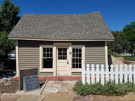
(Photo: The Pine Grove Post Office, formerly part of the Twenty Mile House, located about 20 miles east of Denver in Parker, Colorado. Taken by J. Foster 2017.) In 1864, Alfred Butters built a one-room log cabin near present-day Old Town Parker. Attached to his cabin was a makeshift post office for travelers to post notices or gather additional provisions. It became known as the Pine Grove Post Office. The old cabin was eventually torn down. However, the original post office area was restored by the Parker Area Historical Society and sits at the intersection of Main Street and Stage Run in Parker, Colorado. Today, visitors can see the post office and historic trail markers.

(Photo: Trail monuments onsite of the former Twenty Mile House, J. Foster 2017.) The Seventeen Mile House
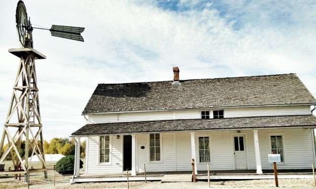
(Photo: Seventeen Mile House, taken by J. Foster, October 2014.) The Seventeen Mile House was built in 1862 by George C. Schleier, a former freight owner and former gold-seeker. He owned about 160 acres near present-day Parker Road and E. Long Avenue. It wasn’t until 1866 that new owner Mary Hightower turned the house into an inn for travelers.
The house transferred ownership several times and eventually was in danger of being torn down for development. The Cherry Creek Valley Historical Society helped to save the property from destruction. In 2000, the Trust for Public Land took ownership and shortly thereafter transferred the land to Arapahoe County. The Seventeen Mile House and surrounding 30 acres now belong to the town of Parker and Arapahoe County Open Spaces under a conservation easement. The Seventeen Mile House is a prime example of grassroots preservation where the community and local agencies have come together to preserve local history.
In 2012, the Seventeen Mile House opened its doors to the public for tours, open houses, and educational programming. Come visit the 17-Mile House!
Check their website for tours and events.
The Twelve Mile and Nine Mile Houses

(Photo: An interpretive sign at the campground office of Cherry Creek State Park, depicting the Twelve Mile House and information regarding the Smoky Hill Trail, J. Foster, 2017). Both the Twelve Mile House and Nine Mile House were located at the present site of Cherry Creek State Park. Nine Mile House sat near the intersection of Parker Road and I-225, near the edge of the present reservoir. Not much information exists on the Nine Mile House, except that it was a “small log cabin” and did not have a barn.
The Twelve Mile House was located near today’s Parker Road and East Orchard Rd (there is now a horse stable called Twelve Mile Stables near the vicinity of the old house). The Twelve Mile House was one of the larger hotels and like several other Mile Houses, it was common to host community dances. John and Jane Melvin, proprietors of the Twelve Mile House hosted dinners and dances for five dollars, including a five-piece orchestra. According to Margaret Long, “…the stage would stop once a day to drop off mail and change out their horses.”
Visit Cherry Creek State Park
Formerly known as Cherry Creek State Recreation Area and founded in 1959, it is Colorado’s first State Park. It has 35 miles of multi-use trails and offers opportunities for birdwatching, picnicking, boating, and camping!
Check out Cherry Creek State Park’s website for recreational activities and more information.
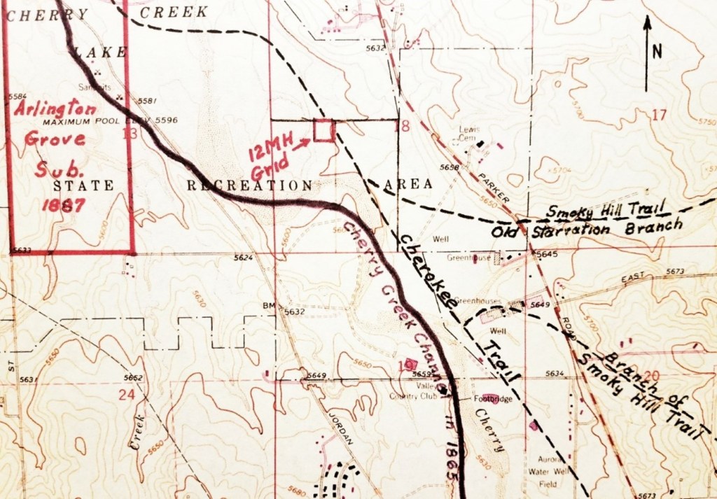
(Photo: 1965 USGS map showing the Smoky Hill Trail, Cherokee Trail, and former site of the Twelve Mile House, designated as site 5AH121, provided by OAHP, 2017.) The Seven Mile House
Unfortunately, less information exists regarding the Seven Mile House. However, an excerpt from Margaret Long’s book The Smoky Hill Trail, stated that the Seven Mile House, “was formerly the O’Neil Ranch” and located on the “east bank of Cherry Creek and the west side of the valley road which runs parallel to Colorado 83 (Parker Road).”
The Four Mile House
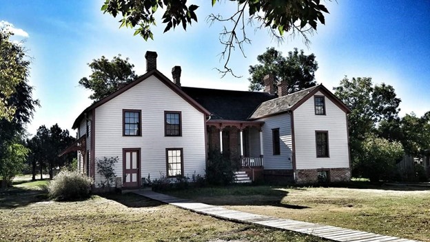
(Photo: Four Mile Historic House. From the outside, you cannot tell that the original log structure is inside of the left door. This log structure is considered the oldest standing structure in Denver, Colorado, J. Foster 2015.) Just four miles from Denver City, this was the last stage stop before arriving in Denver. Built in 1859 by brothers Samuel and Jonas Brantner, it was eventually sold to Mary Cawker a year later. Cawker was a single mother, and she was the first to operate the log home as a stage stop. The property consisted of a tavern, parlor, and sleeping area that you can still tour today—thanks to historic preservation!
The Four Mile Historic Park hosts tours for the public, field trip opportunities, and seasonal events such as a summer concert series, pumpkin harvest festival, and Spirits & Spirits.
Check out their website HERE.
Denver City: End of the Line.

(Photo: Trail Marker, Colfax Ave. and Broadway, J. Foster 2014.) Much has changed since travelers walked the dusty road along the Smoky Hill Trail. However, several significant structures and mile markers remain, reminding us of where we have been and how far we have come.
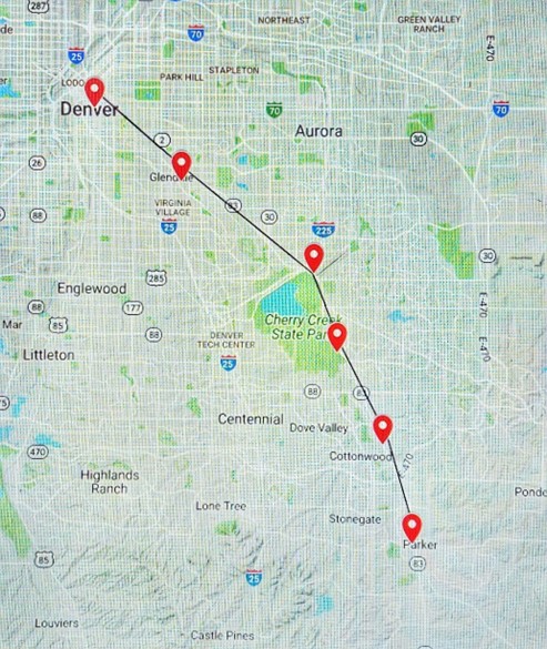
(Google map showing where the Mile Houses are in relation to Parker, Aurora, and Denver.)
Cherokee Trail, Cherry Creek State Park, Cherry Creek Valley Historical Society, colorado, Colorado History, denver, Denver’s Mile Houses, Four Mile House, Historic Denver, nature, Nine Mile House, Parker Area Historical Society, Seven Mile House, Seventeen Mile House, Smoky Hill Trail, Travel, Twelve Mile House, Twenty Mile House -
The Best Fun and Fare in Fairplay, CO.
A Summer Weekend Itinerary:
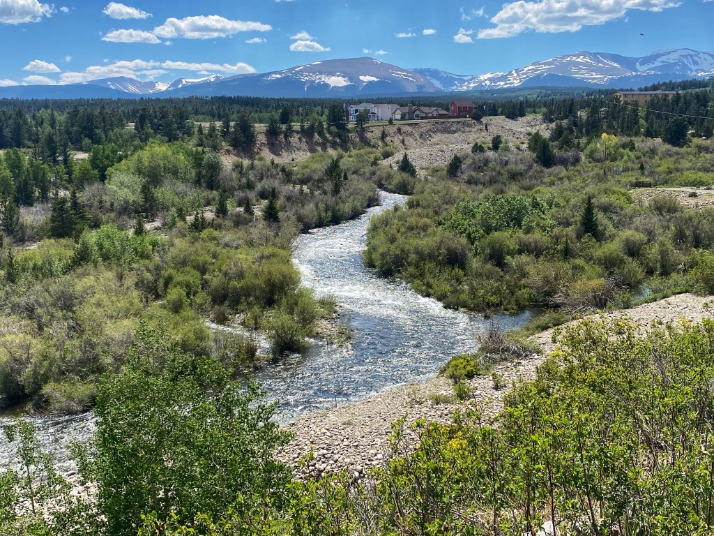
View of the Mosquito Range from Fairplay, Colorado. Best Breakfast in Town: Mr. Burro Cafe
{UPDATE: As of December 2025, Mr. Burro Cafe is temporarily closed due to a fire that destroyed the property. Hopefully, they will be able to return soon.}
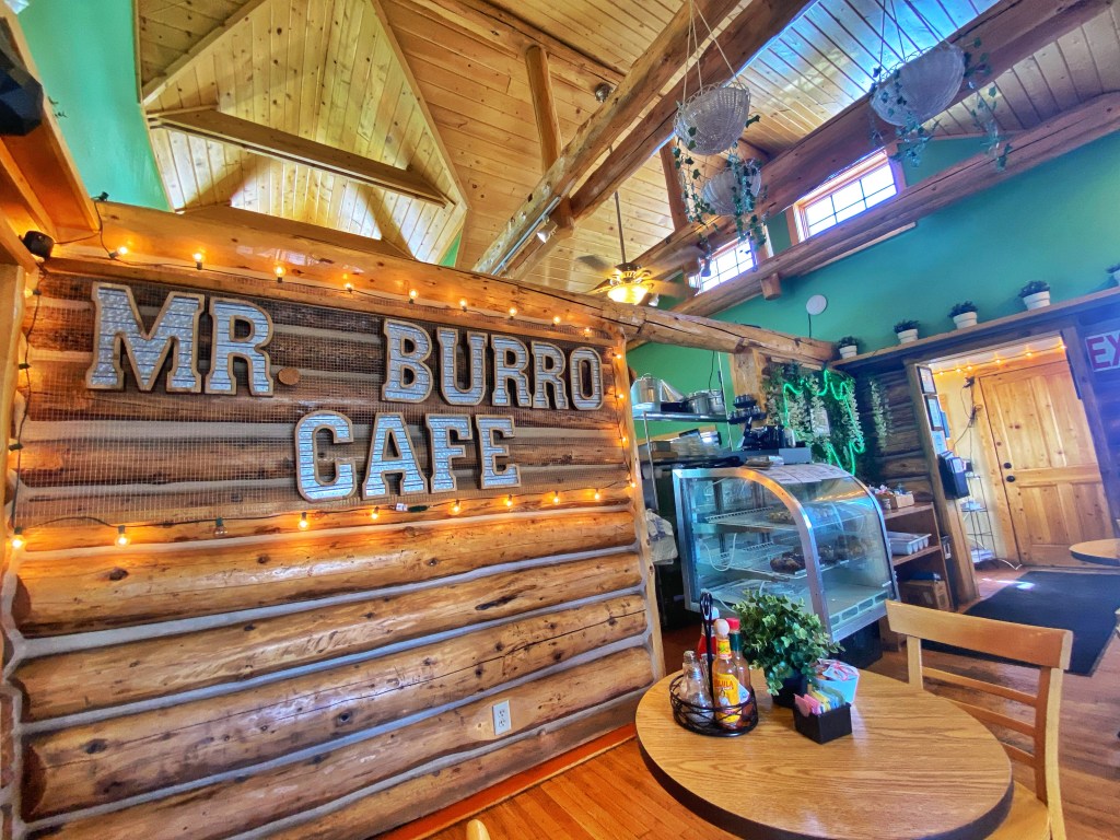
Main sitting area of the Mr. Burro Cafe 
White Chocolate Mocha 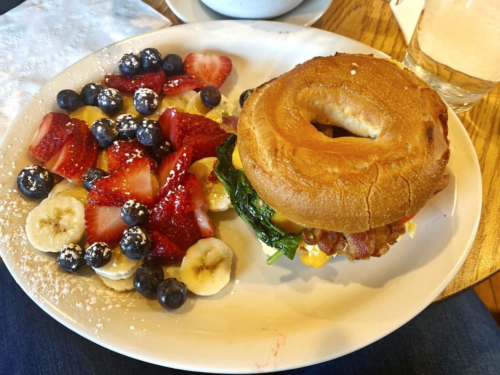
Breakfast sandwich and fruit Co-owners Mily Romero and Lula Frausto opened Mr. Burro Cafe in April of 2022. The cafe serves breakfast and lunch seven days a week. The food is delicious, and the service is very friendly! I highly recommend their lattes or breakfast sandwiches.
Take A Hike:

Trailhead for the Limber Grove Trail, located off of the 4 Mile Creek Rd. Limber Grove Trail:
Situated approximately 30 minutes from downtown Fairplay, the Limber Grove Trail offers a 3.5-mile round trip hike. This scenic route crosses a stream, winds through dense woods, and navigates over scree slopes, leading to an ancient grove of limber pines. Mount Sherman looms in the distance as you ascend 564 feet near the base of Sheep Mountain.
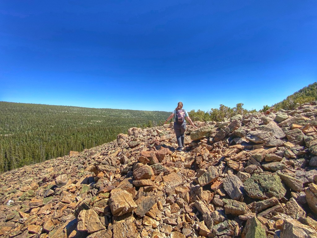
Traversing scree piles 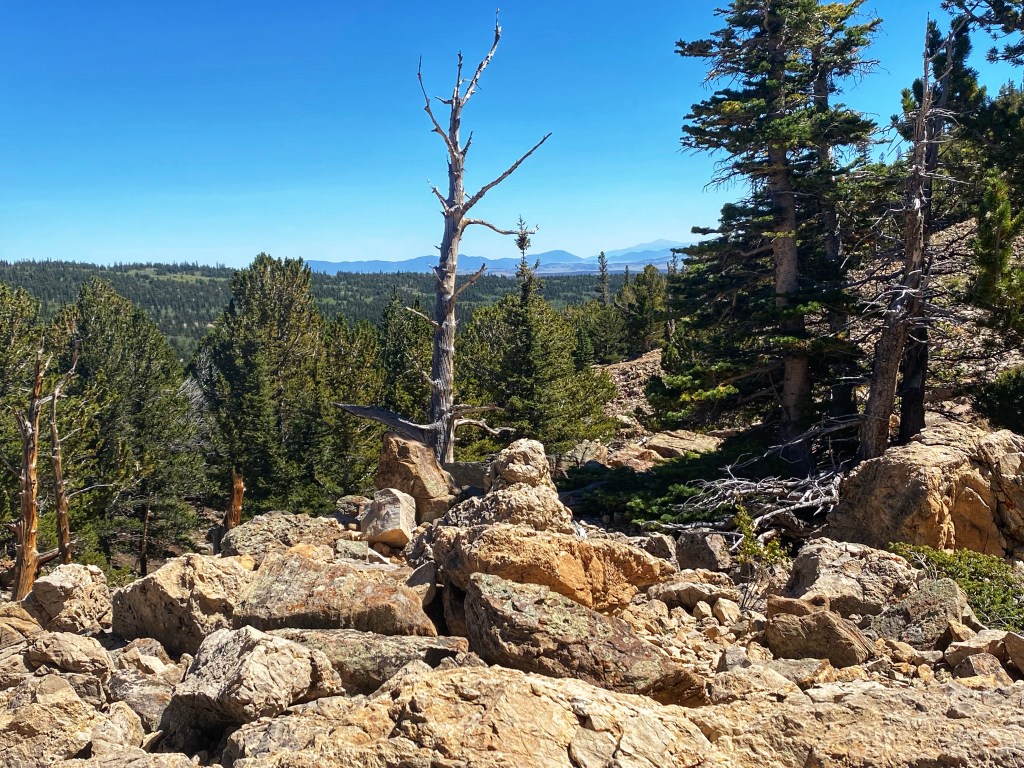
Mountain views Mount Sherman:
Looking to explore a 14er? Mount Sherman is a popular 14er for beginners as the trailhead starts around 12,050. Therefore, the actual hiking distance is only about 5 miles roundtrip. There are various listings for the actual height of Mt. Sherman, but most put it somewhere between 14,034-14,036. Even though the hiking distance is shorter, it is by no means “easy.”

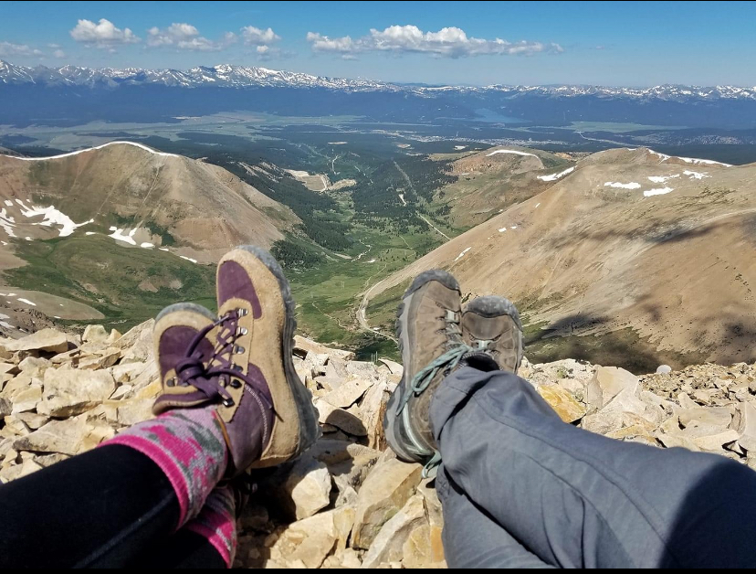
View from the top of Mt. Sherman Be Prepared:
Know the signs of altitude sickness and be prepared for fast-changing weather conditions. Treat this like any other mountaineering experience: Start early, dress in layers, bring plenty of water and snacks, extra sunscreen, and know your route. Know your limits.
Directions:
Both of these hikes are located off of the 4-mile creek road. This road is a gravel, washboard road so allow extra time for travel. It will take about 11 miles to get to the trailhead for Mt. Sherman.
Not a hiker?
Explore South Park City

When people hear the name South Park, they often think of the cartoon sitcom from Comedy Central but South Park is the real name of a valley that formed from the Rocky Mountains in central Colorado. Fairplay, Colorado is the most populated town in the South Park region, as well as being the county seat. At the western end of downtown Fairplay is a reconstructed mining town with thirty-five authentic buildings that were relocated from various locations but represent the gold and silver boom era of 1850-1880. This outdoor museum is called South Park City.
During the second weekend of August, they host Living History Days where volunteer docents re-enact life during the gold rush days. Several of the buildings are on the National Register of Historic Places (e.g. South Park Brewery and the Summer Saloon).
Check out the South Park City Museum website for hours and programs.
Enjoy the Burro Days Festival
The Town of Fairplay hosts the annual Burro Days Festival at the end of July. There are burro races, llama races, arts and crafts vendors, and plenty of summer food and fun! The town hosts this event to honor the many burros that played a crucial role in the mining process during the late 1800s, transporting millions of dollars’ worth of gold and silver from the nearby mines.
Video: Burro Days 2023 Llama Race! Downtown Fairplay, CO. 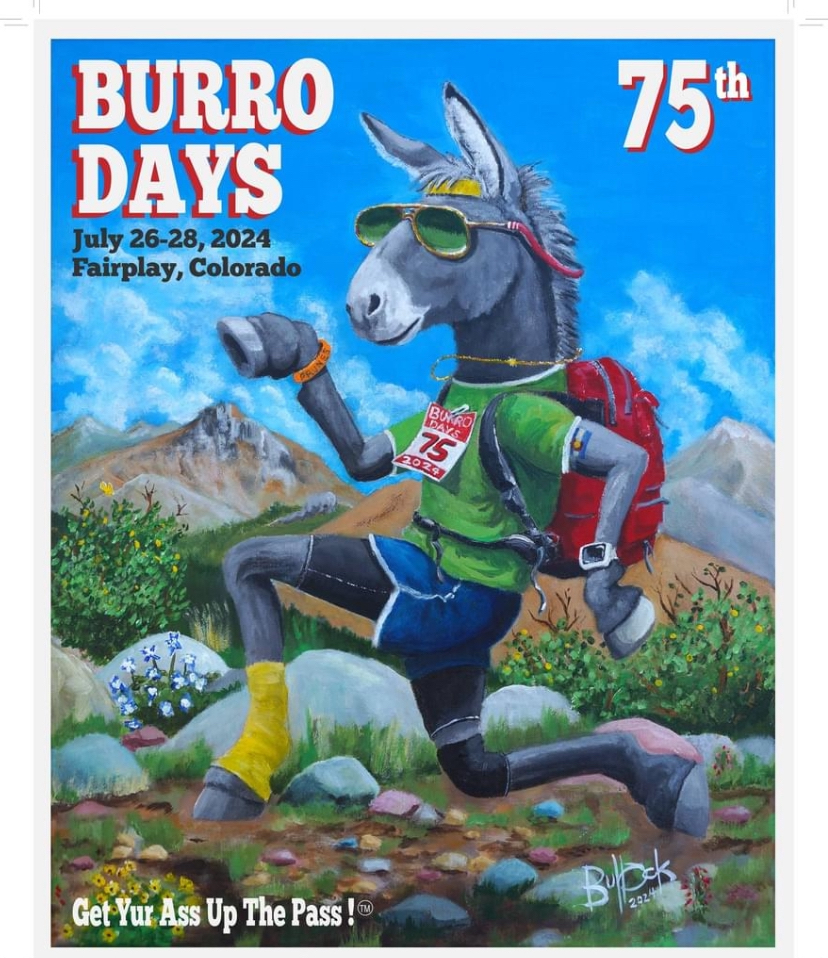
Screenshot: Poster design by artist Scott Bullock, 2024 Burro Days poster. Dinner at Salado!
[***UPDATE: As of August 4, 2024…Salado closed its doors…and, unfortunately, is no longer open. So bummed! However, thanks for the memories!!! And you served Fairplay well!!]
I’ve written about Salado before, but I seriously am obsessed with this hidden Colorado gem! Try their jalapeno poppers or pumpkin seed encrusted mahi! They also have fantastic mocktails like the new-fashioned, a fresh spirit-free take on the classic old-fashioned.
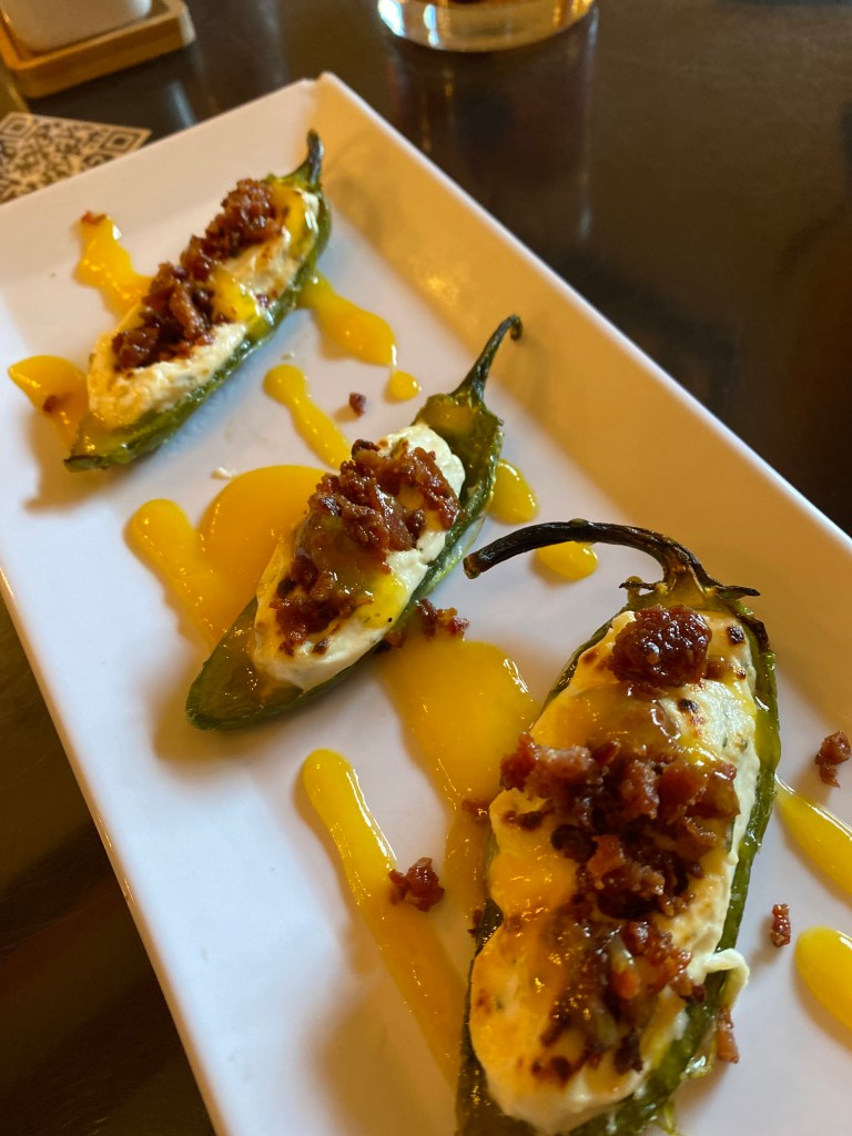
Jalapeno poppers from Salado Looking for Local Whiskey?
Snitching Lady Distillery

Above: Silhouette of the Snitching Lady on an ice block. Love this! 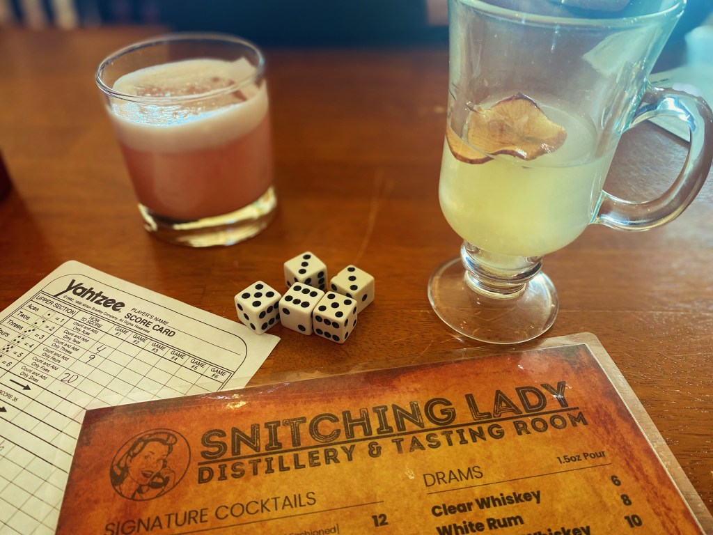

The Snitching Lady Distillery is a local family-owned distillery. Try their Parson Brown, an old-fashioned with the branded ice cube. Or try the Snitch, their flagship whiskey sour! They serve whiskey, brandy, and rum! If you want a good feel of the town, check this place out.
Fairplay: The Trout Fishing Capital of Colorado!
Fairplay, Colorado is known as the trout fishing capital of Colorado! So, get your gear and find a spot along Fairplay Beach or another nearby stream or river! Enjoy!

-
Discovering Bardstown, Kentucky: A Bourbon Enthusiast’s Journey
Kentucky Bourbon Trail: Round 2!
(This is part three of a five-part series. Parts one and two can be found here and here.)
After experiencing the bourbon trail for the first time, Dad and I made a return trip six months later! Our interest and thirst had been piqued! We decided it only made sense to visit Bardstown, Kentucky since it is known as the Bourbon Capital of the World (R).

Trip Itinerary: Day 1
We met up again in Nashville, TN and then drove together to Bardstown. We were eager to explore more about the history, production, and nuances of the bourbon culture.
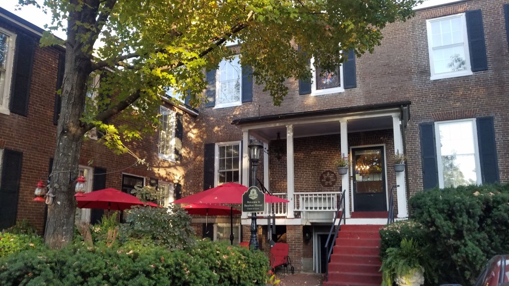
Bourbon Manor Bed & Breakfast We checked in to the Bourbon Manor Bed and Breakfast. The owner was very helpful, and the breakfast was excellent!
[Note: I later learned that this Bed and Breakfast had previously been a plantation home. I have had mixed feelings about how to write about this stay. In my research on how to better think about and understand slavery-era structures and plantations, I have come to believe that such places should have a sign or plaque honoring those slaves who lived, worked, and died in these areas. I also do not want to write in a way that romanticizes or sanitizes plantation life, as slavery was a very real and grievous part of American history.]
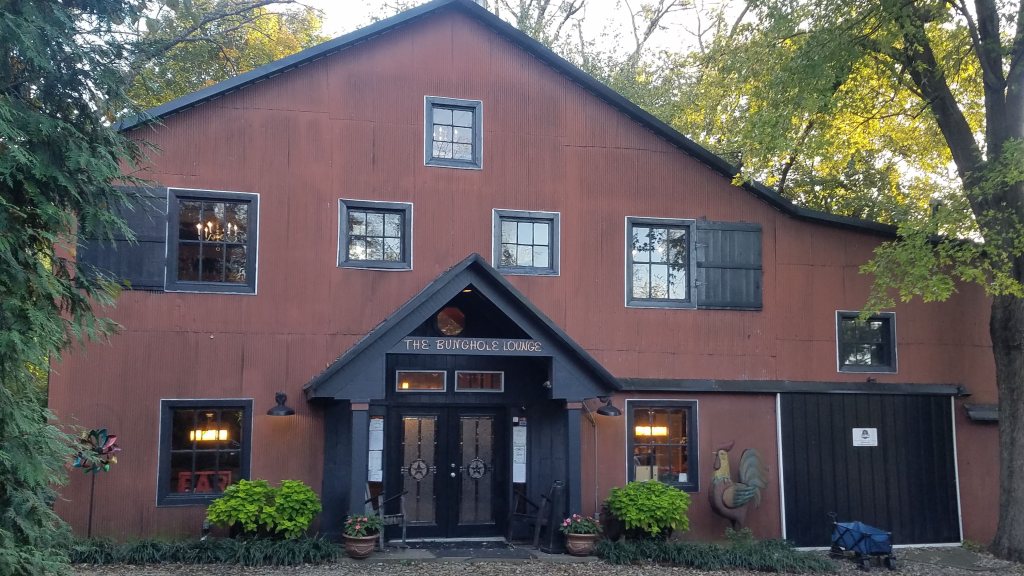
An old tobacco barn was converted into the Bunghole Lounge. If you are wondering what a bunghole is…look up the anatomy of a bourbon barrel. As we sat at the bar of the Bunghole Lounge, my Dad stumbled upon an article listing bourbons similar in taste to Pappy Van Winkle. It may have been this one from Men’s Journal. Thus, in addition to our pursuit of Pappy, we began to explore Wellers, Larceny, and Maker’s Mark. Familiar with Maker’s Mark, we savored it anew, mindfully discerning its flavor notes in anticipation of the day we might sample the legendary Pappy.
For dinner, we decided to explore downtown Bardstown and we found Mammys Kitchen and Bar. They served a hot brown, which is something I got to check off of my must-try southern food list.
Hot Brown: The hot brown originated in Louisville, KY at the Brown Hotel by Fred Schmidt. It is an open-faced sandwich consisting of turkey, ham, and bacon drenched in gravy. The bread is baked or broiled until crispy.
Trip Itinerary: Day 2
Bardstown, KY


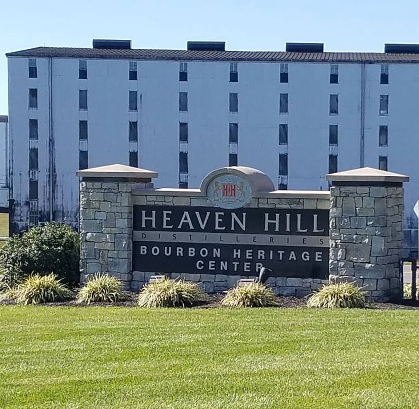
We checked out of our Bed & Breakfast and began to explore distilleries around Bardstown. We started the day by visiting the Bourbon Heritage Center and distillery located at Heaven Hill.
We explored one of the numerous rickhouses on the estate—they were abundant! Heaven Hill is in fact the distillery responsible for 100 different bourbon labels!
Following the tour, we participated in a tasting, which was my first encounter with Elijah Craig Small Batch. Very impressive. We thoroughly enjoyed the tour, especially since Heaven Hill is the largest independent bourbon producer! There was a wealth to observe and discover!
We then visited Bardstown Bourbon Company. During our visit, this distillery had just opened, and a lot of the focus was on the cafe area. So, we had lunch in their new facility and got our bourbon trail passport stamp. We had to leave to make our reservation at Maker’s Mark.

We enjoyed the tour at Maker’s Mark! We also go to hand dip our own take home bottle in the red wax. Like several other distilleries that we have visited, Maker’s Mark had a sprawling property consisting of many different rickhouses, production facilities, and a cafe. We enjoyed the tour and the smells of the fermentation process! I particularly enjoyed learning about Margie Samuels, the co-founder, who designed the distinctive label and creative branding, including the famous red wax bottle seal. You can read about the meaning of the Maker’s Mark symbol here.
At the end of our tour, we signed up to make our own hand-dipped bottle! It made a great souvenir!
Side Note:
If you are a true crime enthusiast, then you might be interested to learn that there have been several unsolved murders in Bardstown. While we were driving around town visiting distilleries, I kept seeing signs posted around town referencing missing women. So, I explored further and found this podcast detailing several unsolved cases. You can explore the podcast called Beyond Bardstown.
Trip Itinerary: Day 3
Downtown Louisville, KY
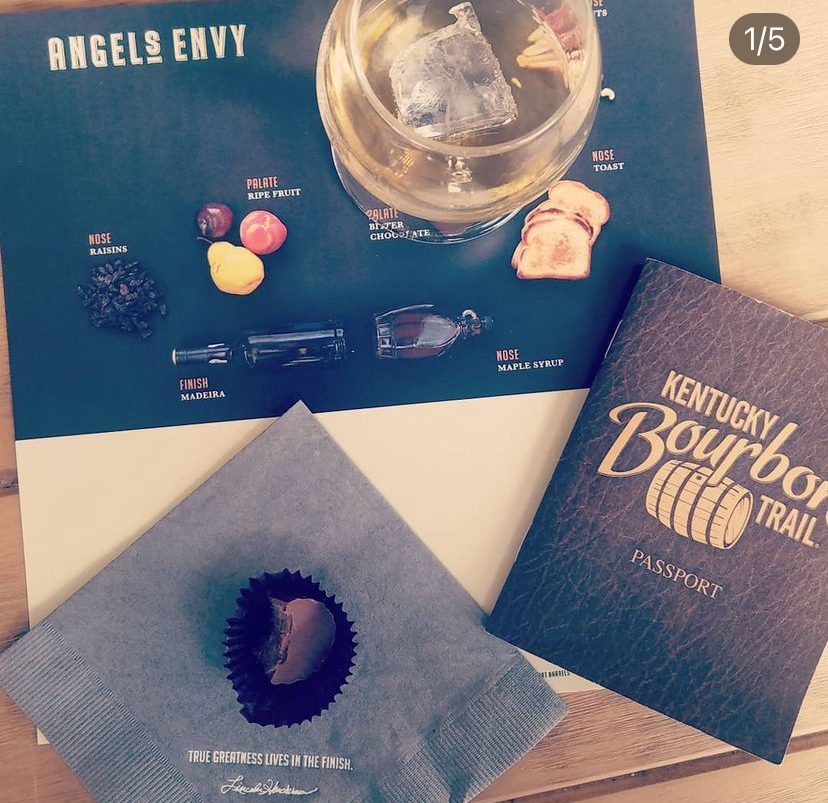
Angel’s Envy: Tour & Tasting. Touring the Angel’s Envy distillery was a delightful experience! The guide conducting the tasting was exceptionally informed and humorous. We savored the bourbon selection paired with an assortment of fruits and chocolates—a perfect combination! Additionally, the view of the production area and the copper stills was fascinating.

Dad and I, in front of the copper still at Angel’s Envy. Old Forester, Evan Williams, and Michter’s distilleries are all on the main drag in downtown Louisville. So, we walked around downtown and explored.

Old Forester tasting flight. The staff at Old Forester were incredibly fun and friendly. This was my least favorite bourbon as far as taste, but a lot of folks seemed to enjoy this one.

Michter’s tasting flight. I really loved the renovated building and architecture that housed Michter’s Fort Nelson Distillery. The building was centrally located on the corner of W. Main Street and N. 8th Street–had a lot of character! The bourbon tasting was fun, and I felt partial towards the Kentucky Straight Bourbon sample. Dad seemed to prefer the Kentucky Straight Rye.
We did not plan on touring the Evan Williams distillery due to time. But we were able to see where they were located and got our bourbon passport stamp.
We wrapped up the bourbon trail section of this trip and then ventured to what has now become our tradition after bourbon tasting: Mammoth Cave National Park!
This time we met up with my aunt and uncle and tried the lantern tour of Great Onyx Cave!
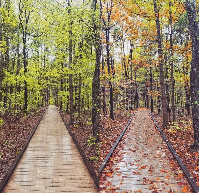
Left: A trail at Mammoth Cave in April 2019. Right: The same trail in October 2019. 
A park ranger at Mammoth Cave National Park points out features of the Great Onyx Cave. 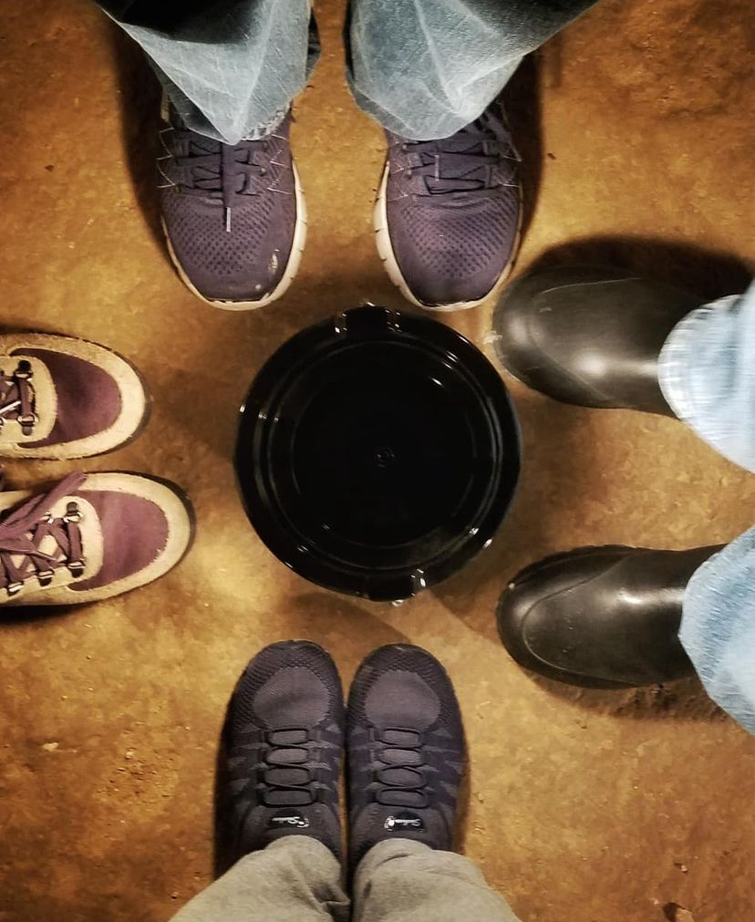
Waiting for the tour to begin, standing around the lantern. The lantern tour was awesome! The geological features of the cave came alive with the lantern light. Lots of stalagmites and stalactites! We even saw a cave salamander (Eurycea lucifuga). So cool!
We said goodbye to my aunt and uncle and then headed back to the Nashville airport to await our flight.
So, what do bourbon and caves have in common? Family bonding. Grateful for our time together.

I love you, Dad. Stay tuned: In the upcoming series, I’ll recount the time we finally savored Pappy Van Winkle bourbon, discovered an astonishing bistro with an exceptional bourbon collection, toured the largest bourbon barrel manufacturing plant in the world, and experienced completing our first Kentucky Bourbon Trail Passport book.
-
Subscribe
Subscribed
Already have a WordPress.com account? Log in now.
